May 2026: New Standard Enhances Seafloor Mapping with Uncrewed Marine Vehicles
The marine technology sector has reached a new milestone with the May 2026 release of ISO 25451:2026, a standard designed to regulate and guide the use of uncrewed marine vehicles (UMVs) for seafloor mapping. Covering a broad spectrum of technical requirements—from navigation and positioning to data processing—the new standard brings clarity, quality, and rigor to marine surveys in estuaries, offshore, and open sea locations. This article unpacks what’s inside ISO 25451:2026 and explores its implications for professionals across natural and applied sciences.
Overview / Introduction
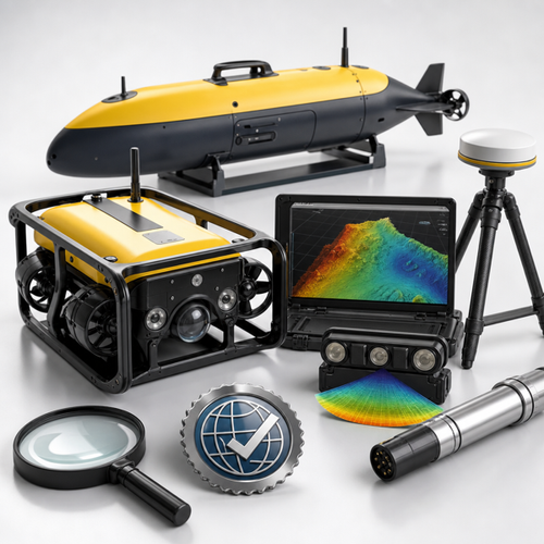
Uncrewed marine vehicles—encompassing both uncrewed surface vehicles (USVs) and uncrewed underwater vehicles (UUVs)—have transformed marine surveys. Their growing deployment in hydrographic mapping, underwater construction, energy exploration, and environmental research requires robust, reliable, and standardized methodologies. This is where ISO 25451:2026 comes in: it establishes technical requirements and operational guidelines to ensure safety, precision, and interoperability across marine industries.
In this article, you'll discover:
- The scope and impact of ISO 25451:2026 on marine technology
- Key clauses—navigation, positioning, survey planning, data handling
- Implementation insights for quality managers, engineers, and surveyors
- How these guidelines bolster compliance and industry best practices
Detailed Standards Coverage
ISO 25451:2026 - Technical Requirements and Guidelines for Seafloor Mapping with Uncrewed Marine Vehicles
Ships and marine technology — Technical requirements and guidelines for seafloor mapping with uncrewed marine vehicles
ISO 25451:2026 establishes baseline methodologies and quality thresholds for conducting seafloor mapping using UMVs such as USVs and UUVs. Its reach includes navigation, survey planning, measurement, deployment, and comprehensive data output specifications.
What This Standard Covers
ISO 25451:2026 standardizes the use of UMVs in producing high-quality bathymetric, geomorphologic, and seabed maps. The focus is on covering the end-to-end survey process:
- Navigation and positioning: Emphasizing precise satellite (GNSS) and acoustic (USBL, LBL) positioning.
- Vehicle assembly and pre-mission inspection: Outlining rigorous pre-survey checks for both USVs and UUVs.
- Survey mission and parameter setting: Defining technical requirements for single-beam and multi-beam echo sounding equipment.
- Data collection and processing: Laying out protocols for data cleaning, correction, and export formats to ensure result reliability and traceability.
Key Requirements and Specifications
- Geographic and Vertical Referencing: The standard mandates the World Geodetic System 1984 (WGS84) for positioning and mean sea level (MSL) for vertical references. Grid positioning is based on UTM and UPS projection systems.
- Positional Accuracy: Surface navigation using GNSS with errors not exceeding 1.0 m; underwater positioning errors to be ≤5.0 m (or ≤1.0 m with satellite differentiation), with USBL and LBL systems required to meet specified accuracy thresholds.
- Survey Operation Planning: Requires detailed mission line planning, survey method selection, and comprehensive pre-launch and instrument checks to prevent data compromise.
- Survey Implementation: Calls for robust communication system installations, pre-launch testing, safe launch and recovery procedures, and thorough process documentation.
- Data Processing: Standardizes procedures for data cleaning, correction (including outlier identification), and output to ensure consistency and comparability between projects and organizations.
Who Should Comply
- Hydrographic surveyors and marine engineers (public and private sector)
- Offshore energy companies (oil, gas, renewables)
- Marine construction and infrastructure planners
- Scientific researchers mapping seabed morphology or habitats
- Government agencies responsible for navigation safety, charting, and environmental monitoring
Practical Implications
Organizations integrating ISO 25451:2026 can achieve:
- Greater consistency in survey deliverables
- Enhanced credibility in project bids and technical outputs
- Improved risk management, particularly in offshore construction and subsea operations
- A clear framework for procurement specifications and supplier evaluation
Notable Changes (if revision)
This is the inaugural edition of ISO 25451—therefore, it establishes a new, international baseline where no prior ISO standard addressing UMV-based seafloor mapping existed.
Key highlights:
- Detailed accuracy requirements for GNSS, USBL, and LBL positioning systems
- Standardized survey planning, including mission line and MOSHIP (mobilization ship) selection guidance
- Mandated protocols for pre-mission inspection and in-field communication systems
- Recommendations for single- and multi-beam echo sounder operation, sound velocity profile (SVP) measurement, and comprehensive data cleaning
Access the full standard:View ISO 25451:2026 on iTeh Standards
Industry Impact & Compliance
ISO 25451:2026 is a game-changer for marine organizations seeking to align with the latest in uncrewed vehicle survey technology. The new standard makes it easier for:
- Procurement and compliance teams to specify technical requirements
- Quality managers to benchmark results against global best practices
- Engineers and planners to streamline project workflows and reduce rework
Compliance considerations:
- Adoption may be required by ports, offshore project developers, and maritime regulators
- Suppliers and contractors can use ISO 25451:2026 as a baseline for equipment and process qualification
- Certification to ISO 25451:2026 demonstrates organizational commitment to technical excellence and safety
Benefits of implementation:
- Reduced operational risk and increased data reliability
- Greater acceptance in bid processes for international projects
- Enhanced interoperability between vessels, survey equipment, and global clients
Risks of non-compliance:
- Lower credibility in the global market
- Potential for data disputes, contractual claims, or regulatory issues
- Missed opportunities in rapidly advancing marine survey sectors
Technical Insights
Across the standard, technical rigor and a focus on accuracy prevail:
- Navigation and Positioning: Robust standards for using GNSS, USBL, and LBL systems mean mission planners must be clear on expected conditions and error tolerances.
- Inspection and Pre-Launch Checks: The standard emphasizes systematic pre-mission checks on both vehicles and survey instruments—crucial for minimizing downtime and faulty data acquisition.
- Parameter Setting and Data Quality: Careful setting and logging of survey parameters (like beam width, frequency, and SVP data) reduce ambiguity in final data products.
- Data Processing & Certification: Data cleaning (e.g., outlier removal in multi-beam bathymetry), correction, and audit trails are now required for full traceability. Organizations are advised to document every stage of data handling for future certification or contractual verification.
Implementation best practices:
- Develop a standard operating procedure (SOP) tailored to ISO 25451:2026
- Train all survey team members on new requirements, with special emphasis on pre-launch, inspection, and reporting
- Invest in compatible and calibrated survey instruments that meet the standard’s accuracy criteria
- Maintain a digital log of data corrections and survey system settings
Testing & Certification Considerations:
- External validation or third-party verification may be advisable for organizations entering new markets or working on high-value projects
- Regular calibration and maintenance logs can help sustain ongoing compliance
Conclusion / Next Steps
ISO 25451:2026 ushers in a new era of reliability and quality for seafloor mapping with uncrewed marine vehicles. From technical managers to procurement teams, adopting these guidelines ensures your projects meet the highest global benchmarks—delivering superior data, safety, and confidence for all stakeholders.
Key takeaways:
- ISO 25451:2026 is the first comprehensive international standard for UMV-based seafloor mapping
- It streamlines survey design, execution, and reporting for higher accuracy and interoperability
- Adopting this standard will position your organization at the forefront of marine technology innovation
Recommendations:
- Acquire the full ISO 25451:2026 standard and conduct a gap analysis within your organization
- Update in-house SOPs and technical training to reflect new requirements
- Engage with technology and service providers to ensure all equipment meets or exceeds ISO specifications
- Stay informed on further standardization developments via iTeh Standards
Adopt ISO 25451:2026 early to secure operational excellence and ensure your marine surveys deliver industry-leading results.
Categories
- Latest News
- New Arrivals
- Generalities
- Services and Management
- Natural Sciences
- Health Care
- Environment
- Metrology and Measurement
- Testing
- Mechanical Systems
- Fluid Systems
- Manufacturing
- Energy and Heat
- Electrical Engineering
- Electronics
- Telecommunications
- Information Technology
- Image Technology
- Precision Mechanics
- Road Vehicles
- Railway Engineering
- Shipbuilding
- Aircraft and Space
- Materials Handling
- Packaging
- Textile and Leather
- Clothing
- Agriculture
- Food technology
- Chemical Technology
- Mining and Minerals
- Petroleum
- Metallurgy
- Wood technology
- Glass and Ceramics
- Rubber and Plastics
- Paper Technology
- Paint Industries
- Construction
- Civil Engineering
- Military Engineering
- Entertainment