

ISO/PRF 25072
(Main)Corrosion of metals and alloys — Guidance and requirements for drawing regional corrosion maps — Detailed measurements of corrosion and interpolation method
General Information
- Abstract
This document provides guidance for drawing regional atmospheric corrosion maps by using detailed corrosion measurements and sub-sequent interpolation of measured corrosion values, and introduces the principles for the revision of atmospheric corrosion maps, as well as the selection of background stations and test stations. This document is applicable to drawing regional atmospheric corrosion maps, which provides the basis for the site selection, material selection, structural design, and corrosion protection of engineering construction.
- Status
- Not Published
- Technical Committee
- ISO/TC 156 - Corrosion of metals and alloys
- Current Stage
- 5020 - FDIS ballot initiated: 2 months. Proof sent to secretariat
- Start Date
- 07-Sep-2026
- Completion Date
- 12-Sep-2026
Buy Documents


ISO/PRF 25072 - Corrosion of metals and alloys — Guidance and requirements for drawing regional corrosion maps — Detailed measurements of corrosion and interpolation method
REDLINE ISO/PRF 25072 - Corrosion of metals and alloys — Guidance and requirements for drawing regional corrosion maps — Detailed measurements of corrosion and interpolation method
Overview
ISO/PRF 25072: Corrosion of metals and alloys - Guidance and requirements for drawing regional corrosion maps - Detailed measurements of corrosion and interpolation method is an international standard developed by ISO/TC 156. This document provides authoritative guidance and requirements for creating regional atmospheric corrosion maps using detailed corrosion measurements and interpolation methods. By standardizing the process for map creation, site selection, and map revision, ISO/PRF 25072 equips engineers, designers, and project managers with the tools to assess atmospheric corrosion risk over wide areas.
Accurate atmospheric corrosion maps are essential for informed decisions in site selection, material specification, structural design, and the implementation of effective corrosion protection strategies in engineering construction. The standard outlines principles for the identification and layout of background and test sites, ensuring data representativeness and practical feasibility. Additionally, guidance is provided for regular revision and updating of corrosion maps to reflect environmental changes or infrastructure developments.
Key Topics
- Atmospheric corrosion mapping: Provides a methodology for creating detailed regional maps based on measured corrosion data and interpolation.
- Site selection: Establishes criteria for the layout and selection of representative background and test sites, considering environmental and socio-economic factors.
- Measurement and data collection: Recommends procedures for exposing standard specimens or collecting environmental data to determine corrosion rates.
- Interpolation methods: Introduces authorized interpolation techniques such as kriging and inverse distance weighting for estimating corrosion values at unsampled locations.
- Use of Geographic Information Systems (GIS): Supports the creation of digital, interactive maps with scalable grid sizes for precise corrosion risk assessment.
- Map revision: Provides requirements for regular updates based on new data or regional environmental changes.
Applications
ISO/PRF 25072 is relevant to a wide variety of stakeholders involved in asset management, infrastructure development, and materials engineering:
- Engineering Construction: Facilitates risk-aware site selection by identifying areas with varying atmospheric corrosivity, supporting structural design and corrosion protection strategies.
- Material Selection: Aids in choosing appropriate metals and alloys for outdoor installations by referencing regional corrosion categories, which can extend service life and reduce maintenance.
- Asset Management: Offers a standardized approach for infrastructure managers to evaluate and monitor corrosion exposure, enabling data-driven maintenance scheduling and investment decisions.
- Environmental Assessment: Assists regulatory and environmental agencies in understanding the impact of industrial, natural, and livestock-derived sources of corrosive agents (e.g., SO₂, NH₃, Cl⁻) on atmospheric corrosivity.
- GIS and Digital Mapping: Leverages GIS technologies to produce interactive corrosion maps that allow users to query corrosivity categories by coordinates, supporting spatial analysis and decision-making.
- Periodic Review: The standard recommends map revision cycles (e.g., every five years), ensuring that changes due to urban development, industrial activity, or environmental shifts are captured.
Related Standards
To maximize the effectiveness and compatibility of corrosion mapping activities, ISO/PRF 25072 references and complements several key standards:
- ISO 9223: Classification, determination, and estimation of atmospheric corrosivity.
- ISO 9225: Measurement of environmental parameters affecting atmospheric corrosivity.
- ISO 9226: Determination of corrosion rate of standard specimens for evaluation of corrosivity.
- ISO 8565: General requirements for atmospheric corrosion testing.
- ISO 19735: Guidance for mapping areas of increased risk of corrosion using environmental data grids.
- ISO 20524-1: Geographic Data Files for mapping and spatial reference.
- ISO 11074: Vocabulary relevant to soil and environmental quality, including kriging definitions.
- ISO 19101-1: Reference model for geographic information systems.
Adhering to ISO/PRF 25072 ensures a robust, standardized methodology for assessing and managing atmospheric corrosion risk, providing clear value for engineers, material specialists, and asset managers involved in the maintenance and protection of metallic infrastructure.
Buy Documents
ISO/PRF 25072 - Corrosion of metals and alloys — Guidance and requirements for drawing regional corrosion maps — Detailed measurements of corrosion and interpolation method
REDLINE ISO/PRF 25072 - Corrosion of metals and alloys — Guidance and requirements for drawing regional corrosion maps — Detailed measurements of corrosion and interpolation method
Get Certified
Connect with accredited certification bodies for this standard

Element Materials Technology
Materials testing and product certification.

Inštitut za kovinske materiale in tehnologije
Institute of Metals and Technology. Materials testing, metallurgical analysis, NDT.
Sponsored listings
Frequently Asked Questions
ISO/PRF 25072 is a draft published by the International Organization for Standardization (ISO). Its full title is "Corrosion of metals and alloys — Guidance and requirements for drawing regional corrosion maps — Detailed measurements of corrosion and interpolation method". This standard covers: This document provides guidance for drawing regional atmospheric corrosion maps by using detailed corrosion measurements and sub-sequent interpolation of measured corrosion values, and introduces the principles for the revision of atmospheric corrosion maps, as well as the selection of background stations and test stations. This document is applicable to drawing regional atmospheric corrosion maps, which provides the basis for the site selection, material selection, structural design, and corrosion protection of engineering construction.
This document provides guidance for drawing regional atmospheric corrosion maps by using detailed corrosion measurements and sub-sequent interpolation of measured corrosion values, and introduces the principles for the revision of atmospheric corrosion maps, as well as the selection of background stations and test stations. This document is applicable to drawing regional atmospheric corrosion maps, which provides the basis for the site selection, material selection, structural design, and corrosion protection of engineering construction.
ISO/PRF 25072 is classified under the following ICS (International Classification for Standards) categories: 77.060 - Corrosion of metals. The ICS classification helps identify the subject area and facilitates finding related standards.
ISO/PRF 25072 is available in PDF format for immediate download after purchase. The document can be added to your cart and obtained through the secure checkout process. Digital delivery ensures instant access to the complete standard document.
Standards Content (Sample)
International
Standard
ISO 25072
First edition
Corrosion of metals and alloys —
Guidance and requirements for
drawing regional corrosion maps
— Detailed measurements of
corrosion and interpolation method
PROOF/ÉPREUVE
Reference number
ISO 25072:2026(en) © ISO 2026
ISO 25072:2026(en)
© ISO 2026
All rights reserved. Unless otherwise specified, or required in the context of its implementation, no part of this publication may
be reproduced or utilized otherwise in any form or by any means, electronic or mechanical, including photocopying, or posting on
the internet or an intranet, without prior written permission. Permission can be requested from either ISO at the address below
or ISO’s member body in the country of the requester.
ISO copyright office
CP 401 • Ch. de Blandonnet 8
CH-1214 Vernier, Geneva
Phone: +41 22 749 01 11
Email: copyright@iso.org
Website: www.iso.org
Published in Switzerland
PROOF/ÉPREUVE
ii
ISO 25072:2026(en)
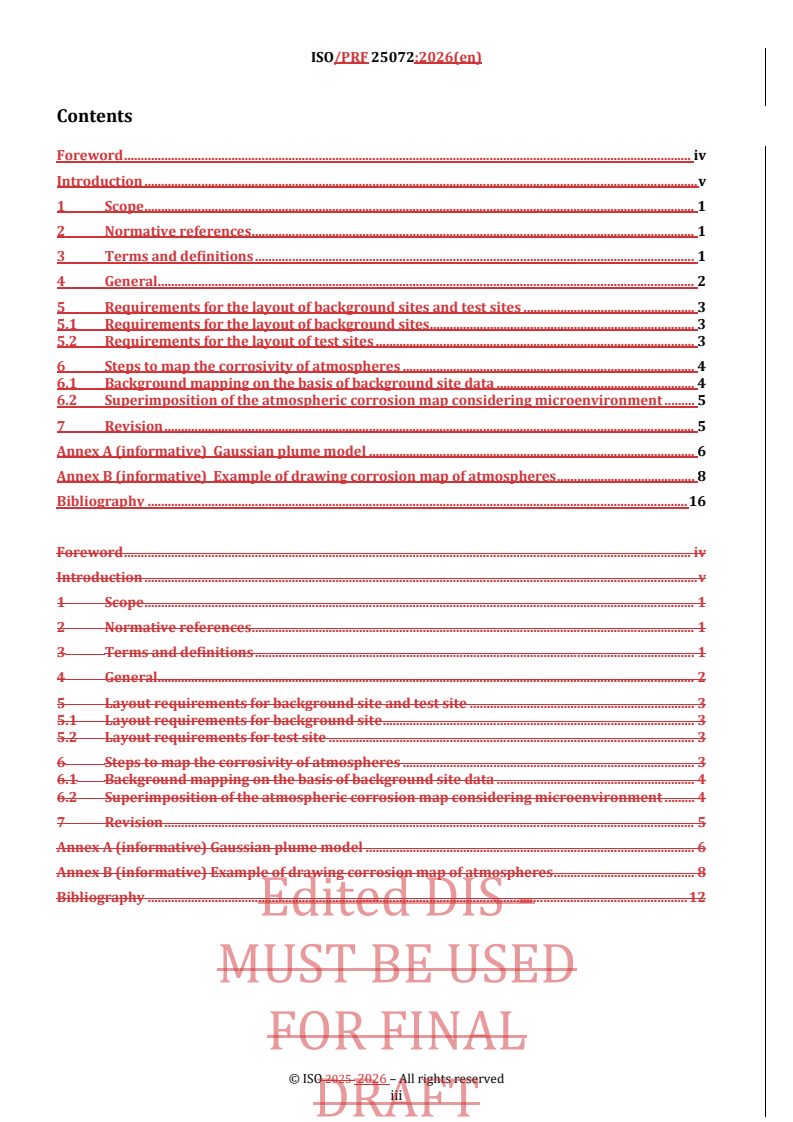
Contents Page
Foreword .iv
Introduction .v
1 Scope . 1
2 Normative references . 1
3 Terms and definitions . 1
4 General . 2
5 Requirements for the layout of background sites and test sites . 3
5.1 Requirements for the layout of background sites .3
5.2 Requirements for the layout of test sites .3
6 Steps to map the corrosivity of atmospheres . 4
6.1 Background mapping on the basis of background site data .4
6.1.1 Investigate emission sources of corrosive agents .4
6.1.2 Determine the background sites for detailed corrosion rate measurements .4
6.1.3 Draw the background map .5
6.2 Superimposition of the atmospheric corrosion map considering microenvironment .5
6.2.1 Evaluate the impact of emission sources of corrosive agent .5
6.2.2 Draw the final atmospheric corrosion map.5
7 Revision . 5
Annex A (informative) Gaussian plume model . 6
Annex B (informative) Example of drawing corrosion map of atmospheres . 9
Bibliography .15
PROOF/ÉPREUVE
iii
ISO 25072:2026(en)
Foreword
ISO (the International Organization for Standardization) is a worldwide federation of national standards
bodies (ISO member bodies). The work of preparing International Standards is normally carried out through
ISO technical committees. Each member body interested in a subject for which a technical committee
has been established has the right to be represented on that committee. International organizations,
governmental and non-governmental, in liaison with ISO, also take part in the work. ISO collaborates closely
with the International Electrotechnical Commission (IEC) on all matters of electrotechnical standardization.
The procedures used to develop this document and those intended for its further maintenance are described
in the ISO/IEC Directives, Part 1. In particular, the different approval criteria needed for the different types
of ISO document should be noted. This document was drafted in accordance with the editorial rules of the
ISO/IEC Directives, Part 2 (see www.iso.org/directives).
ISO draws attention to the possibility that the implementation of this document may involve the use of (a)
patent(s). ISO takes no position concerning the evidence, validity or applicability of any claimed patent
rights in respect thereof. As of the date of publication of this document, ISO had not received notice of (a)
patent(s) which may be required to implement this document. However, implementers are cautioned that this
may not represent the latest information, which may be obtained from the patent database available at
www.iso.org/patents. ISO shall not be held responsible for identifying any or all such patent rights.
Any trade name used in this document is information given for the convenience of users and does not
constitute an endorsement.
For an explanation of the voluntary nature of standards, the meaning of ISO specific terms and expressions
related to conformity assessment, as well as information about ISO's adherence to the World Trade
Organization (WTO) principles in the Technical Barriers to Trade (TBT), see www.iso.org/iso/foreword.html.
This document was prepared by Technical Committee ISO/TC 156, Corrosion of metals and alloys.
Any feedback or questions on this document should be directed to the user’s national standards body. A
complete listing of these bodies can be found at www.iso.org/members.html.
PROOF/ÉPREUVE
iv
ISO 25072:2026(en)
Introduction
ISO 9223 specifies the classification of atmospheric corrosivity and outlines how to:
— determine corrosivity by measuring corrosion loss over one year using standard metal specimens;
— estimate normative corrosivity by calculating corrosion loss in standard metals;
— estimate informative corrosivity by comparing exposure with typical atmospheric conditions.
See ISO 9225 and ISO 9226 for detailed methods for the measurement of environmental parameters that
affect atmospheric corrosivity and methods which can be used for the determination of corrosion rate
with standard specimens. However, according to these standards, identifying the categories of corrosivity
in all locations requires a significant amount of work for long-distance, large-span projects (e.g. power
transmission lines, overhead oil pipelines and railways). It would therefore be more practical to draw the
corrosion map of an entire area by identifying these corrosivity categories using a known scattered set of
corrosivity categories at selected sites and appropriate interpolation methods.
With atmospheric corrosion maps, users can obtain the corrosivity categories of a specific region by inputting
the latitude and longitude coordinates. The map provides guidance for the selection and maintenance of
corrosion-resistant materials, thereby extending the service life of a project and making the project safer and
[3] [4]
more reliable. Corrosion maps of atmospheres have been drawn in many regions, (e.g. Australia , China ,
[5] [6] [7] [8] [9] [3]
Czech Republic , Portugal , South Korea , Spain , Slovakia and Vietnam ). ISO 19735 provides
guidance for calculating corrosivity maps based on arrays of environmental data organized in a grid and
using a dose-response function. However, the construction of corrosion maps using detailed measurements
of corrosion and interpolating the values has not been standardized.
This document introduces the principles of background site selection and atmospheric corrosion mapping,
avoiding actual corrosion categories cannot be truly reflected due to the random layout of background sites.
It addresses the limitation of ignoring changes in the corrosivity categories caused by abrupt changes in the
content of corrosive agents in the microenvironment.
PROOF/ÉPREUVE
v
International Standard ISO 25072:2026(en)
Corrosion of metals and alloys — Guidance and requirements
for drawing regional corrosion maps — Detailed
measurements of corrosion and interpolation method
1 Scope
This document provides guidance and requirements for drawing regional atmospheric corrosion maps
by using detailed corrosion measurements and subsequent interpolation of measured corrosion values.
It introduces the principles for the revision of atmospheric corrosion maps, as well as the selection of
background sites and test sites.
This document is applicable to drawing regional atmospheric corrosion maps, which provides the basis for
site selection, material selection, structural design and corrosion protection of engineering construction.
2 Normative references
The following documents are referred to in the text in such a way that some or all of their content constitutes
requirements of this document. For dated references, only the edition cited applies. For undated references,
the latest edition of the referenced document (including any amendments) applies.
ISO 9223, Corrosion of metals and alloys — Corrosivity of atmospheres — Classification, determination and
estimation
3 Terms and definitions
For the purposes of this document, the following terms and definitions apply.
ISO and IEC maintain terminology databases for use in standardization at the following addresses:
— ISO Online browsing platform: available at https:// www .iso .org/ obp
— IEC Electropedia: available at https:// www .electropedia .org/
3.1
background corrosion
inherent tendency of a given environment to cause corrosion in the absence of any additional contaminating
or accelerating factors
Note 1 to entry: Background corrosion refers to corrosivity contributed by all sources other than local corrosion
sources under test.
3.2
background site
site set up to assess background corrosion (3.1)
3.3
test site
site set up to assess the corrosivity of the atmosphere at a given concentration of a corrosive agent
PROOF/ÉPREUVE
ISO 25072:2026(en)
3.4
air quality model
numerical analysis method simulating the physical dispersion and chemical process that affects the
dispersion and reaction of air pollutants in the atmosphere, including Gaussian plume model, photochemical
air quality models
Note 1 to entry: The Gaussian plume model adopts non-grid, simplified transport and diffusion algorithms without
complex chemical mechanisms. It is generally used to simulate the transport and diffusion of primary pollutants or to
simulate secondary pollutants through simple chemical reaction mechanisms.
3.5
world geodetic system
WGS
set of standard reference ellipsoids that define latitude, longitude and height for every point on the earth
[SOURCE: ISO 20524-1:2020, 3.3.16]
3.6
geographic information system
GIS
information system dealing with information concerning phenomena associated with location relative to
the Earth
[SOURCE: ISO 19101-1:2014, 4.1.20, modified — Preferred term "GIS" has been added.]
3.7
kriging
special interpolation method applied in geostatistics for the estimation of unknown values of a variable at
unsampled locations
Note 1 to entry: Usually illustrated in a variogram.
[SOURCE: ISO 11074:2025, 3.234]
3.8
inverse distance weighting
interpolation method with a known scattered set of points in which the assigned values to unknown points
are calculated with a weighted average of the values available at the known points
4 General
The atmospheric corrosion map is a superposition of the background map of corrosivity categories and the
overlay map of corrosivity categories considering the influence of microenvironment. The background map
of corrosivity categories should be adopted using the WGS. According to the actual situation, the information
should be selectively marked (e.g. national boundaries, regional boundaries, topography and rivers).
Electronic corrosion maps (e-map) in GIS are recommended to be used in drawing atmospheric corrosion
maps. The scale of the e-map should be decided according to extent and extension of corrosion source. The
scale of the e-map should not be less than 1:100 000. An atmospheric corrosion map should have a zoom
function and allow querying corrosivity categories at any location by inputting the latitude and longitude
data. The grid dimensions should be 1×1 km to 10×10 km.
The corrosivity of atmosphere should be classified referring to the measured corrosion rate of the standard
specimen or assessed based on environmental parameters when the measurement is unavailable. The first-
year corrosion rates for the standard metals (carbon steel, zinc, copper, aluminium) corresponding to each
corrosivity category and the dose-response functions for the four standard metals shall be in accordance
with ISO 9223. The corrosion attack presents with different colours ranging from light to dark with the
increase of corrosivity categories in atmospheric corrosion map. The corrosivity categories of two adjacent
areas should show continuous characteristics. The difference of the corrosivity categories between any
adjacent test points should be less than two.
PROOF/ÉPREUVE
ISO 25072:2026(en)
Atmospheric corrosion maps should be accompanied by instructions for drawing, including:
— the basis and principles for drawing atmospheric corrosion maps;
— the number, locations, data collection duration of background sites and test sites;
— the selection of interpolation model;
— a brief analysis of the corrosivity of atmospheres, temperature and relative humidity, atmosphere
pollution, etc.
It is recommended to clearly mark the drawing content and drawing time at the top of the map. At the
appropriate position at the bottom of the map, the corrosion category legend, mapping agency, drawing
scale and other related information should also be marked.
5 Requirements for the layout of background sites and test sites
5.1 Requirements for the layout of background sites
Background sites shall be representative and unaffected by any local corrosion sources.
The selection of the background site is a compromise between practicality and accuracy, and it is known
that increasing the number of background sites will improve the accuracy of the atmospheric corrosion map,
which will result in significant expenses and a great deal of work.
The topography, meteorology and other natural factors should be taken into account when setting
background sites. In mountainous areas, background sites shall be set at the local high points, while in flat
areas, relatively high locations shall be selected.
Background sites should be determined regarding the industrial layout, population status and other relevant
socio-economic characteristics, and show the background corrosion in the area.
Background sites should be determined referring to the urban and rural construction planning.
Data from environmental agencies or other relevant organizations can be consulted when using
environmental parameters to estimate the atmospheric corrosivity.
5.2 Requirements for the layout of test sites
Standard specimens or gas sampling tubes shall be exposed to the direction with highest corrosivity. For
example, in urban areas, specimens shall be oriented towards the road with the highest traffic intensity. The
locations of atmospheric corrosion test sites should be carried out in accordance with the specifications of
ISO 8565.
Test sites should be laid out in advance on demand and be representative and comparable.
It is recommended that specimens should be placed at or near facilities that continuously measure either
gases or particles, or both to obtain as much information as possible about the environmental characteristics
of the test site.
Data from environmental agencies or other
...
ISO/TC156 N8011
ISOPRF 25072
ISO/TC 156
Secretariat: SAC
ISO TC156/WG 4
Date: 2026-0609-04
Corrosion of metals and alloys - — Guidance and requirements for
drawing regional corrosion maps -— Detailed measurements of
corrosion and interpolation method
PROOF
ISO/DIS PRF 25072:2026(en)
All rights reserved. Unless otherwise specified, or required in the context of its implementation, no part of this publication
may be reproduced or utilized otherwise in any form or by any means, electronic or mechanical, including photocopying,
or posting on the internet or an intranet, without prior written permission. Permission can be requested from either ISO
at the address below or ISO’s member body in the country of the requester.
ISO copyright office
CP 401 • Ch. de Blandonnet 8
CH-1214 Vernier, Geneva
Phone: + 41 22 749 01 11
EmailE-mail: copyright@iso.org
Website: www.iso.orgwww.iso.org
Published in Switzerland
ii © ISO #### 2026 – All rights reserved
ii
Contents
Foreword . iv
Introduction . v
1 Scope . 1
2 Normative references . 1
3 Terms and definitions . 1
4 General. 2
5 Requirements for the layout of background sites and test sites . 3
5.1 Requirements for the layout of background sites . 3
5.2 Requirements for the layout of test sites . 3
6 Steps to map the corrosivity of atmospheres . 4
6.1 Background mapping on the basis of background site data . 4
6.2 Superimposition of the atmospheric corrosion map considering microenvironment . 5
7 Revision . 5
Annex A (informative) Gaussian plume model . 6
Annex B (informative) Example of drawing corrosion map of atmospheres . 8
Bibliography . 16
Foreword . iv
Introduction . v
1 Scope . 1
2 Normative references . 1
3 Terms and definitions . 1
4 General. 2
5 Layout requirements for background site and test site . 3
5.1 Layout requirements for background site . 3
5.2 Layout requirements for test site . 3
6 Steps to map the corrosivity of atmospheres . 3
6.1 Background mapping on the basis of background site data . 4
6.2 Superimposition of the atmospheric corrosion map considering microenvironment . 4
7 Revision . 5
Annex A (informative) Gaussian plume model . 6
Annex B (informative) Example of drawing corrosion map of atmospheres . 8
Bibliography . 12
iii
ISO/DIS PRF 25072:2026(en)
Foreword
ISO (the International Organization for Standardization) is a worldwide federation of national standards
bodies (ISO member bodies). The work of preparing International Standards is normally carried out through
ISO technical committees. Each member body interested in a subject for which a technical committee has been
established has the right to be represented on that committee. International organizations, governmental and
non-governmental, in liaison with ISO, also take part in the work. ISO collaborates closely with the
International Electrotechnical Commission (IEC) on all matters of electrotechnical standardization.
The procedures used to develop this document and those intended for its further maintenance are described
in the ISO/IEC Directives, Part 1. In particular, the different approval criteria needed for the different types of
ISO document should be noted. This document was drafted in accordance with the editorial rules of the
ISO/IEC Directives, Part 2 (see www.iso.org/directives).
ISO draws attention to the possibility that the implementation of this document may involve the use of (a)
patent(s). ISO takes no position concerning the evidence, validity or applicability of any claimed patent rights
in respect thereof. As of the date of publication of this document, ISO had not received notice of (a) patent(s)
which may be required to implement this document. However, implementers are cautioned that this may not
represent the latest information, which may be obtained from the patent database available at
www.iso.org/patents. ISO shall not be held responsible for identifying any or all such patent rights.
Any trade name used in this document is information given for the convenience of users and does not
constitute an endorsement.
For an explanation of the voluntary nature of standards, the meaning of ISO specific terms and expressions
related to conformity assessment, as well as information about ISO's adherence to the World Trade
Organization (WTO) principles in the Technical Barriers to Trade (TBT), see www.iso.org/iso/foreword.html.
This document was prepared by Technical Committee ISO/TC 156, Corrosion of metals and alloys.
Any feedback or questions on this document should be directed to the user’s national standards body. A
complete listing of these bodies can be found at www.iso.org/members.html.
iv © ISO #### 2026 – All rights reserved
iv
Introduction
ISO 9223 specifies the classification of atmospheric corrosivity and outlines how to:
— - determine corrosivity by measuring corrosion loss over one year using standard metal specimens;
— - estimate normative corrosivity by calculating corrosion loss in standard metals;
— - estimate informative corrosivity by comparing exposure with typical atmospheric conditions.
See ISO 9225 and ISO 9226 for detailed methods for the measurement of environmental parameters that affect
atmospheric corrosivity and methods which can be used for the determination of corrosion rate with standard
specimens. However, according to these standards, identifying the categories of corrosivity in all locations
requires a significant amount of work for long-distance, large-span projects, (e.g. power transmission lines,
overhead oil pipelines and railways.). It would therefore be more practical to draw the corrosion map of an
entire area by identifying these corrosivity categories using a known scattered set of corrosivity categories at
selected sites and appropriate interpolation methods.
With atmospheric corrosion maps, users can obtain the corrosivity categories of a specific region by inputting
the latitude and longitude coordinates. The map provides guidance for the selection and maintenance of
corrosion-resistant materials, thereby extending the service life of a project and making the project safer and
[3] [4]
more reliable. Corrosion maps of atmospheres have been drawn in many regions, (e.g. Australia , China ,
[5] [6] [7] [8] [9] [3]
Czech Republic , Portugal , South Korea , Spain , Slovakia and Vietnam ). ISO 19735 provides
guidance for calculating corrosivity maps based on arrays of environmental data organized in a grid and using
a dose-response function. However, the construction of corrosion maps using detailed measurements of
corrosion and interpolating the values has not been standardized.
This document introduces the principles of background site selection and atmospheric corrosion mapping,
avoiding actual corrosion categories cannot be truly reflected due to the random layout of background sites.
It addresses the limitation of ignoring changes in the corrosivity categories caused by abrupt changes in the
content of corrosive agents in the microenvironment.
v
International Standard ISO 25072
Corrosion of metals and alloys - — Guidance and requirements for
drawing regional corrosion maps -— Detailed measurements of
corrosion and interpolation method
1 Scope
This document provides guidance and requirements for drawing regional atmospheric corrosion maps by
using detailed corrosion measurements and subsequent interpolation of measured corrosion values. It
introduces the principles for the revision of atmospheric corrosion maps, as well as the selection of
background sites and test sites.
This document is applicable to drawing regional atmospheric corrosion maps, which provides the basis for
site selection, material selection, structural design and corrosion protection of engineering construction.
2 Normative references
The following documents are referred to in the text in such a way that some or all of their content constitutes
requirements of this document. For dated references, only the edition cited applies. For undated references,
the latest edition of the referenced document (including any amendments) applies.
ISO 9223:2012, Corrosion of metals and alloys — Corrosivity of atmospheres — Classification, determination
and estimation
3 Terms and definitions
For the purposes of this document, the following terms and definitions apply.
ISO and IEC maintain terminology databases for use in standardization at the following addresses:
— ISO Online browsing platform: available at https://www.iso.org/obp
— IEC Electropedia: available at https://www.electropedia.org/
3.1
background corrosion
inherent tendency of a given environment to cause corrosion in the absence of any additional contaminating
or accelerating factors
Note 1 to entry: Background corrosion refers to corrosivity contributed by all sources other than local corrosion sources
under test.
3.2
background site
site set up to assess background corrosion (3.1)
3.3
test site
site set up to assess the corrosivity of the atmosphere at a given concentration of a corrosive agent
ISO/DIS PRF 25072:2026(en)
3.4
air quality model
numerical analysis method simulating the physical dispersion and chemical process that affects the dispersion
and reaction of air pollutants in the atmosphere, including Gaussian plume model, photochemical air quality
models
Note 1 to entry: The Gaussian plume model adopts non-grid, simplified transport and diffusion algorithms without
complex chemical mechanisms. It is generally used to simulate the transport and diffusion of primary pollutants or to
simulate secondary pollutants through simple chemical reaction mechanisms.
3.5
world geodetic system
WGS
set of standard reference ellipsoids that define latitude, longitude and height for every point on the earth
[SOURCE: ISO 20524-1:2020, 3.3.16]
3.6
geographic information system
GIS
information system dealing with information concerning phenomena associated with location relative to the
Earth
[SOURCE: ISO 19101-1:2014, 4.1.20, modified — Preferred term "GIS" has been added.]
3.7
kriging
special interpolation method applied in geostatistics for the estimation of unknown values of a variable at
unsampled locations
Note 1 to entry: Usually illustrated in a variogram.
[SOURCE: ISO 11074:2025, 3.234]
3.8
inverse distance weighting
interpolation method with a known scattered set of points in which the assigned values to unknown points
are calculated with a weighted average of the values available at the known points
4 General
The atmospheric corrosion map is a superposition of the background map of corrosivity categories and the
overlay map of corrosivity categories considering the influence of microenvironment. The background map of
corrosivity categories should be adopteadopted using the WGS. According to the actual situation, the
information should be selectively marked, (e.g. national boundaries, regional boundaries, topography and
rivers.).
Electronic corrosion maps (e-map) in GIS are recommended to be used in drawing atmospheric corrosion
maps. The scale of the e-map should be decided according to extent and extension of corrosion source. The
scale of the e-map should not be less than 1:100 000. An atmospheric corrosion map should have a zoom
function and allow querying corrosivity categories at any location by inputting the latitude and longitude data.
The grid dimensions should be 1×1 km to 10×10 km.
The corrosivity of atmosphere should be classified referring to the measured corrosion rate of the standard
specimen or assessed based on environmental parameters when the measurement is unavailable. The first-
2 © ISO #### 2026 – All rights reserved
year corrosion rates for the standard metals (carbon steel, zinc, copper, aluminium) corresponding to each
corrosivity categoriescategory and the dose-response functions for the four standard metals shall be in
accordance with ISO 9223. The corrosion attack presents with different colours ranging from light to dark
with the increase of corrosivity categories in atmospheric corrosion map. The corrosivity categories of two
adjacent areas should show continuous characteristics. The difference of the corrosivity categories between
any adjacent test points should be less than two.
Atmospheric corrosion mapmaps should be accompanied by instructions for drawing, including:
— - the basis and principles for drawing atmospheric corrosion maps;
— - the number, locations, data collection duration of background sites and test sites;
— - the selection of interpolation model;
— - a brief analysis of the corrosivity of atmospheres, temperature and relative humidity, atmosphere
pollution, etc.
It is recommended to clearly mark the drawing content and drawing time at the top of the map. At the
appropriate position at the bottom of the map, the corrosion category legend, mapping agency, drawing scale
and other related information areshould also recommended to markbe marked.
5 Requirements for the layout of background sites and test sites
5.1 Requirements for the layout of background sites
Background sitesites shall be representative and unaffected by any local corrosion sources.
The selection of the background site is a compromise between practicality and accuracy, and it is known that
increasing the number of background sites will improve the accuracy of the atmospheric corrosion map, which
will result in significant expenses and a great deal of work.
The topography, meteorology and other natural factors should be taken into account when setting background
sitesites. In mountainous areas, background sitesites shall be set at the local high points, while in flat areas,
relatively high locations shall be selected.
Background sitesites should be determined regarding the industrial layout, population status and other
relevant socio-economic characteristics, and show the background corrosion in the area.
Background sitesites should be determined referring to the urban and rural construction planning.
Data from environmental agencyagencies or other relevant organizations can be consulted when using
environmental parameters to estimate the atmospheric corrosivity.
5.2 Requirements for the layout of test sites
Standard specimens or gas sampling tubes shall be exposed to the direction with highest corrosivity. For
example, in urban areas, specimens shall be oriented towards the road with the highest traffic intensity. The
locations of atmospheric corrosion test sites should be carried out in accordance with the specifications of ISO
8565.
Test sites should be laid out in advance on demand and be representative and comparable.
ISO/DIS PRF 25072:2026(en)
It is recommended that specimens should be placed at or near facilities that continuously measure either gases
or particles, or both to obtain as much information as possible about the environmental characteristics of the
test site.
Data from environmental agencyagencies or other relevant organizations can be referred to when estimating
the corrosivity of atmospheres using environmental parameters.
6 Steps to map the corrosivity of atmospheres
6.1 Background mapping on the basis of background site data
6.1.1 Investigate emission sources of corrosive agents
Determine the area to be mapped, investigate the emission sources of cor
...