

ISO/IEC 23090-30:2026
(Main)Information technology — Coded representation of immersive media — Part 30: Low latency, low complexity light detection and ranging (LiDAR) coding
- Abstract
This document specifies low latency, low complexity light detection and ranging (LiDAR) coding.
- Status
- Published
- Publication Date
- 26-Jul-2026
- Current Stage
- 6060 - International Standard published
- Start Date
- 27-Jul-2026
- Due Date
- 16-Mar-2026
- Completion Date
- 27-Jul-2026

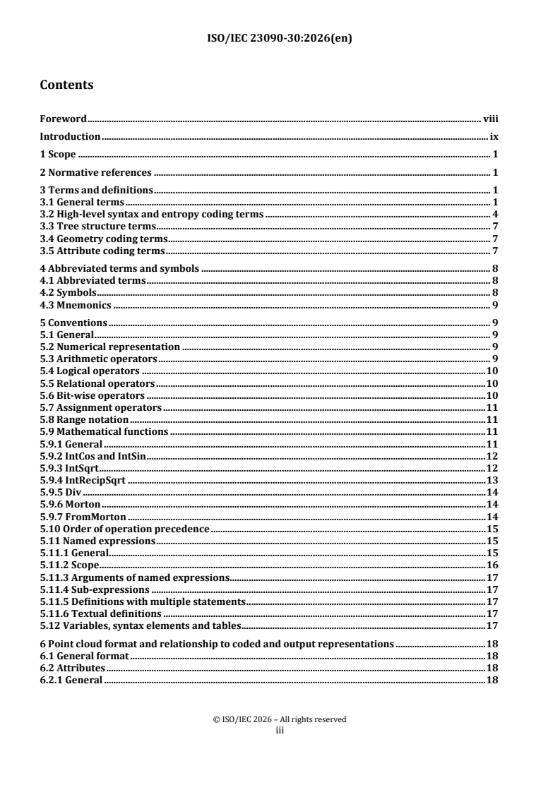
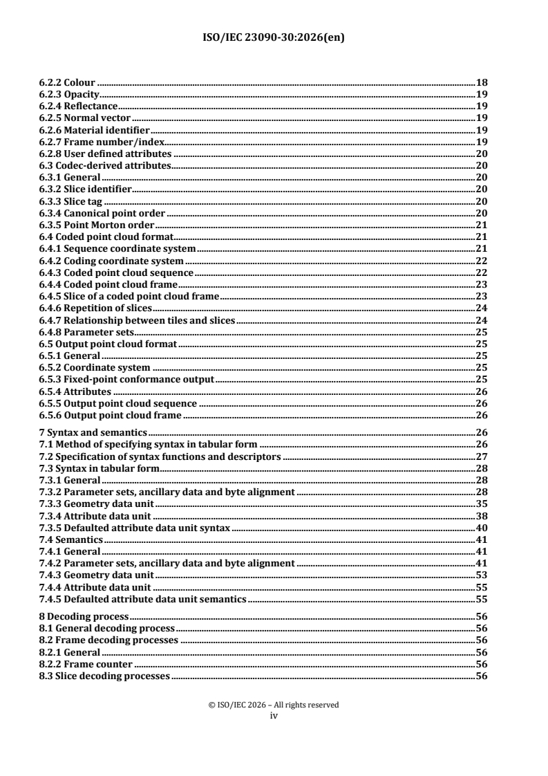
ISO/IEC 23090-30:2026 is an International Standard published by ISO and IEC for low latency, low complexity LiDAR coding, also identified as L3C2. It specifies how LiDAR point clouds are represented, coded, parsed and decoded so that implementations can reconstruct point cloud sequences with low latency and low complexity.
What does ISO/IEC 23090-30:2026 specify?
ISO/IEC 23090-30:2026 specifies low latency, low complexity LiDAR coding for point cloud sequences captured with LiDAR sensors. In practice, it defines the coded representation, the output representation, and the decoding behavior needed for interoperable implementations.
The standard is organized into clauses 1 to 12, followed by four annexes.
| Annex | What it covers |
|---|---|
| Annex A | Profiles and levels |
| Annex B | Type-length-value encapsulated bytestream format |
| Annex C | Arithmetic encoding engine |
| Annex D | Index of named expressions and variables |
The main body covers scope, normative references, terms and definitions, abbreviations and conventions, the point cloud format, syntax and semantics, decoding, slice geometry, slice attributes, parsing, and the OBUF parsing process. That structure matters because implementers need to follow the same data model, syntax, and decoder steps to get matching results.
What are the key requirements of ISO/IEC 23090-30:2026?
ISO/IEC 23090-30:2026 ties together point cloud structure, parameter sets, syntax parsing, and reconstruction rules. The most important practical requirements are the ones that control how a stream is interpreted, how geometry is rebuilt, and how attributes are decoded.
Bitstream structure and parameter sets
Clause 6 defines the point cloud model and how coded and output representations relate. A point cloud is treated as an unordered list of points, but L3C2 point clouds are ordered to follow LiDAR capture characteristics as closely as possible, which helps keep latency low.
Clause 7 defines the syntax system used by the bitstream. It uses data units, syntax elements, and parameter sets, especially the sequence parameter set (SPS), geometry parameter set (GPS), and attribute parameter set (APS). In practice, an encoder and decoder must agree on which parameter set is active before interpreting geometry or attributes.
Clause 7.4.2 defines sequence-level information such as coordinate-system origin and scaling, coded volume dimensions, and the attribute list. It also defines built-in attribute identification and user-defined attributes through object identifiers or ITU-T T.35 registration. That means implementations must carry the metadata needed to interpret positions and attribute meaning, not just the sample values.
Geometry coding and reconstruction
Clause 8 defines the decoding process and states that conforming decoders for the same profile and level produce numerically identical output point cloud frames. For users, this is the interoperability target: two conforming decoders should reconstruct the same point clouds from the same bitstream.
Clause 9 specifies slice geometry and the reconstruction of point positions. It covers sensed point sequences, state variables, contextualization of elevation_offset, and the reconstruction of sensed point positions, output positions, and low latency attributes. In practice, this is the part to study when implementing the geometry decoder for LiDAR-style sensing order.
Clause 9 also stores reconstructed geometry in the PointPos and PointAng arrays. That matters because later attribute decoding can depend on the reconstructed positions, so geometry must be available before attributes are fully decoded.
Attribute coding and reconstruction
Clause 10 specifies how a single slice attribute is reconstructed and stored in PointAttr. It provides four coding paths: raw attribute data, region-adaptive hierarchical transform (RAHT), level(s) of detail (LoD) with Predicting Transform, and LoD with Lifting Transform.
For implementers, the important point is that APS selects the coding type and related prediction, quantization, and level-of-detail behavior. Clause 10 also defines raw attribute decoding, coefficient scaling, transform-domain prediction, inverse transform, predictor search, and quantization parameter handling. That means attribute decoding is not a single generic step - it depends on the selected coding mode and on the available neighbor points.
Clause 10.6 is especially important for low-complexity implementations because it builds attribute reconstruction from coarse to fine detail levels. Points are grouped into refinement lists, predictor sets are searched from neighboring points, and transform coefficients are decoded in detail-level order. In practice, this is the section that governs how much state and search logic a decoder needs.
Parsing, entropy coding, and transport
Clause 11 defines how syntax elements are parsed from a data unit. It covers fixed-length codes, Exp-Golomb codes, truncated unary variants, signed mapping, ASN.1 object identifiers, CABAC parsing, sensor coding state, and memorization/restoration of parsing state across data units.
Clause 11.3 defines chunked bytestream parsing, which is important when bypass bins are multiplexed separately from arithmetic-coded bins. Clause 11.6 defines Sensor Coding State, which helps guide entropy parsing from previously decoded sensed points. In practice, this is where decoder state management becomes critical for low-latency LiDAR streams.
Clause 12 adds OBUF, the Optimal Binary coder with Update on the Fly. OBUF uses contextual information, an internal tree, and adaptive context probability models to choose and update bins while decoding. That matters when an implementation needs adaptive bin handling with changing statistics during parsing.
Annex A adds profile and level constraints, so buyers and engineers can check decoder capability and stream limits against interoperability needs. Annex B defines a TLV-encapsulated bytestream format for delivering data units in byte order without another file wrapper.
What terms does ISO/IEC 23090-30:2026 define?
ISO/IEC 23090-30:2026 defines the basic point-cloud, coding, and parameter-set terms needed to read the rest of the standard. These are the terms most likely to matter when comparing implementations or decoding logs.
- Point - a fundamental point-cloud element with a position and zero or more attributes.
- Point cloud - an unordered list of points.
- Point cloud frame - one point cloud within a point cloud sequence.
- Slice - geometry and attributes for part of, or all of, a coded point cloud frame.
- Tile - a set of slices identified by a common slice_tag value and intended to fit within a bounding box from a tile inventory data unit.
- Sequence parameter set (SPS) - parameters for an entire coded point cloud sequence, activated when referenced by a geometry data unit.
- Geometry parameter set (GPS) - parameters for coding slice geometry, activated when referenced by a geometry data unit.
- Attribute parameter set (APS) - parameters for coding slice attributes, activated when referenced by an attribute data unit.
- Low latency attributes - additional attributes coded together with geometry to support low-latency decoding.
Who uses ISO/IEC 23090-30:2026?
ISO/IEC 23090-30:2026 is used by engineers and system designers who build LiDAR compression and decompression systems, and by teams that need to exchange point clouds in a predictable format. It is especially relevant in assisted and autonomous driving, cartography, and other industrial processes that rely on real-time 3D data.
Typical users include encoder and decoder developers, point-cloud platform vendors, sensor-fusion integrators, test laboratories, quality managers, and technical buyers assessing decoder capability. They use it to choose profiles and levels, define SPS/GPS/APS signaling, implement parsing and reconstruction, and verify interoperability.
Which standards are used with ISO/IEC 23090-30:2026?
ISO/IEC 23090-30:2026 relies on a small set of normative references for encoding rules, object identifiers, and coded attribute signaling.
- ISO/IEC 8825-1 | Rec. ITU-T X.690 - provides ASN.1 encoding rules, including BER, CER and DER, which support ASN.1-based syntax and object-identifier handling.
- ISO/IEC 9834-1 | Rec. ITU-T X.660 - provides the general procedures and top arcs for the international object identifier tree.
- ISO/IEC 9834-8 | Rec. ITU-T X.667 - provides UUID generation and their use in object identifiers.
- ISO/IEC 23091-2 - provides coding-independent code points for video, used for some attribute properties.
- Recommendation ITU-T T.35 - provides the procedure for allocating ITU-T defined codes for non-standard facilities, used for user-defined attribute properties.
What does the ISO/IEC 23090-30:2026 document contain?
ISO/IEC 23090-30:2026 contains the full syntax and semantics for L3C2 point-cloud coding, including the tables that define parameter sets, attribute properties, syntax descriptors, permitted ranges, and parsing behavior. It also contains the decoding process, the slice-geometry reconstruction process, and the slice-attribute reconstruction methods.
The document includes detailed procedures for CABAC parsing, chunked bytestream parsing, Sensor Coding State handling, and OBUF-based decoding. It also includes formulas and named expressions for coordinate transforms, Morton-related functions, prediction, scaling, and quantization, plus Figure 9 as an example of points across detail levels.
Annex A gives the profile and level framework, Annex B gives a transport-friendly TLV encapsulation format, Annex C gives the complementary arithmetic encoding engine, and Annex D indexes the named expressions and variables used throughout the standard.
Get Certified
Connect with accredited certification bodies for this standard

BSI Group
BSI (British Standards Institution) is the business standards company that helps organizations make excellence a habit.

NYCE
Mexican standards and certification body.
Sponsored listings
Frequently Asked Questions
ISO/IEC 23090-30:2026 is a standard published by the International Organization for Standardization (ISO). Its full title is "Information technology — Coded representation of immersive media — Part 30: Low latency, low complexity light detection and ranging (LiDAR) coding". This standard covers: This document specifies low latency, low complexity light detection and ranging (LiDAR) coding.
This document specifies low latency, low complexity light detection and ranging (LiDAR) coding.
ISO/IEC 23090-30:2026 is classified under the following ICS (International Classification for Standards) categories: 35.040.40 - Coding of audio, video, multimedia and hypermedia information. The ICS classification helps identify the subject area and facilitates finding related standards.
ISO/IEC 23090-30:2026 is available in PDF format for immediate download after purchase. The document can be added to your cart and obtained through the secure checkout process. Digital delivery ensures instant access to the complete standard document.
Standards Content (Sample)
International
Standard
ISO/IEC 23090-30
First edition
Information technology — Coded
2026-07
representation of immersive
media —
Part 30:
Low latency, low complexity light
detection and ranging (LiDAR)
coding
Reference number
© ISO/IEC 2026
All rights reserved. Unless otherwise specified, or required in the context of its implementation, no part of this publication may
be reproduced or utilized otherwise in any form or by any means, electronic or mechanical, including photocopying, or posting on
the internet or an intranet, without prior written permission. Permission can be requested from either ISO at the address below
or ISO’s member body in the country of the requester.
ISO copyright office
CP 401 • Ch. de Blandonnet 8
CH-1214 Vernier, Geneva
Phone: +41 22 749 01 11
Email: copyright@iso.org
Website: www.iso.org
Published in Switzerland
© ISO/IEC 2026 – All rights reserved
ii
Contents
Foreword . viii
Introduction . ix
1 Scope . 1
2 Normative references . 1
3 Terms and definitions . 1
3.1 General terms . 1
3.2 High-level syntax and entropy coding terms . 4
3.3 Tree structure terms . 7
3.4 Geometry coding terms . 7
3.5 Attribute coding terms . 7
4 Abbreviated terms and symbols . 8
4.1 Abbreviated terms . 8
4.2 Symbols . 8
4.3 Mnemonics . 9
5 Conventions . 9
5.1 General . 9
5.2 Numerical representation . 9
5.3 Arithmetic operators . 9
5.4 Logical operators . 10
5.5 Relational operators . 10
5.6 Bit-wise operators . 10
5.7 Assignment operators . 11
5.8 Range notation . 11
5.9 Mathematical functions . 11
5.9.1 General . 11
5.9.2 IntCos and IntSin . 12
5.9.3 IntSqrt . 12
5.9.4 IntRecipSqrt . 13
5.9.5 Div . 14
5.9.6 Morton . 14
5.9.7 FromMorton . 14
5.10 Order of operation precedence . 15
5.11 Named expressions . 15
5.11.1 General . 15
5.11.2 Scope . 16
5.11.3 Arguments of named expressions. 17
5.11.4 Sub-expressions . 17
5.11.5 Definitions with multiple statements . 17
5.11.6 Textual definitions . 17
5.12 Variables, syntax elements and tables . 17
6 Point cloud format and relationship to coded and output representations . 18
6.1 General format . 18
6.2 Attributes . 18
6.2.1 General . 18
© ISO/IEC 2026 – All rights reserved
iii
6.2.2 Colour . 18
6.2.3 Opacity . 19
6.2.4 Reflectance . 19
6.2.5 Normal vector . 19
6.2.6 Material identifier . 19
6.2.7 Frame number/index. 19
6.2.8 User defined attributes . 20
6.3 Codec-derived attributes . 20
6.3.1 General . 20
6.3.2 Slice identifier . 20
6.3.3 Slice tag . 20
6.3.4 Canonical point order . 20
6.3.5 Point Morton order . 21
6.4 Coded point cloud format . 21
6.4.1 Sequence coordinate system . 21
6.4.2 Coding coordinate system . 22
6.4.3 Coded point cloud sequence . 22
6.4.4 Coded point cloud frame . 23
6.4.5 Slice of a coded point cloud frame . 23
6.4.6 Repetition of slices . 24
6.4.7 Relationship between tiles and slices . 24
6.4.8 Parameter sets. 25
6.5 Output point cloud format . 25
6.5.1 General . 25
6.5.2 Coordinate system . 25
6.5.3 Fixed-point conformance output . 25
6.5.4 Attributes . 26
6.5.5 Output point cloud sequence . 26
6.5.6 Output point cloud frame . 26
7 Syntax and semantics . 26
7.1 Method of specifying syntax in tabular form . 26
7.2 Specification of syntax functions and descriptors . 27
7.3 Syntax in tabular form . 28
7.3.1 General . 28
7.3.2 Parameter sets, ancillary data and byte alignment . 28
7.3.3 Geometry data unit . 35
7.3.4 Attribute data unit . 38
7.3.5 Defaulted attribute data unit syntax . 40
7.4 Semantics . 41
7.4.1 General . 41
7.4.2 Parameter sets, ancillary data and byte alignment . 41
7.4.3 Geometry data unit . 53
7.4.4 Attribute data unit . 55
7.4.5 Defaulted attribute data unit semantics . 55
8 Decoding process . 56
8.1 General decoding process . 56
8.2 Frame decoding processes . 56
8.2.1 General . 56
8.2.2 Frame counter . 56
8.3 Slice decoding processes . 56
© ISO/IEC 2026 – All rights reserved
iv
8.3.1 General . 56
8.3.2 State variables . 56
8.3.3 Geometry decoding process . 57
8.3.4 Default attribute values . 57
8.3.5 Attribute decoding process . 57
8.3.6 At the end of a slice . 57
9 Slice geometry . 57
9.1 General . 57
9.2 Sensed point sequence . 58
9.2.1 General . 58
9.2.2 State variables and expressions . 58
9.2.3 Syntax element semantics . 59
9.2.4 Contextualization of decoding elevation_offset . 62
9.2.5 Reconstruction of sensed point positions . 65
9.2.6 Reconstructed output point positions . 74
9.2.7 Reconstructed output low latency attributes values . 74
9.2.8 Reconstructed point positions for attributes decoding . 74
10 Slice attributes . 74
10.1 General . 74
10.2 Point coordinates . 74
10.2.1 General . 74
10.2.2 Conversion to scaled angular coordinates . 75
10.3 Syntax element semantics . 75
10.4 Raw attribute decoding . 76
10.5 Attribute decoding using the region-adaptive hierarchical transform . 76
10.5.1 General . 76
10.5.2 Transform tree. 76
10.5.3 Coefficient order . 79
10.5.4 Coefficient scaling . 80
10.5.5 Transform domain prediction . 82
10.5.6 Inverse transform . 86
10.5.7 Reconstructed attribute values . 88
10.6 Attribute decoding using levels of detail . 88
10.6.1 General . 88
10.6.2 Syntax element semantics . 89
10.6.3 Reconstruction process . 89
10.6.4 State variables . 89
10.6.5 Levels of detail . 90
10.6.6 Predictor search . 96
10.6.7 Reconstruction of attribute values . 102
10.6.8 Prediction mode coding . 103
10.6.9 Scaling . 105
10.6.10 Coefficient prediction . 105
10.6.11 Transform coefficient weights . 106
10.6.12 Transform . 107
10.7 Attribute quantization parameters . 108
10.7.1 Syntax element semantics . 108
10.7.2 Per-point regional QP offset. 109
10.7.3 Attribute coefficient QP . 109
10.7.4 Definition of AttrQstep . 109
© ISO/IEC 2026 – All rights reserved
v
11 Parsing process . 110
11.1 General . 110
11.2 Data unit buffer . 111
11.2.1 General . 111
11.2.2 State . 111
11.2.3 Initialization at the start of parsing a data unit . 112
11.2.4 Initialization at the start of parsing a geometry data unit footer . 112
11.2.5 Definition of DuNextBit . 112
11.3 Chunked bytestream parsing . 112
11.3.1 General . 112
11.3.2 Chunk syntax . 113
11.3.3 Chunk semantics . 113
11.3.4 State . 113
11.3.5 Span of chunked bytestream data within a data unit . 113
11.3.6 The chunk buffer . 114
11.3.7 State update at the start of every CBS . 114
11.3.8 Unpacking a single chunk . 114
11.3.9 Definition of ChunkNextAeBit . 114
11.3.10 Definition of ChunkNextBpBit . 115
11.3.11 Boundary between spliced chunked bytestreams . 115
11.3.12 Location of chunked bytestream boundaries . 116
11.4 General inverse binarization processes . 116
11.4.1 Parsing unsigned fixed-length codes (FL) . 116
11.4.2 Parsing signed fixed-length codes (FL+S) . 116
11.4.3 Parsing 𝑘𝑘-th order exp-Golomb codes (EGk) . 117
11.4.4 Parsing concatenated truncated unary and 𝑘𝑘-th order exp-Golomb codes (TU+EGk) . 117
11.4.5 Parsing concatenated bounded truncated unary and 𝑘𝑘-th order exp-Golomb codes
(BTU+EGk) . 117
11.4.6 Parsing signed concatenated truncated unary and 𝑘𝑘-th order exp-Golomb codes
(TU+EGk+S) . 118
11.4.7 Parsing signed concatenated bounded truncated unary and 𝑘𝑘-th order exp-Golomb
codes (BTU+EGk+S) . 118
11.4.8 Parsing signed concatenated asymmetrically bounded truncated unary and 𝑘𝑘-th
order exp-Golomb codes (ABTU+EGk+S) . 119
11.4.9 Parsing truncated unary codes (TU) . 120
11.4.10 Mapping process for signed codes . 120
11.4.11 Parsing ASN.1 object identifiers . 120
11.5 CABAC parsing processes . 121
11.5.1 Initialization . 121
11.5.2 Definition of AeReadBin . 121
11.5.3 Contextual probability models . 121
11.5.4 Arithmetic decoding engine . 125
11.6 Sensor Coding State . 127
11.6.1 State variable . 127
11.6.2 Initialization at the start of a GDU . 129
11.6.3 Initialization with decoded coarse position of first sensed point . 130
11.6.4 Update with azimuth_offset . 131
11.6.5 Update while decoding elevation_offset . 132
11.6.6 Update with sensed point coarse position . 132
11.7 Parsing state memorization and restoration . 133
© ISO/IEC 2026 – All rights reserved
vi
11.7.1 General . 133
11.7.2 Geometry data units . 133
11.7.3 Attribute data units . 134
11.7.4 Defaulted attribute data units . 134
12 OBUF parsing process . 134
12.1 General . 134
12.2 Creation of an OBUF instance . 134
12.2.1 Creation and initialization of OBUF trees . 135
12.2.2 Creation and initialization of an array of OBUF ACPMs . 136
12.3 Call and update of an OBUF instance . 136
12.3.1 Decode and update according to OBUF trees . 136
12.4 Decode of a bin based on an OBUF ACPM . 137
Annex A (normative) Profiles and levels . 139
Annex B (normative) Type-length-value encapsulated bytestream format . 144
Annex C (informative) Arithmetic encoding engine . 146
Annex D (informative) Index of named expressions and variables . 149
© ISO/IEC 2026 – All rights reserved
vii
Foreword
ISO (the International Organization for Standardization) and IEC (the International Electrotechnical
Commission) form the specialized system for worldwide standardization. National bodies that are members
of ISO or IEC participate in the development of International Standards through technical committees
established by the respective organization to deal with particular fields of technical activity. ISO and IEC
technical committees collaborate in fields of mutual interest. Other international organizations, governmental
and non-governmental, in liaison with ISO and IEC, also take part in the work.
The procedures used to develop this document and those intended for its further maintenance are described
in the ISO/IEC Directives, Part 1. In particular, the different approval criteria needed for the different types of
document should be noted. This document was drafted in accordance with the editorial rules of the ISO/IEC
Directives, Part 2 (see www.iso.org/directives or www.iec.ch/members_experts/refdocs).
ISO and IEC draw attention to the possibility that the implementation of this document may involve the use of
(a) patent(s). ISO and IEC take no position concerning the evidence, validity or applicability of any claimed
patent rights in respect thereof. As of the date of publication of this document, ISO and IEC had received notice
of (a) patent(s) which may be required to implement this document. However, implementers are cautioned
that this may not represent the latest information, which may be obtained from the patent database available
at www.iso.org/patents and https://patents.iec.ch. ISO and IEC shall not be held responsible for identifying
any or all such patent rights.
Any trade name used in this document is information given for the convenience of users and does not
constitute an endorsement.
For an explanation of the voluntary nature of standards, the meaning of ISO specific terms and expressions
related to conformity assessment, as well as information about ISO's adherence to the World Trade
Organization (WTO) principles in the Technical Barriers to Trade (TBT) see www.iso.org/iso/foreword.html.
In the IEC, see www.iec.ch/understanding-standards.
This document was prepared by Joint Technical Committee ISO/IEC JTC 1, Subcommittee SC 29, Coding of
audio, picture, multimedia and hypermedia information.
A list of all parts in the ISO/IEC 23090 series can be found on the ISO and IEC websites.
Any feedback or questions on this document should be directed to the user’s national standards body. A
complete listing of these bodies can be found at www.iso.org/members.html and www.iec.ch/national-
committees.
© ISO/IEC 2026 – All rights reserved
viii
Introduction
Advancements in 3D capturing and rendering technologies are enabling new applications and services in the
fields of assisted and autonomous driving, cartography, and other industrial processes. Point clouds captured
with LiDAR (Light Detection And Ranging) sensors, sometimes coupled with traditional camera sensors, have
arisen as one of the main representations for such applications. A point cloud frame consists of a set of 3D
points. Every point, in addition to having a 3D position, may also be associated with numerous other attributes
such as intensity, colour, timestamp, and classification. Such representations require a large amount of data,
which can be costly in terms of storage and transmission and are often used in real-time application which
requires fast processing of the point cloud data. This document provides the method for efficiently
compressing point cloud representations while ensuring low complexity and low latency constraints can be
met.
© ISO/IEC 2026 – All rights reserved
ix
International Standard ISO/IEC 23090-30:2026(en)
Information technology — Coded representation of
immersive media —
Part 30:
Low latency, low complexity light detection and ranging
(LiDAR) coding
1 Scope
This document specifies low latency, low complexity light detection and ranging (LiDAR) coding.
2 Normative references
The following documents are referred to in the text in such a way that some or all of their content constitutes
requirements of this document. For dated references, only the edition cited applies. For undated references,
the latest edition of the referenced document (including any amendments) applies.
ISO/IEC 8825-1 | Rec. ITU-T X.690, Information technology — ASN.1 encoding rules — Part 1: Specification of
Basic Encoding Rules (BER), Canonical Encoding Rules (CER) and Distinguished Encoding Rules (DER)
ISO/IEC 9834-1 | Rec. ITU-T X.660, Information technology — Procedures for the operation of object identifier
registration authorities — Part 1: General procedures and top arcs of the international object identifier tree
ISO/IEC 9834-8 | Rec. ITU-T X.667, Information technology — Procedures for the operation of object identifier
registration authorities — Part 8: Generation of universally unique identifiers (UUIDs) and their use in object
identifiers
ISO/IEC 23091-2, Information technology — Coding-independent code points — Part 2: Video
Recommendation ITU-T T.35, Procedure for the allocation of ITU-T defined codes for non-standard facilities
3 Terms and definitions
For the purposes of this document, the following terms and definitions apply.
ISO and IEC maintain terminology databases for use in standardization at the following addresses:
— ISO Online browsing platform: available at https://www.iso.org/obp
— IEC Electropedia: available at https://www.electropedia.org/
3.1 General terms
3.1.1
point
fundamental element of a point cloud (3.1.2) comprising a position specified as Cartesian coordinates (3.1.8)
and zero or more attributes (3.1.19)
© ISO/IEC 2026 – All rights reserved
3.1.2
point cloud
unordered list of points (3.1.1)
3.1.3
point cloud sequence
sequence of one or more point clouds (3.1.2)
3.1.4
point cloud frame
point cloud (3.1.2) in a point cloud sequence (3.1.3)
3.1.5
coded point cloud frame
coded representation of a point cloud frame (3.1.4)
3.1.6
canonical point order
canonical decoding order
order of points (3.1.1) decoded from a slice (3.1.21) according to the decoding and parsing processes specified
in this document
3.1.7
bounding box
axis-aligned cuboid defining a spatial region that bounds a set of points (3.1.1)
3.1.8
coordinates
three scalar multiples of respective orthogonal XYZ (3.1.11) unit vectors with finite precision and
bounds that specify a position relative to a fixed reference
3.1.9
coordinates
a position specified as the radial distance 𝜌𝜌 from the V axis, an azimuth angle 𝜑𝜑 in the S-T plane and
an indexed elevation
3.1.10
coordinates
either STV (3.1.12) or scaled RPI (3.1.13) point coordinates used to code an attribute
3.1.11
XYZ (axes)
X, Y and Z axes, in that order, used to represent Cartesian coordinates (3.1.8)
3.1.12
STV (axes)
S, T and V axes, in that order, that are a sequence-dependent permutation of the XYZ axes (3.1.11); used to
represent the coded geometry (3.1.18)
3.1.13
RPI (axes)
R, P and I axes, in that order, used to represent angular coordinates (3.1.9)
3.1.14
sequence coordinate system
scaled and translated application-specific coordinate system that applies to an entire coded point cloud
sequence (3.1.3), and in which all points (3.1.1) have non-negative, fixed-point coordinates
© ISO/IEC 2026 – All rights reserved
3.1.15
coding coordinate system
scaled sequence coordinate system (3.1.14) that applies for an entire coded point cloud sequence (3.1.3), and in
which all points (3.1.1) have non-negative integer coordinates
3.1.16
slice coordinate system
translated coding coordinate system (3.1.15) that applies for a single slice (3.1.21), and in which all points
(3.1.1) in the slice have non-negative integer coordinates
3.1.17
sensing beam
sampler of point positions using angular coordinates by rays cast with a fixed elevation and from a point on
and rotating around the V axis at the angular origin
3.1.18
geometry
point positions (3.4.1) associated with a set of points (3.1.1)
3.1.19
attribute
scalar or vector property associated with each point (3.1.1) in a point cloud (3.1.2)
EXAMPLE Colour, reflectance, frame index, etc.
3.1.20
position
position
bit in a binary string or value, representing the factor 2
EXAMPLE The LSB has bit position 0.
3.1.21
slice
geometry and attributes for part of, or an entire, coded point cloud frame (3.1.5)
Note 1 to entry: the bounding boxes of any two slices can intersect.
3.1.22
tile
set of slices (3.1.21) identified by a common slice_tag syntax element value (3.2.15) whose geometry (3.1.18)
should be contained within a bounding box (3.1.7) specified in a tile inventory data unit
3.1.23
Morton code
non-negative integer obtained by interleaving the bits of three integers
3.1.24
Morton order
elements ordered according to their Morton code (3.1.23)
3.1.25
sparse array
array with fewer set elements than total addressable elements; u
...