

oSIST prEN IEC 61174:2026
(Main)Maritime navigation and radiocommunication equipment and systems - Electronic chart display and information system (ECDIS) - Operational and performance requirements, methods of testing and required test results
- Status
- Not Published
- Public Enquiry End Date
- 30-Nov-2026
- Technical Committee
- I11 - Imaginarni 11
- Current Stage
- 4020 - Public enquire (PE) (Adopted Project)
- Start Date
- 07-Oct-2026
- Due Date
- 24-Feb-2027


oSIST prEN IEC 61174:2026 is the Slovenian adoption of the IEC draft for Electronic chart display and information system (ECDIS). It specifies operational and performance requirements, methods of testing and required test results for bridge equipment used in maritime navigation and radiocommunication. In practice, it is the document manufacturers, test laboratories, integrators and ship operators use to check how an ECDIS should display chart data, handle route planning and monitoring, exchange routes, and connect with other shipboard systems.
What does oSIST prEN IEC 61174:2026 specify?
oSIST prEN IEC 61174:2026 covers the minimum behaviour expected from an ECDIS, how that behaviour is tested, and how the results are judged. The document is organised into clauses on requirements, IHO-related chart functions, S-100 based data, other special requirements, and test methods, followed by normative and informative annexes for data, interfaces, test cases and guidance.
The main body runs through Clause 4 to Clause 8:
- Clause 4 - minimum operational and performance requirements
- Clause 5 - requirements related to IHO publications for S-57 ENC charts
- Clause 6 - requirements related to IHO publications for S-100 based data
- Clause 7 - other requirements
- Clause 8 - test methods and required test results
| Annex | What it covers |
|---|---|
| A | System database information to be displayed during route planning and route monitoring |
| B | Navigational elements and parameters |
| C | Areas for which special conditions exist |
| D | Alerts and indications |
| E | Back-up arrangements |
| F | ECDIS in the RCDS mode of operation |
| G | Alerts and indications in the RCDS mode of operation |
| H | Scenario definitions and plots |
| I | Guidance on geodetic calculations |
| J | Guidance for testing |
| K | Use cases for safety contour and safety depth |
| L | Guidelines on use of electronic chart systems in polar waters |
| M | Scenarios for polar areas above 85° North |
| N | IEC 61162 interfaces |
| O | Conversion between IEC 61162-1 sentences and IEC 61162-3 parameter group numbers |
| P | Route plan exchange format - RTZ |
| Q | Interface for reporting route transfer |
| R | Symbols |
| S | RTZ v1.2 test files |
| T | UML model of the route plan exchange format |
| U | Comparison of RTZ schema versions |
What are the key requirements of oSIST prEN IEC 61174:2026?
oSIST prEN IEC 61174:2026 requires an ECDIS to present chart and navigation data in a controlled, testable way, and to support route planning, route monitoring, route exchange and voyage recording. It also ties the display and data handling rules to IHO publications, interface standards and defined test methods so that suppliers can verify interoperability rather than rely on vendor-specific behaviour.
Display, chart data and updates
Clause 4 sets requirements for displaying system database information, including how the system handles chart objects, display scale, safety contour and safety depth, dynamic water level, and indications when data come from a non-HO source. For a buyer or engineer, this means the display is not just a map - it must show the right layers, warn when chart data are outside the expected source or scale, and keep navigators aware of what they are actually using.
Clause 4 also covers the provision and updating of ENDS information, display modes, colours and symbols, and display of other navigational information such as radar information, AIS objects, own ship AIS information and anchor watch. In practice, the ECDIS has to manage overlays and alerts without hiding the chart or confusing the mariner.
Clause 5 adds display rules linked to IHO publications for S-57 ENC charts, including chart display priority, scale and navigation purpose, units and legend, terminology, cursor pick, date-dependent ENC objects, supplementary display functions, the presentation library, display characteristics, ergonomic requirements, and chart update handling. This matters because the ECDIS must present official chart content consistently, and users need a predictable way to inspect objects, update charts and review changes.
Route planning, monitoring and exchange
Clause 4 requires route planning, route monitoring, route exchange with other equipment, additional mariner’s information, sensor integration, object information, LOP position fix, and voyage recording. It also covers calculations and accuracy. In practical terms, the ECDIS must be able to build a route, check it against charted dangers, monitor progress against the planned track, and retain useful voyage data.
Clause 4 further addresses interfaces with navigation and radio equipment, CAM system, VDR, BNWAS, system database information, NAVTEX or EGC for MSI, route transfer within a vessel, INS, and GMDSS radio communication equipment for received distress alert. This is important because many shipboard functions depend on the ECDIS sharing data correctly with other bridge systems.
Clause 7 adds other requirements for operational area and Automatic Executable Program File Verification. That means the supplier must also control where the system is intended to operate and how executable software files are checked before use.
Backup, power, software and management controls
Clause 4 includes back-up arrangements, power supply, software maintenance, quality management requirements, and user and default settings. Annex E expands the back-up system requirements, including functions, reliability, accuracy, warnings, operational ergonomics, information presentation, power supply and interfaces with other systems.
For the user, these requirements matter because an ECDIS is expected to remain usable during failures and after restarts, and settings must be managed in a way that supports safe operation rather than hidden customisation.
Testing and acceptance
Clause 8 sets the test framework. It covers EUT installation, technical documentation, interfaces, general and presentation requirements, preparation and power-up, initial ship parameters, ENC chart tests, accuracy, visual requirements, functional requirements, and operational requirements. Annex J explains the test methods used: observation, inspection of documented evidence, measurement and analytical evaluation.
In practice, this gives laboratories a defined way to test the equipment and gives purchasers a basis for asking what was checked - for example display behaviour, route handling, interface messages, alarm response and chart update handling.
Special operating modes and polar use
Annex F covers ECDIS in RCDS mode of operation, and Annex G covers alerts and indications in that mode. Annex L gives guidance for polar waters, and Annex M gives scenarios for polar areas above 85° North. This matters for vessels that may operate where Mercator-based display and geometry handling become more difficult, or where raster chart fallback is relevant.
What terms does oSIST prEN IEC 61174:2026 define?
- Electronic chart display and information system (ECDIS) - the shipborne system covered by the standard for chart display, route support and navigation-related information.
- Electronic Navigational Chart (ENC) - the chart data type used in the standard’s main ECDIS mode.
- Raster Chart Display System (RCDS) - the alternative mode covered in Annex F for raster chart use.
- Route plan exchange format - RTZ - the XML-based route exchange format defined in Annex P.
- Voyage Data Recorder (VDR) - the shipboard recorder that receives selected ECDIS information through the Annex N interface.
- Bridge navigational watch alarm system (BNWAS) - the bridge alarm system that can exchange information with ECDIS.
- Automatic Identification System (AIS) - the vessel and target data source used for target display, alarms and voyage-related information.
Who uses oSIST prEN IEC 61174:2026?
oSIST prEN IEC 61174:2026 is used by ECDIS manufacturers, software developers, bridge system integrators and test laboratories. It gives them the functions, interface behaviour and test evidence expected for compliance work and product verification.
Shipowners, fleet technical managers, buyers and quality managers use it when comparing products, specifying bridge equipment or checking test reports. It is also relevant to classification, approval and acceptance teams that need to understand what the ECDIS must do with ENC, AIS, radar, route exchange and backup functions.
What changed in oSIST prEN IEC 61174:2026 from the previous edition?
The document text refers back to IEC 61174:2015 and updates the route plan exchange part to RTZ v1.2. Annex P states that the route exchange format now supports version 1.2 by default, still allows version 1.0 for export, and requires import support for both versions.
Annex U says the RTZ schema update corrects typographical errors, resolves ambiguity, improves extension handling and validation, adds missing extension-related elements and attributes, and standardises several route-plan data fields. The document also notes that these changes address robustness issues found in earlier RTZ testing.
Which standards are used with oSIST prEN IEC 61174:2026?
| Standard | What it contributes |
|---|---|
| IEC 61162-1, IEC 61162-2, IEC 61162-3 | Digital interface sentences and parameter group numbers for navigation, heading, position, AIS, route transfer and related data |
| IEC 61996-1 | VDR header and format used for transmitting ECDIS information to the voyage data recorder |
| IEC 61924-2 | INS-related operational and performance context for integrated navigation data |
| IEC 62616 | BNWAS interface context |
| ISO 9001 | Quality management requirements |
| ISO 9241-12 | Presentation of information on visual display terminals |
| IHO S-100, S-101, S-102, S-104, S-111, S-122, S-123, S-124, S-127, S-128, S-129, S-131 | Hydrographic and marine data products used in ECDIS-related display and interoperability |
| IMO MSC.530(106)/Rev.1 | Revised ECDIS performance standards |
| IMO SN.1/Circ.243/Rev.2 and IMO SN.1/Circ.289 / SN.1/Circ.290 | Symbols, terminology, and AIS presentation guidance |
| IHO S-98 | Data product interoperability in S-100 navigation systems |
What does the oSIST prEN IEC 61174:2026 document contain?
The document contains detailed requirement clauses, test clauses and a large set of annexes with tables, scenarios, interfaces and examples. It includes route-planning and route-monitoring cases, backup arrangements, RCDS mode rules, polar-area scenarios, and an extensive RTZ route exchange definition with XML schema, examples, and test files.
It also contains interface tables for IEC 61162 messaging, route transfer reporting, and VDR-related data, plus conversion tables between IEC 61162-1 sentences and IEC 61162-3 parameter group numbers. Annex H gives plotted test scenarios, Annex M gives polar control points, Annex R defines presentation symbols, and Annex S provides RTZ v1.2 test files for validation work.
Relations
- Effective Date
- 20-Feb-2024
Get Certified
Connect with accredited certification bodies for this standard

DNV
DNV is an independent assurance and risk management provider.

Lloyd's Register
Lloyd's Register is a global professional services organisation specialising in engineering and technology.

FSC International
Forest Stewardship Council certification.
Sponsored listings
Frequently Asked Questions
oSIST prEN IEC 61174:2026 is a draft published by the Slovenian Institute for Standardization (SIST). Its full title is "Maritime navigation and radiocommunication equipment and systems - Electronic chart display and information system (ECDIS) - Operational and performance requirements, methods of testing and required test results". This standard covers: Maritime navigation and radiocommunication equipment and systems - Electronic chart display and information system (ECDIS) - Operational and performance requirements, methods of testing and required test results
Maritime navigation and radiocommunication equipment and systems - Electronic chart display and information system (ECDIS) - Operational and performance requirements, methods of testing and required test results
oSIST prEN IEC 61174:2026 is classified under the following ICS (International Classification for Standards) categories: 47.020.70 - Navigation and control equipment. The ICS classification helps identify the subject area and facilitates finding related standards.
oSIST prEN IEC 61174:2026 has the following relationships with other standards: It is inter standard links to SIST EN 61174:2016. Understanding these relationships helps ensure you are using the most current and applicable version of the standard.
oSIST prEN IEC 61174:2026 is available in PDF format for immediate download after purchase. The document can be added to your cart and obtained through the secure checkout process. Digital delivery ensures instant access to the complete standard document.
Standards Content (Sample)
SLOVENSKI STANDARD
01-november-2026
Pomorska navigacijska in radiokomunikacijska oprema in sistemi - Prikazovalnik
elektronskih kart in informacijski sistem (ECDIS) - Zahteve za delovanje in
lastnosti, preskusne metode in zahtevani rezultati preskušanja
Maritime navigation and radiocommunication equipment and systems - Electronic chart
display and information system (ECDIS) - Operational and performance requirements,
methods of testing and required test results
Navigations- und Funkkommunikationsgeräte und -systeme für die Seeschifffahrt -
Elektronisches Kartendarstellungs- und Informationssystem (ECDIS) - Betriebs- und
Leistungsanforderungen, Prüfverfahren und geforderte Prüfergebnisse
Matériels et systèmes de navigation et de radiocommunication maritimes - Système de
visualisation des cartes électroniques et d'information (ECDIS) - Exigences
opérationnelles et de fonctionnement, méthodes d'essai et résultats d'essai exigés
Ta slovenski standard je istoveten z: prEN IEC 61174:2026
ICS:
47.020.70 Navigacijska in krmilna Navigation and control
oprema equipment
2003-01.Slovenski inštitut za standardizacijo. Razmnoževanje celote ali delov tega standarda ni dovoljeno.
80/1206/CDV
COMMITTEE DRAFT FOR VOTE (CDV)
PROJECT NUMBER:
IEC 61174 ED5
DATE OF CIRCULATION: CLOSING DATE FOR VOTING:
2026-10-02 2026-12-25
SUPERSEDES DOCUMENTS:
80/1191/CD, 80/1205/CC
IEC TC 80 : MARITIME NAVIGATION AND RADIOCOMMUNICATION EQUIPMENT AND SYSTEMS
SECRETARIAT: SECRETARY:
United Kingdom Mr Kim Fisher
OF INTEREST TO THE FOLLOWING COMMITTEES: HORIZONTAL FUNCTION(S):
ASPECTS CONCERNED:
SUBMITTED FOR CENELEC PARALLEL VOTING NOT SUBMITTED FOR CENELEC PARALLEL VOTING
Attention IEC-CENELEC parallel voting
The attention of IEC National Committees, members of
CENELEC, is drawn to the fact that this Committee Draft
for Vote (CDV) is submitted for parallel voting.
The CENELEC members are invited to vote through the
CENELEC online voting system.
This document is still under study and subject to change. It should not be used for reference purposes.
Recipients of this document are invited to submit, with their comments, notification of any relevant patent rights of
which they are aware and to provide supporting documentation.
Recipients of this document are invited to submit, with their comments, notification of any relevant “In Some
Countries” clauses to be included should this proposal proceed. Recipients are reminded that the CDV stage is
the final stage for submitting ISC clauses. (SEE AC/22/2007 OR NEW GUIDANCE DOC).
TITLE:
Maritime navigation and radiocommunication equipment and systems - Electronic chart display
and information system (ECDIS) - Operational and performance requirements, methods of
testing and required test results
PROPOSED STABILITY DATE: 2030
NOTE FROM TC/SC OFFICERS:
download this electronic file, to make a copy and to print out the content for the sole purpose of preparing National
Committee positions. You may not copy or "mirror" the file or printed version of the document, o r any part of it,
for any other purpose without permission in writing from IEC.
IEC CDV 61174 © IEC 2026
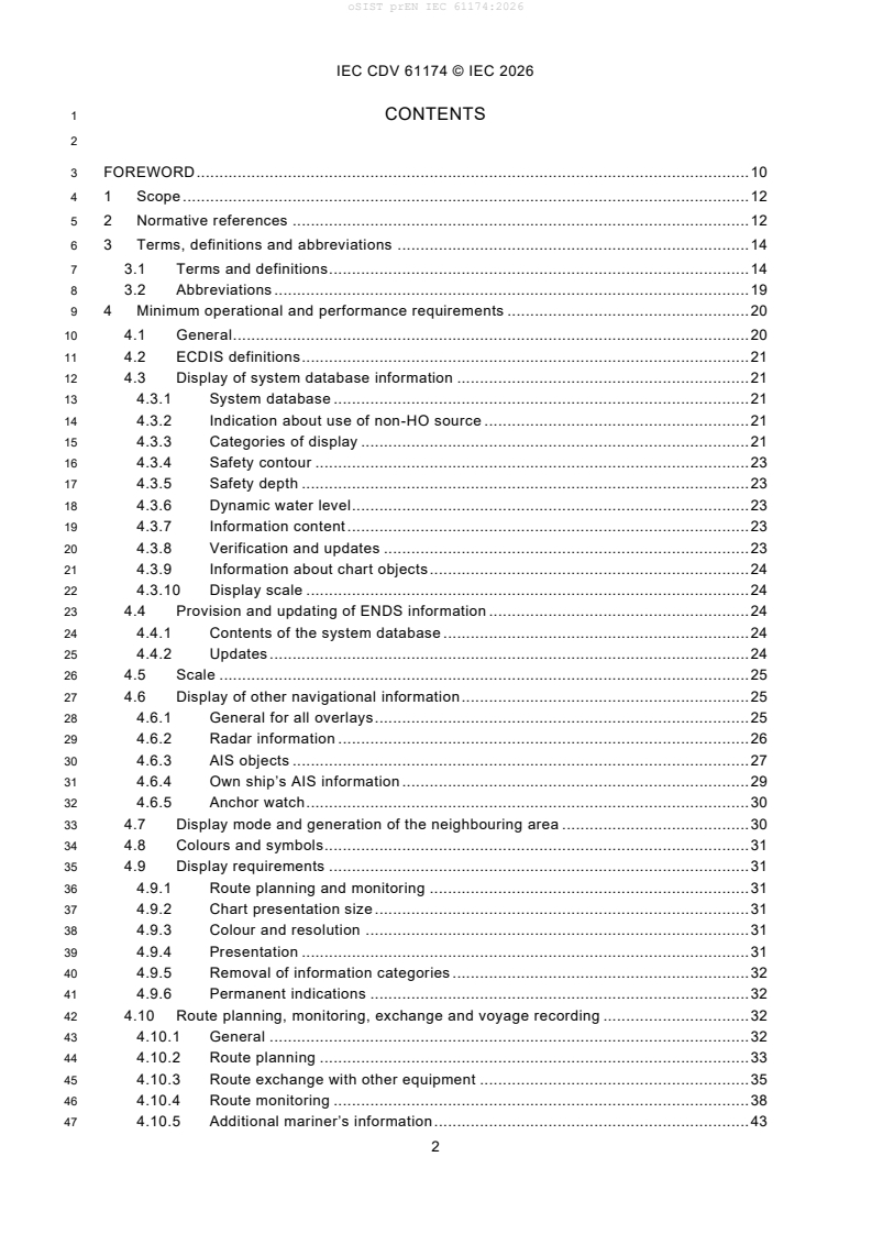
1 CONTENTS
3 FOREWORD . 10
4 1 Scope . 12
5 2 Normative references . 12
6 3 Terms, definitions and abbreviations . 14
7 3.1 Terms and definitions . 14
8 3.2 Abbreviations . 19
9 4 Minimum operational and performance requirements . 20
10 4.1 General . 20
11 4.2 ECDIS definitions . 21
12 4.3 Display of system database information . 21
13 4.3.1 System database . 21
14 4.3.2 Indication about use of non-HO source . 21
15 4.3.3 Categories of display . 21
16 4.3.4 Safety contour . 23
17 4.3.5 Safety depth . 23
18 4.3.6 Dynamic water level. 23
19 4.3.7 Information content . 23
20 4.3.8 Verification and updates . 23
21 4.3.9 Information about chart objects . 24
22 4.3.10 Display scale . 24
23 4.4 Provision and updating of ENDS information . 24
24 4.4.1 Contents of the system database . 24
25 4.4.2 Updates . 24
26 4.5 Scale . 25
27 4.6 Display of other navigational information . 25
28 4.6.1 General for all overlays . 25
29 4.6.2 Radar information . 26
30 4.6.3 AIS objects . 27
31 4.6.4 Own ship’s AIS information . 29
32 4.6.5 Anchor watch . 30
33 4.7 Display mode and generation of the neighbouring area . 30
34 4.8 Colours and symbols. 31
35 4.9 Display requirements . 31
36 4.9.1 Route planning and monitoring . 31
37 4.9.2 Chart presentation size . 31
38 4.9.3 Colour and resolution . 31
39 4.9.4 Presentation . 31
40 4.9.5 Removal of information categories . 32
41 4.9.6 Permanent indications . 32
42 4.10 Route planning, monitoring, exchange and voyage recording . 32
43 4.10.1 General . 32
44 4.10.2 Route planning . 33
45 4.10.3 Route exchange with other equipment . 35
46 4.10.4 Route monitoring . 38
47 4.10.5 Additional mariner’s information . 43
IEC CDV 61174 © IEC 2026
48 4.10.6 Sensor integration . 43
49 4.10.7 Object information . 44
50 4.10.8 LOP position fix . 44
51 4.10.9 Voyage recording . 44
52 4.11 Calculations and accuracy . 45
53 4.12 Connections with other equipment (interfaces) . 45
54 4.12.1 Connection with navigation and radio equipment . 45
55 4.12.2 Connection with CAM system . 46
56 4.12.3 Connection with VDR . 46
57 4.12.4 Connection with BNWAS . 46
58 4.12.5 Connection for system database information . 47
59 4.12.6 Connection with NAVTEX or EGC for MSI . 47
60 4.12.7 Connection for transfer of route information within a vessel . 47
61 4.12.8 Connection with INS . 48
62 4.12.9 Connection with GMDSS radio communication equipment for received
63 distress alert . 48
64 4.13 Performance tests, malfunction alerts and indications . 49
65 4.14 Back-up arrangements . 50
66 4.15 Power supply . 50
67 4.16 Software maintenance . 50
68 4.17 Quality management requirements . 50
69 4.18 User and default settings . 51
70 5 Requirements contained in IHO publications related to S-57 ENC charts . 51
71 5.1 Priority of chart display . 51
72 5.2 Display of chart information . 51
73 5.2.1 Scale and navigation purpose . 51
74 5.2.2 Units and legend. 52
75 5.2.3 Terminology . 52
76 5.3 Display functions . 52
77 5.3.1 Cursor pick . 52
78 5.3.2 Navigational information . 53
79 5.3.3 Date-dependant ENC objects . 53
80 5.4 Supplementary display functions . 53
81 5.4.1 Additional non-HO information . 53
82 5.4.2 Tidal adjustment . 54
83 5.5 Use of the presentation library . 54
84 5.5.1 Presentation library . 54
85 5.5.2 Test diagrams . 54
86 5.6 Display characteristics . 54
87 5.7 Performance requirements . 55
88 5.7.1 Redraw . 55
89 5.7.2 Resolution . 55
90 5.7.3 Symbols . 55
91 5.7.4 Number of colours . 56
92 5.7.5 Brightness and contrast . 56
93 5.8 Ergonomic requirements . 56
94 5.8.1 Mode and orientation . 56
95 5.8.2 Windows . 56
IEC CDV 61174 © IEC 2026
96 5.9 Update of chart information . 57
97 5.9.1 General . 57
98 5.9.2 Manual update . 58
99 5.9.3 Semi-automatic update . 58
100 5.9.4 Reception of updates . 58
101 5.9.5 Sequence check . 59
102 5.9.6 Consistency check . 59
103 5.9.7 Geographic applicability. 59
104 5.9.8 Summary report . 59
105 5.9.9 Review of ENC updates . 60
106 5.9.10 Modification of updates . 60
107 6 Requirements contained in IHO publications related to S-100 based data . 60
108 7 Other requirements . 60
109 7.1 Operational area . 60
110 7.2 Automatic Executable Program File Verification. . 60
111 8 Test methods and required test results . 61
112 8.1 EUT installation, technical documentation, and test requirements . 61
113 8.2 Interfaces . 61
114 8.2.1 General . 61
115 8.2.2 CAM system interface . 61
116 8.2.3 VDR interface . 62
117 8.2.4 BNWAS interface . 63
118 8.3 General requirements and presentation requirements . 63
119 8.3.1 General requirements . 63
120 8.3.2 Presentation requirements . 63
121 8.4 Preparation . 63
122 8.4.1 Power-up . 63
123 8.4.2 Initial ship parameters . 64
124 8.4.3 Required test items . 64
125 8.5 Requirements related to ENC chart . 64
126 8.5.1 General . 64
127 8.5.2 ENC . 65
128 8.5.3 Encrypted ENC . 65
129 8.6 Accuracy . 65
130 8.6.1 Presentation library . 65
131 8.7 Visual requirements . 65
132 8.7.1 Symbols . 65
133 8.7.2 Terminology, units and legend . 65
134 8.7.3 Colour table . 66
135 8.7.4 Resolution . 66
136 8.7.5 Display characteristics . 66
137 8.8 Functional requirements . 66
138 8.8.1 Test methods . 66
139 8.8.2 Standard display . 66
140 8.8.3 Display base . 67
141 8.8.4 All other information . 67
142 8.8.5 Viewing group layers and text group layers for S-57 ENC charts. 67
143 8.8.6 Context parameters for S-100 based products . 68
IEC CDV 61174 © IEC 2026
144 8.8.7 Display priorities . 68
145 8.8.8 Additional display functions . 68
146 8.8.9 Scale and navigation purpose . 68
147 8.8.10 Mode and orientation . 69
148 8.8.11 Safety contour . 69
149 8.8.12 Safety depth . 69
150 8.8.13 Object information and cursor pick . 69
151 8.8.14 Navigation related functions. 69
152 8.8.15 Sensor integration . 70
153 8.8.16 Radar and other navigational information . 70
154 8.8.17 Loading of corrupted data . 73
155 8.8.18 Automatic updates . 73
156 8.8.19 Manual updates . 74
157 8.8.20 Self-tests of major functions . 74
158 8.8.21 S-100 related standards and product specifications . 74
159 8.8.22 Operational area . 74
160 8.8.23 Automatic executable program file verification. . 75
161 8.8.24 Additional mariner’s information . 76
162 8.9 Operational requirements . 76
163 8.9.1 Ergonomic principles . 76
164 8.9.2 Route planning . 76
165 8.9.3 Route appraisal and complete route check . 79
166 8.9.4 Route plan exchange with other equipment . 80
167 8.9.5 Shore-based route exchange . 80
168 8.9.6 Route monitoring — General and safety contour . 84
169 8.9.7 Route monitoring — Hazards, areas, and current/next leg checks . 85
170 8.9.8 Route monitoring current and next leg checks. 88
171 8.9.9 Route monitoring — Alternative routes, action points, and navigation
172 tools . 88
173 8.9.10 Twelve hour log . 89
174 8.9.11 Voyage record . 90
175 8.9.12 Power supply . 90
176 8.9.13 LOP position fix . 90
177 8.10 Permanent Indications . 91
178 8.11 Software maintenance . 91
179 8.12 Quality management . 91
180 8.13 User and default settings . 92
181 8.14 AIS information and AIS target data . 92
182 8.14.1 General . 92
183 8.14.2 AIS functionality and presentation. 92
184 8.14.3 AIS target data . 92
185 8.14.4 Activation and deactivation of AIS targets . 94
186 8.14.5 AIS CPA/TCPA alarm . 94
187 8.14.6 AIS lost target warning . 95
188 8.15 AIS voyage-related data . 95
189 8.16 Anchor watch . 95
190 8.17 NAVTEX and EGC for MSI . 96
191 8.18 Interface for transfer of route information within a vessel . 97
192 8.19 Interface with INS . 97
IEC CDV 61174 © IEC 2026
193 8.20 Interface with GMDSS radio equipment for received distress alert . 98
194 Annex A (normative) System database information to be displayed during route
195 planning and route monitoring . 100
196 Annex B (normative) Navigational elements and parameters . 101
197 Annex C (normative) Areas for which special conditions exist . 102
198 Annex D (normative) Alerts and indications . 103
199 Annex E (normative) Back-up arrangements . 108
200 E.1 Overview. 108
201 E.2 Purpose . 108
202 E.3 Functional requirements . 108
203 E.3.1 Required functions and their availability . 108
204 E.3.2 Reliability and accuracy . 111
205 E.3.3 Malfunctions, warnings, alerts and indications . 112
206 E.4 Operational requirements . 112
207 E.4.1 Ergonomics . 112
208 E.4.2 Presentation of information . 112
209 E.5 Power supply . 112
210 E.6 Other requirement . 113
211 E.6.1 Connection with other systems . 113
212 E.6.2 Route transfer interface . 114
213 E.6.3 Radar as back-up system . 114
214 E.6.4 Operational area . 114
215 E.6.5 Software maintenance . 114
216 E.6.6 Quality management . 114
217 E.6.7 Default Control Settings and Saved User Control Settings . 114
218 E.6.8 External removable media . 114
219 E.7 Test methods and required test results . 114
220 E.7.1 EUT installation and technical documentation . 114
221 E.7.2 Interfaces . 115
222 E.7.3 General requirements and presentation requirements . 115
223 E.7.4 Preparation . 115
224 E.7.5 Initial data tests – Chart . 115
225 E.7.6 Accuracy . 116
226 E.7.7 Visual requirements . 116
227 E.7.8 Functional requirements . 116
228 E.7.9 Operational requirements . 118
229 Annex F (normative) ECDIS in the RCDS mode of operation . 121
230 F.1 Overview. 121
231 F.2 RCDS definitions . 121
232 F.3 Display of SRNC information . 122
233 F.3.1 SRNC . 122
234 F.3.2 Categories of display . 122
235 F.3.3 Power failure . 122
236 F.3.4 Information content . 122
237 F.3.5 Verification and updates . 122
238 F.3.6 Indication . 123
239 F.4 Provision and updating of chart information . 123
240 F.4.1 Contents of the RNC . 123
IEC CDV 61174 © IEC 2026
241 F.4.2 Updates . 123
242 F.5 Scale . 124
243 F.6 Display of other navigational information . 124
244 F.6.1 General for all overlays . 124
245 F.6.2 Radar information . 124
246 F.6.3 AIS information . 125
247 F.6.4 AIS Targets . 125
248 F.6.5 AIS CPA/TCPA alarms . 125
249 F.6.6 AIS lost target warning . 125
250 F.6.7 AIS Voyage Related Data . 125
251 F.6.8 Anchor watch . 125
252 F.7 Display mode and generation of the neighbouring area . 125
253 F.8 Colours and symbols. 126
254 F.9 Display requirements . 126
255 F.9.1 Route planning and monitoring . 126
256 F.9.2 Display characteristics . 126
257 F.9.3 Chart notes . 126
258 F.10 Route planning, monitoring, exchange and voyage recording . 127
259 F.10.1 General . 127
260 F.10.2 Route planning and exchange . 127
261 F.10.3 Route monitoring . 127
262 F.10.4 Position integration . 128
263 F.10.5 Object information . 129
264 F.10.6 LOP position fix . 129
265 F.10.7 Voyage recording . 130
266 F.11 Calculations and accuracy . 130
267 F.12 Connections with other equipment (interfaces) . 131
268 F.13 Performance tests, malfunction alerts and indications . 131
269 F.14 Back-up arrangements for RCDS mode of operation . 131
270 F.15 Power supply for RCDS mode of operation . 132
271 F.16 Requirements contained in IHO publications . 132
272 F.16.1 Structure of RNC data . 132
273 F.16.2 RNC data resolution and accuracy . 132
274 F.16.3 RNC meta-data . 133
275 F.16.4 RNC colours . 133
276 F.16.5 RNC notes, diagrams, etc . 133
277 F.16.6 Operational area . 133
278 F.16.7 External removable media . 133
279 F.17 Test methods and required test results . 134
280 F.17.1 Preparation – Required test items . 134
281 F.17.2 Initial data tests . 134
282 F.17.3 Accuracy . 135
283 F.17.4 Visual requirements . 135
284 F.17.5 Functional requirements . 136
285 F.17.6 Operational requirement . 142
286 F.18 RNC test data set . 144
287 Annex G (normative) . 145
288 Alerts and indications in the RCDS mode of operation . 145
IEC CDV 61174 © IEC 2026
289 Annex H (normative) Scenario definitions and plots . 147
290 H.1 Overview. 147
291 H.2 Scenario 1: . 148
292 H.3 Scenario 2: . 149
293 H.4 Scenario 3: . 151
294 H.5 Scenario 4: . 152
295 Annex I (informative) Guidance on geodetic calculations . 154
296 I.1 Overview. 154
297 I.2 Distance deviations between Great Circle (orthodrome) and Rhumb Line
298 (loxodrome) . 154
299 I.3 Bearing deviations at start point between Great Circle (orthodrome) and
300 Rhumb Line (loxodrome) . 155
301 Annex J (informative) Guidance for testing . 157
302 J.1 Test methods . 157
303 J.2 Observation . 157
304 J.3 Inspection of documented evidence . 157
305 J.4 Measurement . 157
306 J.5 Analytical evaluation . 158
307 Annex K (informative) Use cases for safety contour and safety depth . 159
308 Annex L (informative) Guidelines on use of electronic chart systems in polar waters . 161
309 L.1 Projection and coordinate system . 161
310 L.2 Consistency . 162
311 Annex M (normative) Scenarios for polar areas above 85° North . 163
312 Annex N (normative) IEC 61162 interfaces . 170
313 N.1 General . 170
314 N.2 VDR interface . 173
315 N.3 SECOM Terminal interface. 175
316 N.4 AIS interface and interrogation . 175
317 N.5 Route transfer interface . 175
318 Annex O (informative) Conversion between IEC 61162-1 sentences and IEC 61162-3
319 parameter group numbers . 176
320 Annex P (normative) Route plan exchange format – RTZ . 178
321 P.1 General . 178
322 P.2 RTZP Data container . 179
323 P.3 High-level description of the RTZ format . 180
324 P.4 Adaptation to third-party extensions and handling of optional dara . 180
325 P.4.1 Generic idea . 180
326 P.4.2 Unique identification of a waypoint. 180
327 P.4.3 Creation of new waypoints . 181
328 P.4.4 Change of geographic data for a waypoint . 181
329 P.4.5 Waypoint removal . 181
330 P.4.6 Waypoint modification . 181
331 P.5 Detailed RTZ format description . 181
332 P.5.1 File components . 181
333 P.5.2 Route node description . 182
334 P.5.3 RouteInfo node description . 182
335 P.5.4 Waypoints node description . 183
336 P.5.5 DefaultWaypoint node description . 183
IEC CDV 61174 © IEC 2026
337 P.5.6 Waypoint node description . 184
338 P.5.7 Storing date and time for legs . 185
339 P.5.8 Schedules node description . 186
340 P.5.9 Schedule node description . 186
341 P.5.10 Extensions node description .
...