

ISO 28564-1:2026
(Main)Public information guidance systems — Part 1: Design principles and element requirements for location plans, maps and diagrams
- Abstract
This document specifies requirements and principles for the design and application of location plans, maps and diagrams used in public areas and workplaces to assist users to understand the environment, locate facilities and determine appropriate routes to reach those facilities. These location plans, maps and diagrams are referred to as location plans in this document. Location plans are intended for use in, for example, shopping centres, stores, hospitals, bus and train stations, airports, sporting and entertainment complexes, urban areas, parks, gardens and countryside, public attractions, museums and office complexes. This document is not applicable to the design of escape plans, nor does it cover the design of location signs, direction signs, information index signs, and installation and assessment of wayfinding systems. NOTE 1 The design of escape plans is covered in ISO 23601. NOTE 2 The design of location signs and direction signs is covered in ISO 28564-2. The design of information index signs is covered in ISO 28564-3. The installation and assessment of wayfinding systems are covered in ISO 28564-4.
- Status
- Published
- Publication Date
- 21-Jul-2026
- Technical Committee
- ISO/TC 145/SC 1 - Public information symbols
- Drafting Committee
- ISO/TC 145/SC 1/WG 5 - Public information guidance systems
- Current Stage
- 6060 - International Standard published
- Start Date
- 22-Jul-2026
- Due Date
- 21-Nov-2026
- Completion Date
- 22-Jul-2026


ISO 28564-1:2026 is an International Standard from ISO for public information guidance systems. It sets design principles and element requirements for location plans, maps and diagrams used in public areas and workplaces to help users understand the environment, locate facilities and choose routes to them. It is aimed at the people who design, specify, install and maintain wayfinding plans, and at the facilities that rely on them.
What does ISO 28564-1:2026 specify?
ISO 28564-1:2026 specifies how location plans are to be designed and applied, and it uses the term location plan for plans, maps and diagrams of this kind. The document applies to places such as shopping centres, hospitals, stations, airports, parks, museums and office complexes.
It is organized into Clauses 1 to 9 and Annexes A to C.
| Annex | What it covers |
|---|---|
| Annex A | Examples of location-plan layouts |
| Annex B | Example of orientation |
| Annex C | Performance tests for location plans |
The scope also makes clear what is outside its coverage: escape plans, location signs, direction signs, information index signs, and installation and assessment of wayfinding systems.
What are the key requirements of ISO 28564-1:2026?
ISO 28564-1:2026 focuses on making location plans easy to understand, easy to place, and worth testing with real users. The requirements are spread across preparation, design, positioning, testing, and maintenance.
Preparation and content
- Clause 5.1 says the brief should define the area to be covered, the information to be shown, and any special presentation needs. In practice, teams should agree early on what the plan must help people do, rather than adding content later.
- Clause 5.2 calls for data from the client, designers, engineers, users and existing plans, depending on whether the area is planned or already in use. That matters because a plan should reflect how people actually move and decide on site.
- Clause 5.3 says a very large or complex area should be divided into smaller units if a single plan would be too hard to remember. This keeps the plan usable when users need to navigate step by step.
- Clause 5.4 points designers to the user position, the facilities to show, language needs, and whether only selected information is needed. That helps prevent overcrowded plans.
Design of the plan
- Clause 6.1 says a location plan shall have at least a title and a main body, and normally a legend; it may also have an index, scale and north designator. The practical point is that users need a clear frame for reading the information.
- Clause 6.1 also calls for minimal text, high-legibility fonts, strong contrast, consistent graphic style in a series of plans, and good treatment of colour and spacing. This supports quick reading from standing or seated positions.
- Clause 6.1 and 6.3 say the plan should show the user’s position prominently, and outdoor plans should include a north designator. For a reader, that is the core answer to “where am I?” and “which way is north?”
- Clause 6.3 says a 2D location plan should normally be drawn to scale, while 3D or distorted presentations need careful attention and testing. If a site uses multiple floors, the plan may need 3D or cross-section treatment so users can follow routes between levels.
- Clause 6.4 says the legend, if used, should explain symbols, colours and line types clearly and quickly. Clause 6.5 allows an index keyed to a grid or similar reference, and Clause 6.6 recommends a scale bar and/or typical walking times to show distance.
Positioning, orientation and use
- Clause 7.1 says plans should be placed where users expect them, such as entrances, assembly points and decision points, but away from distracting visual clutter. In practice, the plan should support the moment when a user needs reassurance or a route choice.
- Clause 7.1 also says plans should be easy to see, should not create hazards, should not block circulation, and should be accessible where possible. This matters for crowded public spaces and for inclusive use.
- Clause 7.2 says a single plan should normally match the viewing direction at the installation position, while a series should follow consistent design principles and may use a consistent north-up approach. That helps people move from one plan to the next without re-learning the layout.
Testing and maintenance
- Clause 8 says the effectiveness of location plans should be tested to see whether users can find their current location and popular destinations quickly and accurately. Annex C gives laboratory and field test procedures and interview methods.
- Clause 9 says plans should suit their environment, use sustainable materials and low-energy methods where possible, have appropriate illumination, be durable, easy to clean, repair and update, and be inspected regularly. This is important because a wrong or faded plan can mislead users.
What terms does ISO 28564-1:2026 define?
Clause 3 defines three terms directly, and the document uses a few recurring design terms throughout.
- Location plan - a plan, map or diagram displayed in public areas and workplaces to help users understand the environment, locate facilities and determine routes.
- Series of plans - a group of similar location plans that may be provided at different points within the same area.
- Main body - the area of the location plan where the core information is shown.
- North designator - the element used to show north on a location plan, especially useful for outdoor orientation.
- Legend - the part of the plan that explains symbols, colours, line types and other graphic details used on the plan.
Who uses ISO 28564-1:2026?
ISO 28564-1:2026 is used by people who design and manage wayfinding in public places and workplaces. That includes facility clients, architects, interior and landscape designers, engineers, graphic designers and wayfinding specialists.
It also matters to operators of shopping centres, stores, hospitals, bus and train stations, airports, sporting and entertainment complexes, urban areas, parks, gardens, public attractions, museums and office complexes. For buyers and quality managers, it gives a common basis for specifying location plans that are readable, testable and maintainable.
What changed in ISO 28564-1:2026 from the previous edition?
ISO 28564-1:2026 is the second edition and replaces ISO 28564-1:2010. The foreword says it has been technically revised.
The stated changes are:
- updating the foreword, introduction and bibliography
- updating the normative references
- adding a note in the scope to point to the other parts of ISO 28564
- adding requirements in 4.2 for symbol perceptual quality testing and symbol referent association
- adding a coordination recommendation in 5.1
Which standards are used with ISO 28564-1:2026?
| Standard | What it contributes |
|---|---|
| ISO 3864-1 | Design principles for safety signs and safety markings, used to avoid confusion with public information symbols |
| ISO 3864-3 | Design principles for graphical symbols used in safety signs, used when developing new graphical symbols |
| ISO 7001 | Registered public information symbols for use on location plans |
| ISO 7010 | Registered safety signs, relevant because location-plan symbols must not be confused with safety signs |
| ISO 9186-1 | Comprehensibility testing for graphical symbols |
| ISO 9186-2 | Perceptual quality testing for graphical symbols |
| ISO 9186-3 | Symbol referent association testing |
| ISO 17724 | Vocabulary for graphical symbols |
| ISO 22727 | Requirements for creating and designing public information symbols |
| ISO 23601 | Escape and evacuation plan signs, cited in the scope as the standard for escape plans |
| ISO 28564-2 | Location signs and direction signs |
| ISO 28564-3 | Information index signs |
| ISO 28564-4 | Installation and assessment of wayfinding systems |
What does the ISO 28564-1:2026 document contain?
The document gives the structure and design logic for location plans, then supports that guidance with examples and test methods. Annex A shows seven example layouts, including user position, transport stops, a 3D view, an enlarged detail, an indexed plan, a scale with walking times, and a typical urban-area layout.
Annex B gives an orientation example, and Annex C sets out simplified laboratory and field tests plus interview questionnaires. The body of the standard also covers brief preparation, data gathering, plan content, titles, legends, indexes, scale, placement, illumination, durability, inspection and updating.
Relations
- Effective Date
- 07-Jan-2025
Frequently Asked Questions
ISO 28564-1:2026 is a standard published by the International Organization for Standardization (ISO). Its full title is "Public information guidance systems — Part 1: Design principles and element requirements for location plans, maps and diagrams". This standard covers: This document specifies requirements and principles for the design and application of location plans, maps and diagrams used in public areas and workplaces to assist users to understand the environment, locate facilities and determine appropriate routes to reach those facilities. These location plans, maps and diagrams are referred to as location plans in this document. Location plans are intended for use in, for example, shopping centres, stores, hospitals, bus and train stations, airports, sporting and entertainment complexes, urban areas, parks, gardens and countryside, public attractions, museums and office complexes. This document is not applicable to the design of escape plans, nor does it cover the design of location signs, direction signs, information index signs, and installation and assessment of wayfinding systems. NOTE 1 The design of escape plans is covered in ISO 23601. NOTE 2 The design of location signs and direction signs is covered in ISO 28564-2. The design of information index signs is covered in ISO 28564-3. The installation and assessment of wayfinding systems are covered in ISO 28564-4.
This document specifies requirements and principles for the design and application of location plans, maps and diagrams used in public areas and workplaces to assist users to understand the environment, locate facilities and determine appropriate routes to reach those facilities. These location plans, maps and diagrams are referred to as location plans in this document. Location plans are intended for use in, for example, shopping centres, stores, hospitals, bus and train stations, airports, sporting and entertainment complexes, urban areas, parks, gardens and countryside, public attractions, museums and office complexes. This document is not applicable to the design of escape plans, nor does it cover the design of location signs, direction signs, information index signs, and installation and assessment of wayfinding systems. NOTE 1 The design of escape plans is covered in ISO 23601. NOTE 2 The design of location signs and direction signs is covered in ISO 28564-2. The design of information index signs is covered in ISO 28564-3. The installation and assessment of wayfinding systems are covered in ISO 28564-4.
ISO 28564-1:2026 is classified under the following ICS (International Classification for Standards) categories: 01.080.10 - Public information symbols. Signs. Plates. Labels. The ICS classification helps identify the subject area and facilitates finding related standards.
ISO 28564-1:2026 has the following relationships with other standards: It is inter standard links to ISO 28564-1:2010. Understanding these relationships helps ensure you are using the most current and applicable version of the standard.
ISO 28564-1:2026 is available in PDF format for immediate download after purchase. The document can be added to your cart and obtained through the secure checkout process. Digital delivery ensures instant access to the complete standard document.
Standards Content (Sample)
International
Standard
ISO 28564-1
Second edition
Public information guidance
2026-07
systems —
Part 1:
Design principles and element
requirements for location plans,
maps and diagrams
Systèmes de guidage destinés à l'information du public —
Partie 1: Principes de conception et exigences pour éléments de
plans, cartes et diagrammes de situation
Reference number
© ISO 2026
All rights reserved. Unless otherwise specified, or required in the context of its implementation, no part of this publication may
be reproduced or utilized otherwise in any form or by any means, electronic or mechanical, including photocopying, or posting on
the internet or an intranet, without prior written permission. Permission can be requested from either ISO at the address below
or ISO’s member body in the country of the requester.
ISO copyright office
CP 401 • Ch. de Blandonnet 8
CH-1214 Vernier, Geneva
Phone: +41 22 749 01 11
Email: copyright@iso.org
Website: www.iso.org
Published in Switzerland
ii
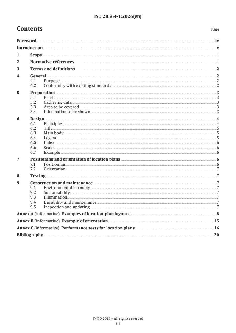
Contents Page
Foreword .iv
Introduction .v
1 Scope . 1
2 Normative references . 1
3 Terms and definitions . 2
4 General . 2
4.1 Purpose .2
4.2 Conformity with existing standards .2
5 Preparation . 3
5.1 Brief .3
5.2 Gathering data .3
5.3 Area to be covered . .3
5.4 Information to be shown .3
6 Design . 4
6.1 Principles .4
6.2 Title .5
6.3 Main body . .5
6.4 Legend .5
6.5 Index .6
6.6 Scale .6
6.7 Example .6
7 Positioning and orientation of location plans . 6
7.1 Positioning . .6
7.2 Orientation .7
8 Testing. 7
9 Construction and maintenance . 7
9.1 Environmental harmony .7
9.2 Sustainability .7
9.3 Illumination .7
9.4 Durability and maintenance .7
9.5 Inspection and updating .7
Annex A (informative) Examples of location-plan layouts . 8
Annex B (informative) Example of orientation .15
Annex C (informative) Performance tests for location plans.16
Bibliography .20
iii
Foreword
ISO (the International Organization for Standardization) is a worldwide federation of national standards
bodies (ISO member bodies). The work of preparing International Standards is normally carried out through
ISO technical committees. Each member body interested in a subject for which a technical committee
has been established has the right to be represented on that committee. International organizations,
governmental and non-governmental, in liaison with ISO, also take part in the work. ISO collaborates closely
with the International Electrotechnical Commission (IEC) on all matters of electrotechnical standardization.
The procedures used to develop this document and those intended for its further maintenance are described
in the ISO/IEC Directives, Part 1. In particular, the different approval criteria needed for the different types
of ISO document should be noted. This document was drafted in accordance with the editorial rules of the
ISO/IEC Directives, Part 2 (see www.iso.org/directives).
ISO draws attention to the possibility that the implementation of this document may involve the use of (a)
patent(s). ISO takes no position concerning the evidence, validity or applicability of any claimed patent
rights in respect thereof. As of the date of publication of this document, ISO had not received notice of (a)
patent(s) which may be required to implement this document. However, implementers are cautioned that
this may not represent the latest information, which may be obtained from the patent database available at
www.iso.org/patents. ISO shall not be held responsible for identifying any or all such patent rights.
Any trade name used in this document is information given for the convenience of users and does not
constitute an endorsement.
For an explanation of the voluntary nature of standards, the meaning of ISO specific terms and expressions
related to conformity assessment, as well as information about ISO's adherence to the World Trade
Organization (WTO) principles in the Technical Barriers to Trade (TBT), see www.iso.org/iso/foreword.html.
This document was prepared by Technical Committee ISO/TC 145, Graphical symbols, Subcommittee SC 1,
Public information symbols, signs and guidance system.
This second edition cancels and replaces the first edition (ISO 28564-1:2010), which has been technically
revised.
The main changes are as follows:
— updating foreword, introduction and bibliography;
— updating normative references;
— adding one note in scope to mention other parts of ISO 28564;
— adding requirements related to symbol perceptual quality testing and symbol referent association to
4.2;
— adding coordination recommendation to 5.1.
A list of all parts in the ISO 28564 series can be found on the ISO website.
Any feedback or questions on this document should be directed to the user’s national standards body. A
complete listing of these bodies can be found at www.iso.org/members.html.
iv
Introduction
Continued growth in travel and mobility within and between countries has generated a growing range
of wayfinding guidance systems and styles containing a wide variety of information. Such systems serve
various purposes, such as enabling users to:
— understand the range of facilities and points of interest present;
— understand the physical relationship between those facilities and points of interest;
— determine the best way to reach a required facility or point of interest given their mobility circumstances.
This document is concerned with location plans, maps and diagrams used to support wayfinding.
The purpose of this document is to provide principles on the design and use of location plans, maps and
diagrams to enable users to assimilate required information swiftly and accurately. It is not the intention
to limit design freedom unnecessarily, but to set guidelines and, where appropriate, specifications which
reflect relevant research and best practice.
Where appropriate, as part of an integrated wayfinding system, location plans, maps and diagrams are
used in association with fixed location signs and direction signs (see ISO 28564-2), information index signs
(see ISO 28564-3), hand-held maps, and IT applications, as well as human assistance. For guidelines on the
installation and assessment of wayfinding systems, please refer to ISO 28564-4.
v
International Standard ISO 28564-1:2026(en)
Public information guidance systems —
Part 1:
Design principles and element requirements for location
plans, maps and diagrams
1 Scope
This document specifies requirements and principles for the design and application of location plans,
maps and diagrams used in public areas and workplaces to assist users to understand the environment,
locate facilities and determine appropriate routes to reach those facilities. These location plans, maps and
diagrams are referred to as location plans in this document.
Location plans are intended for use in, for example, shopping centres, stores, hospitals, bus and train
stations, airports, sporting and entertainment complexes, urban areas, parks, gardens and countryside,
public attractions, museums and office complexes.
This document is not applicable to the design of escape plans, nor does it cover the design of location signs,
direction signs, information index signs, and installation and assessment of wayfinding systems.
NOTE 1 The design of escape plans is covered in ISO 23601.
NOTE 2 The design of location signs and direction signs is covered in ISO 28564-2. The design of information index
signs is covered in ISO 28564-3. The installation and assessment of wayfinding systems are covered in ISO 28564-4.
2 Normative references
The following documents are referred to in the text in such a way that some or all of their content constitutes
requirements of this document. For dated references, only the edition cited applies. For undated references,
the latest edition of the referenced document (including any amendments) applies.
ISO 3864-1, Graphical symbols — Safety colours and safety signs — Part 1: Design principles for safety signs and
safety markings
ISO 3864-3, Graphical symbols — Safety colours and safety signs — Part 3: Design principles for graphical
symbols for use in safety signs
1)
ISO 7001 , Graphical symbols — Registered public information symbols
ISO 7010 , Graphical symbols — Safety colours and safety signs — Registered safety signs
ISO 9186-1, Graphical symbols — Test methods — Part 1: Method for testing comprehensibility
ISO 9186-2, Graphical symbols — Test methods — Part 2: Method for testing perceptual quality
ISO 9186-3, Graphical symbols — Test methods — Part 3: Method for testing symbol referent association
ISO 17724, Graphical symbols — Vocabulary
ISO 22727, Graphical symbols — Creation and design of public information symbols — Requirements
1) The graphical symbol collections of ISO 7001 and ISO 7010 can be previewed and purchased on the Online Browsing
Platform (OBP), www .iso .org/ obp
3 Terms and definitions
For the purposes of this document, the terms and definitions given in ISO 17724 and the following apply.
ISO and IEC maintain terminology databases for use in standardization at the following addresses:
— ISO Online browsing platform: available at https:// www .iso .org/ obp
— IEC Electropedia: available at https:// www .electropedia .org/
3.1
location plan
plan, map or diagram displayed in public areas and workplaces to assist users to understand the environment,
locate facilities and determine appropriate routes to reach those facilities
Note 1 to entry: A location plan may include the physical display structure.
Note 2 to entry: The term diagram is included because, in some situations, a location plan can be schematic or exclude
or distort physical arrangements.
3.2
series of plans
group of the same or similar location plans (3.1) which may be provided at different locations within a given
area
3.3
main body
area within a location plan where the information related to the purpose of the location plan (3.1) is given
4 General
4.1 Purpose
The purpose of a location plan is to provide orientation within a building or defined geographical area and
to enable users to reach destinations quickly and easily.
4.2 Conformity with existing standards
Symbols used on location plans shall be taken, where they exist, from ISO 7001 and ISO 7010.
If a new graphical symbol is required, the relevant International Standard (ISO 22727 or ISO 3864-3) shall
be used as part of the development process. The new graphical symbol shall be tested with the relevant
testing methods: comprehension testing shall be in accordance with ISO 9186-1, perceptual quality testing
shall be in accordance with ISO 9186-2, and symbol referent association testing shall be in accordance with
ISO 9186-3.
The public information symbols given in ISO 7001 may be reproduced in any colour. However, the
combination of safety colours and shapes specified in ISO 3864-1 shall be avoided to ensure that there is no
confusion between public information symbols and safety signs. This also applies to arrows where the use
of green and white shall be avoided to ensure that there is no risk of confusion with the direction arrows or
safe conditions, used for evacuation routes.
In addition, any colours used shall not conflict with the use of those colours within the location plan to
indicate a safety function.
5 Preparation
5.1 Brief
Before design work is undertaken, the requirements and objectives of a location plan should be clearly
understood and expressed in a brief. The brief should include the area to be covered, the information to be
shown, as determined by the nature of the tasks that the expected users will wish to accomplish, and any
special requirements concerning information presentation.
If relevant, the brief should also define the requirements for location signs and direction signs (see
ISO 28564-2), guidelines for information index signs (see ISO 28564-3), guidelines for installation and
assessment (see ISO 28564-4), and guidelines or methods for coordination with location plans.
5.2 Gathering data
Sources of information will depend on whether the area to be shown is at the planning stage or already in
use. Where the area is at the planning stage, information may be obtained from the facility client and from
architects, interior/landscape designers, engineers and other professionals with knowledge relevant to the
current task. Where the facility is already in use, additional information can be obtained by consulting with:
a) potential users of a location plan;
b) local police, shopkeepers, reception/information desk staff and others who can have experience of
wayfinding issues within the area to be covered; and
c) any existing location plans.
NOTE A site visit can be useful in gaining information regarding the site and its requirements, and, where
possible, to observe and document relevant behavioural patterns.
At the conclusion, the data gathered should be reconciled with the brief.
5.3 Area to be covered
The area to be covered by a location plan will often have logical boundaries, for example as defined by a
floor of a building or by a discrete local geographical area; however, in some circumstances this area may be
large or complex. The area covered by an individual location plan should not be such that it becomes difficult
for users to remember sufficient detail to reliably reach any location shown. In such circumstances, the area
should be divided into smaller units, each with its own location plan. Design consistency should be such that
users can easily recognize the family relationship.
5.4 Information to be shown
Examples of location-plan layouts are shown in Annex A.
Some considerations to determine the information to be shown are as follows.
a) The location of the users and the types and positions of the facilities about which they will require
information. See Figure A.1.
b) The proportion of the expected users for whom the use of the official local language(s) can be insufficient.
c) Whether the location plan will need to show only specific information, for example, the locations of
different transportation stops. See Figure A.2.
6 Design
6.1 Principles
The following should be taken into account in the design of a location plan.
a) The relevant information from sources described in Clause 5.
b) It shall consist at least of a title (see 6.2), main body (see 6.3) and, normally, a legend (see 6.4). It may
also include an index (see 6.5), a scale (see 6.6) and a north designator.
c) The use of text on the main body should be kept to a minimum.
d) The use of the official local language(s) can be sufficient. It is recommended that, if an additional
language is required, English should be used first.
e) When using text, jargon should be avoided and specialized terms should only be used where the target
audience is known to be familiar with them. Abbreviations should only be used where they are in
common use and well understood.
f) Text should always use font(s) with high legibility. A single sans-serif font family is recommended.
g) The text should be designed so that all the information it contains is clear and legible for users in a
standing or seated position to facilitate readability by those in wheelchairs.
h) Details should stand out clearly, including any appropriate designator showing the users' position.
i) In a series of plans, information should be illustrated and presented consistently, such as by using the
same symbols, terms and graphic style.
j) The method of representing the relationship between the site shown on a location plan and the area
beyond should be considered. For example, an overview plan may be needed and/or it may be important
to show where entrances come from and where exits lead to.
k) The colour combination shown on a location plan should be considered to ensure legibility for all kinds
of users, for example, users with colour-vision deficiency.
l) Additional methods should be considered to make it useful for all kinds of users, for example, users with
vision impairment.
m) A three-dimensional view can be easier for users to understand than a two-dimensional view. However,
caution should be taken to minimize complexity and to ensure that other important details are not
obscured. It may be appropriate to show only selected landmarks in three dimensions. See Figure A.3.
n) Incorporating relevant architectural/environmental features may assist orientation and comprehension.
o) Wherever possible, the shape of the area covered should be reflected in a location plan.
p) High contrast and other graphic techniques, such as appropriate spacing and scaling, should be used to
ensure legibility under all normal viewing conditions.
q) Where fine detail is requi
...