

ASTM F3673-23
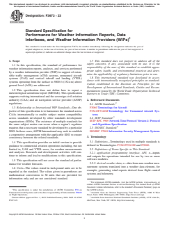
(Specification)Standard Specification for Performance for Weather Information Reports, Data Interfaces, and Weather Information Providers (WIPs)
General Information
- Abstract
SCOPE
1.1 In this specification, the standard of performance for weather information reports, analyses, and services performed by a weather information provider (WIP) in support of extensible traffic management (xTM) systems, unmanned aircraft systems (UAS) and vertical takeoff and landing (VTOL) systems operating from the surface to 5000 ft (1524 m) above ground level (AGL) are addressed.
1.2 This specification does not define how to report a meteorological aerodrome report (METAR). This specification supports evolving international and the sovereign civil aviation authority (CAA) and air navigation service provider (ANSP) regulations.
1.3 Relationship to International WIP Standards—One objective of this specification is to harmonize the standard across CAAs internationally to enable subject matter compatibility across standards developed by other standards development organizations (SDOs). The existence of multiple standards for the same subject matter can occur when a region’s regulator requires that a necessary standard be developed by a particular SDO. In these cases, ASTM International may seek to establish a cooperative arrangement with the applicable SDO to ensure consistency between the related standards.
1.4 This specification provides an initial version to provide guidance to commercial aviation operations including, but not limited to, UAS and VTOL users, for weather measurements and analyses. Research and development activities will continue to inform and lead to modifications to this specification.
1.5 This specification will not cover the standard of performance for weather forecasts.
1.6 Units—The values stated in inch-pound units are to be regarded as the standard. The values given in parentheses are mathematical conversions to SI units that are provided for information only and are not considered standard.
1.7 This standard does not purport to address all of the safety concerns, if any, associated with its use. It is the responsibility of the user of this standard to establish appropriate safety, health, and environmental practices and determine the applicability of regulatory limitations prior to use.
1.8 This international standard was developed in accordance with internationally recognized principles on standardization established in the Decision on Principles for the Development of International Standards, Guides and Recommendations issued by the World Trade Organization Technical Barriers to Trade (TBT) Committee.
- Status
- Published
- Publication Date
- 31-Oct-2023
- Technical Committee
- F38 - Unmanned Aircraft Systems
- Drafting Committee
- F38.02 - Flight Operations
Overview
ASTM F3673-23: Standard Specification for Performance for Weather Information Reports, Data Interfaces, and Weather Information Providers (WIPs) outlines the minimum performance requirements for weather reporting, data exchange, and analysis by weather information providers (WIPs). This standard targets operations within extensible traffic management (xTM) systems, unmanned aircraft systems (UAS), and vertical takeoff and landing (VTOL) aircraft operating from the surface up to 5000 ft (1524 m) above ground level. Developed by ASTM International, it supports evolving regulations from international civil aviation authorities (CAAs) and air navigation service providers (ANSPs), promoting harmonization and compatibility with global standards for weather information reporting.
Key Topics
- Weather Data Performance Standard: Introduces a tier-based framework (Tiers 1-3) for weather data quality and accuracy, supporting risk-based operational decision-making for UAS and VTOL users.
- Coverage: Applies to weather information reports, analyses, and services excluding meteorological aerodrome reports (METAR) and weather forecasts.
- Supporting Regulations: Assists CAAs and ANSPs in implementing regulations for weather data use in aviation, aligning practices across international boundaries.
- Data Formats & Interfaces: Requires the use of standardized formats such as JSON, GeoJSON, and OpenAPI for data exchange, and compliance with ISO/IEC 27001 for data security.
- Reporting & Reliability: Establishes reliability targets, update intervals, and notification practices for weather alerts, ensuring timely and actionable weather data.
- Quality Control: Mandates continuous data health monitoring, confidence metrics, and robust reporting to maintain data integrity and user trust.
Applications
ASTM F3673-23 is particularly valuable for organizations and stakeholders in commercial aviation, airspace management, and the rapidly growing field of unmanned aviation. Its adoption is essential for:
- Weather Information Providers (WIPs): Qualifies how WIPs must gather, process, and distribute weather data using validated sources, ensuring adherence to accuracy, reliability, and performance tiers.
- Commercial UAS and VTOL Operators: Empowers operators to make informed, risk-based decisions with standardized, tiered weather data, enhancing safety and operational efficiency.
- Air Navigation Service Providers (ANSPs): Assures interoperability and harmonized weather data practices, facilitating seamless integration of UAS and VTOL operations into the National Airspace System (NAS) and other jurisdictions.
- Regulators and Standards Bodies: Offers a foundation for harmonizing existing and future standards for weather reporting in aviation, reducing fragmentation and supporting global best practices.
Related Standards
Organizations implementing ASTM F3673-23 should also consider these related standards and references to ensure comprehensive compliance and compatibility:
- ASTM F3060: Terminology for Aircraft
- ASTM F3341/F3341M: Terminology for Unmanned Aircraft Systems
- IETF RFC 5905: Network Time Protocol Version 4 - essential for maintaining time synchronization across weather information systems.
- ISO/IEC 27001: Information Security Management Systems - defines requirements for data security in weather information exchange.
- ICAO meteorological information exchange model (IWXXM): Supports international data compatibility.
- Automated Surface Observing System (ASOS) and Automated Weather Observing System (AWOS): Established sources for validated weather data.
Practical Value
Implementing ASTM F3673-23 brings substantial benefits:
- Improved Safety: With reliable and consistent weather information, flight and mission planning for UAS, VTOL, and other low-altitude operations become safer and more predictable.
- Regulatory Alignment: Facilitates compliance with national and international regulations, enabling cross-border operations and simplifying certification for WIPs.
- Operational Efficiency: Tiered data quality and standardized interfaces streamline integration into modern air traffic management systems.
- Data Integrity & Accountability: Clear protocols for data retention, reporting, and auditability enhance transparency and support accident or incident investigations.
Keywords
weather information provider, weather information report, UAS weather standard, VTOL weather report, extensible traffic management, aviation weather data, ASTM F3673-23, data interfaces, weather analysis, air navigation service provider
Frequently Asked Questions
ASTM F3673-23 is a technical specification published by ASTM International. Its full title is "Standard Specification for Performance for Weather Information Reports, Data Interfaces, and Weather Information Providers (WIPs)". This standard covers: SCOPE 1.1 In this specification, the standard of performance for weather information reports, analyses, and services performed by a weather information provider (WIP) in support of extensible traffic management (xTM) systems, unmanned aircraft systems (UAS) and vertical takeoff and landing (VTOL) systems operating from the surface to 5000 ft (1524 m) above ground level (AGL) are addressed. 1.2 This specification does not define how to report a meteorological aerodrome report (METAR). This specification supports evolving international and the sovereign civil aviation authority (CAA) and air navigation service provider (ANSP) regulations. 1.3 Relationship to International WIP Standards—One objective of this specification is to harmonize the standard across CAAs internationally to enable subject matter compatibility across standards developed by other standards development organizations (SDOs). The existence of multiple standards for the same subject matter can occur when a region’s regulator requires that a necessary standard be developed by a particular SDO. In these cases, ASTM International may seek to establish a cooperative arrangement with the applicable SDO to ensure consistency between the related standards. 1.4 This specification provides an initial version to provide guidance to commercial aviation operations including, but not limited to, UAS and VTOL users, for weather measurements and analyses. Research and development activities will continue to inform and lead to modifications to this specification. 1.5 This specification will not cover the standard of performance for weather forecasts. 1.6 Units—The values stated in inch-pound units are to be regarded as the standard. The values given in parentheses are mathematical conversions to SI units that are provided for information only and are not considered standard. 1.7 This standard does not purport to address all of the safety concerns, if any, associated with its use. It is the responsibility of the user of this standard to establish appropriate safety, health, and environmental practices and determine the applicability of regulatory limitations prior to use. 1.8 This international standard was developed in accordance with internationally recognized principles on standardization established in the Decision on Principles for the Development of International Standards, Guides and Recommendations issued by the World Trade Organization Technical Barriers to Trade (TBT) Committee.
SCOPE 1.1 In this specification, the standard of performance for weather information reports, analyses, and services performed by a weather information provider (WIP) in support of extensible traffic management (xTM) systems, unmanned aircraft systems (UAS) and vertical takeoff and landing (VTOL) systems operating from the surface to 5000 ft (1524 m) above ground level (AGL) are addressed. 1.2 This specification does not define how to report a meteorological aerodrome report (METAR). This specification supports evolving international and the sovereign civil aviation authority (CAA) and air navigation service provider (ANSP) regulations. 1.3 Relationship to International WIP Standards—One objective of this specification is to harmonize the standard across CAAs internationally to enable subject matter compatibility across standards developed by other standards development organizations (SDOs). The existence of multiple standards for the same subject matter can occur when a region’s regulator requires that a necessary standard be developed by a particular SDO. In these cases, ASTM International may seek to establish a cooperative arrangement with the applicable SDO to ensure consistency between the related standards. 1.4 This specification provides an initial version to provide guidance to commercial aviation operations including, but not limited to, UAS and VTOL users, for weather measurements and analyses. Research and development activities will continue to inform and lead to modifications to this specification. 1.5 This specification will not cover the standard of performance for weather forecasts. 1.6 Units—The values stated in inch-pound units are to be regarded as the standard. The values given in parentheses are mathematical conversions to SI units that are provided for information only and are not considered standard. 1.7 This standard does not purport to address all of the safety concerns, if any, associated with its use. It is the responsibility of the user of this standard to establish appropriate safety, health, and environmental practices and determine the applicability of regulatory limitations prior to use. 1.8 This international standard was developed in accordance with internationally recognized principles on standardization established in the Decision on Principles for the Development of International Standards, Guides and Recommendations issued by the World Trade Organization Technical Barriers to Trade (TBT) Committee.
ASTM F3673-23 is available in PDF format for immediate download after purchase. The document can be added to your cart and obtained through the secure checkout process. Digital delivery ensures instant access to the complete standard document.
Standards Content (Sample)
This international standard was developed in accordance with internationally recognized principles on standardization established in the Decision on Principles for the
Development of International Standards, Guides and Recommendations issued by the World Trade Organization Technical Barriers to Trade (TBT) Committee.
Designation: F3673 − 23
Standard Specification for
Performance for Weather Information Reports, Data
Interfaces, and Weather Information Providers (WIPs)
This standard is issued under the fixed designation F3673; the number immediately following the designation indicates the year of
original adoption or, in the case of revision, the year of last revision. A number in parentheses indicates the year of last reapproval. A
superscript epsilon (´) indicates an editorial change since the last revision or reapproval.
1. Scope 1.7 This standard does not purport to address all of the
safety concerns, if any, associated with its use. It is the
1.1 In this specification, the standard of performance for
responsibility of the user of this standard to establish appro-
weather information reports, analyses, and services performed
priate safety, health, and environmental practices and deter-
by a weather information provider (WIP) in support of exten-
mine the applicability of regulatory limitations prior to use.
sible traffic management (xTM) systems, unmanned aircraft
1.8 This international standard was developed in accor-
systems (UAS) and vertical takeoff and landing (VTOL)
dance with internationally recognized principles on standard-
systems operating from the surface to 5000 ft (1524 m) above
ization established in the Decision on Principles for the
ground level (AGL) are addressed.
Development of International Standards, Guides and Recom-
1.2 This specification does not define how to report a
mendations issued by the World Trade Organization Technical
meteorological aerodrome report (METAR). This specification
Barriers to Trade (TBT) Committee.
supports evolving international and the sovereign civil aviation
authority (CAA) and air navigation service provider (ANSP) 2. Referenced Documents
regulations.
2.1 ASTM Standards:
F3060 Terminology for Aircraft
1.3 Relationship to International WIP Standards—One ob-
F3341/F3341M Terminology for Unmanned Aircraft Sys-
jective of this specification is to harmonize the standard across
tems
CAAs internationally to enable subject matter compatibility
across standards developed by other standards development 2.2 IETF Standard:
IETF RFC 5905 Network Time Protocol Version 4: Protocol
organizations (SDOs). The existence of multiple standards for
the same subject matter can occur when a region’s regulator and Algorithms Specification
requires that a necessary standard be developed by a particular 2.3 ISO/IEC Standard:
SDO. In these cases, ASTM International may seek to establish ISO/IEC 27001 Information Security Management Systems
a cooperative arrangement with the applicable SDO to ensure
3. Terminology
consistency between the related standards.
3.1 Definitions—Terminology used in multiple standards is
1.4 This specification provides an initial version to provide
defined in Terminologies F3341/F3341M and F3060.
guidance to commercial aviation operations including, but not
limited to, UAS and VTOL users, for weather measurements
3.2 Definitions of Terms Specific to This Standard:
and analyses. Research and development activities will con- 3.2.1 application programming interface, API, n—inputs
tinue to inform and lead to modifications to this specification.
and outputs for operations intended for use by two or more
software modules.
1.5 This specification will not cover the standard of perfor-
3.2.2 derived weather data, n—data from non-weather mea-
mance for weather forecasts.
surement systems translated into a weather data element, for
1.6 Units—The values stated in inch-pound units are to be
example, generating wind reports derived from flight control
regarded as the standard. The values given in parentheses are
systems and telemetry.
mathematical conversions to SI units that are provided for
information only and are not considered standard.
For referenced ASTM standards, visit the ASTM website, www.astm.org, or
contact ASTM Customer Service at service@astm.org. For Annual Book of ASTM
Standards volume information, refer to the standard’s Document Summary page on
This specification is under the jurisdiction of ASTM Committee F38 on the ASTM website.
Unmanned Aircraft Systems and is the direct responsibility of Subcommittee F38.02 Available from the Internet Engineering Task Force (IETF), 1000 N West
on Flight Operations. Street, Suite 1200, Wilmington, DE 19801, https://www.ietf.org/.
Current edition approved Nov. 1, 2023. Published January 2024. DOI: 10.1520/ Available from American National Standards Institute (ANSI), 25 W. 43rd St.,
F3673-23. 4th Floor, New York, NY 10036, http://www.ansi.org.
Copyright © ASTM International, 100 Barr Harbor Drive, PO Box C700, West Conshohocken, PA 19428-2959. United States
F3673 − 23
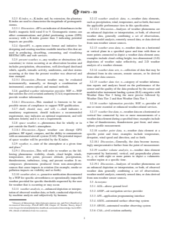
3.2.3 K-index, n—K-index and, by extension, the planetary 3.2.12 weather analysis data, n—weather data elements,
K-index are used to characterize the magnitude of geomagnetic such as precipitation, wind, temperature, and so forth, that meet
storms.
the applicable performance tiers in this specification.
3.2.3.1 Discussion—KP is an indicator of disturbances in the
3.2.12.1 Discussion—Analyses of weather phenomena are
Earth’s magnetic field rated 0 to 9. Geomagnetic storms can
an enhanced depiction or interpretation, or both, of observed
affect communications and global positioning system (GPS)
weather data, generally combining a set of observations,
accuracy with a K-index greater than 3 indicating potential
weather model analysis, remotely sensed data, or data derived
impacts are possible.
from non-weather sensor sources.
3.2.4 OpenAPI, n—open-source format and initiative for
3.2.13 weather area data, n—weather data on a horizontal
designing and creating machine-readable interface files that are
or vertical plane in a specified space and time with three or
used in producing, describing, consuming, and visualizing
more points connected to depict a weather data element area;
RESTful APIs and web services.
examples include cloud ceiling height, two-dimensional (2-D)
3.2.5 present weather, n—any weather or obstructions (ob-
depictions of weather radar reflectivity, and 2-D weather
scurations) to vision occurring at an observation location and
analysis of a weather element.
includes precipitation, obscurations, well-developed dust/sand
whirls, squalls, tornadic activity, sandstorms, and dust storms 3.2.14 weather data sets, n—collection of data that may be
occurring at the time the present weather was observed and obtained from in situ sensors, remote sensors, or be derived
time stamped.
from other data sources.
3.2.5.1 Discussion—Present weather may be evaluated
3.2.15 weather data tier, n—category of weather informa-
instrumentally, manually, or through a combination of
tion reports and analyses based on the performance of the
instrumental, camera optical, and manual methods.
sensor and the quality of the data produced by the sensor and
3.2.6 qualified weather information provider, WIP, n—WIP
modeled after instrument landing system (ILS) categories with
that satisfies the civil aviation authority (CAA) requirements to
Weather Data Tier 3 being the most precise followed by
provide weather information.
Weather Data Tier 2 and then Weather Data Tier 1.
3.2.6.1 Discussion—This standard is foreseen to be one
3.2.16 weather information provider, WIP, n—provider of
possible means of compliance to support WIP qualification.
one or more essential or enhanced weather-related services.
3.2.7 shall, should, may, and will, v—shall indicates a
3.2.17 weather line data, n—weather data on a horizontal or
mandatory requirement, should indicates a recommended
vertical line connected by two or more measurements of a
requirement, may indicates an optional requirement, and will
indicates futurity and it is not a requirement. weather data element during a specified time; examples include
a line of thunderstorms, thunderstorm gust front, and atmo-
3.2.8 space weather, n—phenomena that lie wholly or in
spheric profile measurement.
part outside the Earth’s atmosphere.
3.2.8.1 Discussion—Space weather can disrupt GPS
3.2.18 weather point data, n—weather data element at a
guidance, RF signal, compass, and the ability to communicate
specific point and time; examples include temperature,
with an unmanned aircraft system (UAS). The potential impact
dewpoint, wind speed and direction, and so forth.
of space weather will be provided by the K-index.
3.2.18.1 Discussion—Generally, the data become increas-
3.2.9 weather, n—state of the atmosphere at a given time
ingly unrepresentative further from the point of measurement.
and place.
3.2.19 weather volume analysis, n—weather data element
3.2.9.1 Discussion—This will refer to weather as the fol-
represented by horizontal, vertical, and perpendicular planes
lowing phenomena: visibility, clouds, cloud height, winds,
(x, y, z) with eight or more points to depict a volumetric
temperature, dew point, pressure altitude, precipitation,
weather region at a specific time.
thunderstorms, turbulence, icing, and present weather. It en-
compasses phenomena produced from non-atmospheric
3.2.19.1 Discussion—Analyses of weather phenomena are
sources that cause impacts to aviation (for example, smoke or an enhanced depiction or interpretation, or both, of observed
pollution impacts on visibility and so forth).
weather data generally combining a set of observations,
weather model analysis, remotely sensed data, or data derived
3.2.10 weather alert, n—proactive notification disseminated
from non-weather sensor sources.
by a WIP for specific airworthiness or operationally impactful
weather provided for specific thresholds requested by the user
3.3 Acronyms:
for weather that is occurring or may occur.
3.3.1 AGL—above ground level
3.2.11 weather analysis, n—enhanced depiction or interpre-
3.3.2 ANSP—air navigation service provider
tation of observed weather data, or both, conducted objectively
by machine analysis and subjectively by humans.
3.3.3 API—application programming interface
3.3.4 ASOS—automated surface observing system
Glossary of Meteorology, https://glossary.ametsoc.org, and Pilot’s Handbook of
Aeronautical Knowledge, FAA-H 8083 25B, Chapter 12, Weather Theory, https://
3.3.5 AWOS—automated weather observing system
www.faa.gov/aviation/phak/pilots-handbook-aeronautical-knowledge-faa-h-8083-
25b, (blend of definition from two sources). 3.3.6 CAA—civil aviation authority
F3673 − 23
3.3.7 GeoJSON—geographic JSON 4.4.5.1 Measurement and weather analysis of attributes such
as, but not limited to, winds (for example, surface and aloft;
3.3.8 GPS—global positioning system
three-dimensional (3-D) wind), visibility, ceiling/cloud height,
3.3.9 ICAO—International Civil Aviation Organization
temperature, dewpoint, barometric pressure, precipitation,
3.3.10 ILS—instrument landing system
icing, and turbulence; and
3.3.11 IWXXM—ICAO meteorological information ex-
4.4.5.2 Alerting of weather conditions that may adversely
change model
impact UAS operations;
3.3.12 JSON—JavaScript object notation
4.4.6 Aircraft flight control and telemetry data may be used
to derive encountered winds aloft;
3.3.13 METAR—meteorological aerodrome report
4.4.7 JSON/GeoJSON data formats and standard compli-
3.3.14 NAS—National Airspace System
ance; and
3.3.15 PIREP—pilot report
4.4.8 Support for automated aircraft reporting of in-flight
3.3.16 QNH—atmospheric pressure (Q) at nautical height
weather measurements.
(aviation radiotelephony code)
4.5 A single WIP is not required to provide all weather
3.3.17 SDO—standards development organization
information identified in this specification. For example, a WIP
3.3.18 TAF—terminal area forecast
might wish to provide only wind data sets. WIPs may also
3.3.19 UAS—unmanned aircraft system
provide additional, value-added capabilities and still be com-
3.3.20 UTC—universal time coordinated pliant with this specification if the value-added capabilities do
not conflict with the services defined in this specification and
3.3.21 VTOL—vertical takeoff and landing
the implementation of services defined in this specification
3.3.22 WIP—weather information provider
conform to the applicable requirements. In this specification,
3.3.23 xTM—extensible traffic management
aspects common to all roles and services, such as data
performance standard, reliability of service, security, auditing,
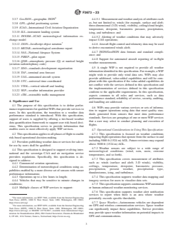
4. Significance and Use
and handling are addressed.
4.1 The purpose of this specification is to define perfor-
4.6 WIPs may provide various services or sets of informa-
mance requirements for qualified WIPs that provide services to
tion to support operations using data that meet quality stan-
users. In this specification, the transition to a weather data
dards generated from sensors that meet data performance
performance standard is introduced. With this specification,
standards. Services are groupings of one or more WIP services
support of users is supplied by offering a tier-based weather
that a user may select to conduct planning and execution of
data quantification framework to support user risk-based deci-
flights.
sions. This specification serves to provide information that
enables users to most effectively apply WIP services.
4.7 Operational Considerations in Using This Specification:
4.7.1 This specification is focused on weather conditions
4.2 This specification applies to all phases of flight to enable
risk-based operational decision-making. impacting flight operations that operate from the surface to and
including 5000 ft (1524 m) AGL. Future revisions may expand
4.3 Providers publishing weather data or services for sale or
above 5000 ft (1524 m) AGL.
for use by users shall be qualified.
4.7.2 Weather sensors are subject to a wide range of
4.4 This specification is designed to support evolving inter-
meteorological conditions (wind, rain, snow, extreme
national and the sovereign CAA and air navigation service
temperatures, and so forth).
providers regulations. Specifically, this specification is de-
4.7.3 This specification covers measurement of attributes
signed to address:
such as: winds (surface and aloft; 3-D winds), visibility,
4.4.1 Commercial aviation operations;
ceilings, temperature, dewpoint, barometric pressure,
4.4.2 Determination of meteorological conditions using ca-
precipitation, present weather, precipitation type,
pabilities enabled by a more diverse set of sensors with sensor
thunderstorms, icing, and turbulence.
performance information;
4.7.4 This specification supports weather data mapping and
4.4.3 Operations up to a few hours in length;
imagery services for users to visualize data sets.
4.4.4 Vehicles that may be sensitive to minute changes in
conditions;
4.7.5 This specification supports continuous WIP automated
4.4.5 Multiple classes of WIP services to support: or human-enhanced weather-monitoring services.
4.7.6 This specification supports weather alert notification
services to report when there is an area where weather
For more information, see IETF 7946, available from the Internet Engineering
potentially exceeds specific thresholds.
Task Force (IETF), 1000 N West Street, Suite 1200, Wilmington, DE 19801,
4.7.7 Space Weather—Autonomous vehicles are dependent
https://www.ietf.org/.
For more information, see IETF 8259, available from the Internet Engineering
on GPS and wireless communication services. Space weather
Task Force (IETF), 1000 N West Street, Suite 1200, Wilmington, DE 19801,
can significantly impact these capabilities. Service providers
https://www.ietf.org/, or ISO/IEC 21778:2017, available from International Orga-
may provide space weather information on potential impacts to
nization for Standardization (ISO), ISO Central Secretariat, Chemin de Blandonnet
8, CP 401, 1214 Vernier, Geneva, Switzerland, https://www.iso.org. GPS and communications.
F3673 − 23
4.7.8 UAS that operate over large bodies of water may be may not be of the same quality, nor will all operations require
impacted by additional environmental factors such as sea states the same fidelity of data. The tiering was developed with
and salt spray. These conditions are not addressed in this Weather Data Tier 1 being the least accurate data tier and
specification. Weather Data Tier 3 being the most. Additional tiers can be
4.7.9 WIP data may be sent to any user.
stood-up in the future if a higher level of data quality and
accuracy is required, such as flight within urban environments
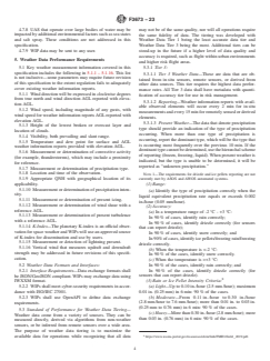
5. Weather Data Performance Requirements
and higher risk flight areas.
5.1 Key weather measurement information covered in this
5.3.1 Tier 3:
specification includes the following in 5.1.1 – 5.1.16. This list
5.3.1.1 Tier 3 Weather Data—These are data that are ob-
is not inclusive—some parameters may require future revision
tained from in situ sensors, remote sensors, or derived from
of this specification to the extent regulation fails to adequately
other data sources. This tier requires the highest data perfor-
cover existing weather information reports.
mance rates. All Tier 3 data shall have metadata with quanti-
5.1.1 Wind direction will be expressed in clockwise degrees
fication of accuracy tier for use in risk management.
from true north and wind direction AGL reported with eleva-
5.3.1.2 Reporting—Weather information reports with avail-
tion AGL.
able observed elements will occur every 2 min for in situ
5.1.2 Wind speed, including magnitude of any gusts, with
measurements and every 15 min for remotely sensed or derived
wind speed for weather information reports AGL reported with
elements.
elevation AGL.
5.3.1.3 Present Weather—The data that denote precipitation
5.1.3 Height of the lowest broken or overcast layer and
type should provide an indication of the type of precipitation
location of clouds.
occurring. When more than one type of precipitation is
5.1.4 Visibility, both prevailing and slant range.
occurring, report the dominant type, which will be the type that
5.1.5 Temperature and dew point for surface and AGL
is occurring most frequently over the previous 10 min. If the
weather information reports provided with elevation AGL.
dominant type cannot be determined, use the hierarchal scheme
5.1.6 Measurement or determination of convective activity
of reporting (frozen, freezing, liquid). When present weather is
(for example, thunderstorms), which may include a proximity
indicated, but the type is unable to be determined, it will be
for reference.
reported as “unknown precipitation.”
5.1.7 Measurement or determination of precipitation type.
5.1.8 Location and time of the observation.
NOTE 1—The requirements for drizzle and ice pellets reporting are not
5.1.9 Appropriate QNH with geographical location of its
currently met by ASOS and AWOS automated systems.
(1) Range:
applicability.
5.1.10 Measurement or determination of precipitation inten-
(a) Identify the type of precipitation correctly when the
sity.
liquid equivalent precipitation rate equals or exceeds 0.002
5.1.11 Measurement or determination of present icing.
in./hour (0.05 mm/hour).
5.1.12 Measurement or determination of wind shear with a
(2) Accuracy:
reference AGL.
(a) In a temperature range of -2 °C - +3 °C:
5.1.13 Measurement or determination of present turbulence
In 90 % of cases, identify rain correctly;
with a reference AGL.
In 90 % of cases, identify drizzle correctly (for sensors
5.1.14 K-Index—The planetary K-index is an official obser-
that can report drizzle);
vation for space weather and WIPs will use an approved source
In 90 % of cases, identify snow correctly; and
of K-index for dissemination and use by users.
In 90% of cases, identify ice pellets/freezing rain/freezing
5.1.15 Measurement or detection of lightning present.
drizzle correctly.
5.1.16 Vertical wind that measures updraft and downdraft
(b) When the temperature is <-2 °C:
strength may be addressed in future revisions of this specifi-
In 90 % of the cases, identify snow correctly.
cation.
(c) When the temperature
...