

ISO/DTS 19144-4
(Main)Geographic information — Classification systems — Part 4: Registration and implementation aspects
General Information
- Abstract
This part of ISO 19144 specifies a methodology for the registration of Land Cover and Land Use classification systems, together with a mechanism of registration of the elements needed to extend either of the Land Cover or Land Use metalanguages as described in ISO 19144-2 (LCML) and ISO 19144-3 (LUML). In addition, this part of ISO 19144 describes supporting implementation aspects that assist in the recording of registered systems or elements, and for the encoding of the description of these systems and elements for inclusion in an ISO register. It is anticipated that the project will refer to ISO 19135 procedures for item registration. The revision of ISO 19135 is expected to start the DIS stage within the next two months. The project team will draft ISO 19144-4 to conform to the new ISO 19135 edition.
- Status
- Not Published
- Technical Committee
- ISO/TC 211 - Geographic information/Geomatics
- Drafting Committee
- ISO/TC 211 - Geographic information/Geomatics
- Current Stage
- 5020 - FDIS ballot initiated: 2 months. Proof sent to secretariat
- Start Date
- 13-Jul-2026
- Completion Date
- 13-Jul-2026
Buy Documents
ISO/DTS 19144-4 - Geographic information — Classification systems — Part 4: Registration and implementation aspects
REDLINE ISO/DTS 19144-4 - Geographic information — Classification systems — Part 4: Registration and implementation aspects
Overview
ISO/DTS 19144-4:2026, Geographic information - Classification systems - Part 4: Registration and implementation aspects, is an International Standard developed by ISO/TC 211 in partnership with the UN Food and Agriculture Organization (UNFAO). This standard provides a comprehensive methodology for the registration of Land Cover and Land Use classification systems. It establishes mechanisms for registering the elements necessary to extend the Land Cover Meta Language (LCML, ISO 19144-2) and Land Use Meta Language (LUML, ISO 19144-3). It also covers the supporting implementation aspects that enable the recording, maintenance, and encoding of these registered systems and elements for integration into ISO register systems.
The primary objective of ISO/DTS 19144-4 is to promote interoperability, transparency, and reuse of classification systems, supporting the needs of global, regional, and national stakeholders in geographic information management. This enables more standardized approaches to land data integration, facilitating robust decision-making and efficient data sharing.
Key Topics
Registration Methodology
- Specifies a coherent process for registering Land Cover and Land Use classification systems and associated elements.
- Follows item registration and governance procedures outlined in ISO 19135.
- Ensures all registered items retain validity status and historical data for consistency over time.
Extension Mechanisms
- Supports the addition of new descriptors, characteristics, Land Use activities, attributes, and code list values in LCML and LUML.
- Allows localization and adaptation to national or organizational needs while maintaining global interoperability.
Implementation Aspects
- Outlines requirements for database and register implementation, including schema conformance (UML, XML encoding).
- Emphasizes multilingual and culturally adaptable registration to support diverse stakeholders and legal contexts.
- Supports distributed, federated, and hierarchical register structures, enabling both centralized and decentralized management.
Historical Validity and Versioning
- Ensures prior definitions remain accessible, supporting comparison of datasets across time.
Applications
ISO/DTS 19144-4 delivers significant practical value in a range of areas involving geographic classification and land data standardization:
National and Regional Land Data Management
- Facilitates the registration and comparison of diverse land classification systems, supporting integration in multi-jurisdictional contexts.
Global Environmental Monitoring
- Supports initiatives such as climate change analysis, agricultural monitoring, and ecosystem assessments by harmonizing land cover and land use data.
International Collaboration and Reporting
- Assists organizations (e.g., UNFCCC, IPCC) in aggregating and managing land information from multiple national sources, promoting unbiased, standardized reporting.
Academic and Research Integration
- Provides standardized frameworks for describing, sharing, and comparing land classification systems, making research data more interoperable and reusable.
Data Sharing and Interoperability
- Enables encoding and exchange of classification systems and elements in standardized formats (XML, UML), improving compatibility between databases and geographic information systems (GIS).
Related Standards
ISO/DTS 19144-4 is closely associated with several foundational ISO standards in geographic information:
- ISO 19144-1:2009 – Classification System Structure: Describes the fundamentals of classification system structures.
- ISO 19144-2:2023 (LCML) – Land Cover Meta Language: Details the meta-language for describing land cover.
- ISO/TS 19144-3:2024 (LUML) – Land Use Meta Language: Defines the meta-language for land use descriptions.
- ISO 19135:2026 – Registration and Register Governance: Provides the framework for consistent item registration and management.
- ISO 19103 – Conceptual Schema Language: Sets principles for modeling geographic information.
- ISO 19123-1 – Coverage Geometry and Functions: Establishes fundamentals for coverage schema.
- ISO 19115-1 – Metadata Fundamentals: Specifies core metadata concepts for geographic information.
- ISO 19127:2019 – Geodetic Register: Covers geodetic register implementation.
By following ISO/DTS 19144-4, organizations benefit from a robust, interoperable methodology for the registration and ongoing management of land cover and land use classification systems, directly supporting broader objectives in geographic information standardization and data sharing.
Relations
- Effective Date
- 05-Apr-2025
Buy Documents
ISO/DTS 19144-4 - Geographic information — Classification systems — Part 4: Registration and implementation aspects
REDLINE ISO/DTS 19144-4 - Geographic information — Classification systems — Part 4: Registration and implementation aspects
Get Certified
Connect with accredited certification bodies for this standard

BSI Group
BSI (British Standards Institution) is the business standards company that helps organizations make excellence a habit.

NYCE
Mexican standards and certification body.
Sponsored listings
Frequently Asked Questions
ISO/DTS 19144-4 is a draft published by the International Organization for Standardization (ISO). Its full title is "Geographic information — Classification systems — Part 4: Registration and implementation aspects". This standard covers: This part of ISO 19144 specifies a methodology for the registration of Land Cover and Land Use classification systems, together with a mechanism of registration of the elements needed to extend either of the Land Cover or Land Use metalanguages as described in ISO 19144-2 (LCML) and ISO 19144-3 (LUML). In addition, this part of ISO 19144 describes supporting implementation aspects that assist in the recording of registered systems or elements, and for the encoding of the description of these systems and elements for inclusion in an ISO register. It is anticipated that the project will refer to ISO 19135 procedures for item registration. The revision of ISO 19135 is expected to start the DIS stage within the next two months. The project team will draft ISO 19144-4 to conform to the new ISO 19135 edition.
This part of ISO 19144 specifies a methodology for the registration of Land Cover and Land Use classification systems, together with a mechanism of registration of the elements needed to extend either of the Land Cover or Land Use metalanguages as described in ISO 19144-2 (LCML) and ISO 19144-3 (LUML). In addition, this part of ISO 19144 describes supporting implementation aspects that assist in the recording of registered systems or elements, and for the encoding of the description of these systems and elements for inclusion in an ISO register. It is anticipated that the project will refer to ISO 19135 procedures for item registration. The revision of ISO 19135 is expected to start the DIS stage within the next two months. The project team will draft ISO 19144-4 to conform to the new ISO 19135 edition.
ISO/DTS 19144-4 is classified under the following ICS (International Classification for Standards) categories: 35.240.70 - IT applications in science. The ICS classification helps identify the subject area and facilitates finding related standards.
ISO/DTS 19144-4 has the following relationships with other standards: It is inter standard links to ISO/IEC 23093-3:2022. Understanding these relationships helps ensure you are using the most current and applicable version of the standard.
ISO/DTS 19144-4 is available in PDF format for immediate download after purchase. The document can be added to your cart and obtained through the secure checkout process. Digital delivery ensures instant access to the complete standard document.
Standards Content (Sample)
FINAL DRAFT
Technical
Specification
ISO/TC 211
Geographic information —
Secretariat: SIS
Classification systems —
Voting begins on:
2026-07-13
Part 4:
Registration and implementation
Voting terminates on:
2026-10-05
aspects
Information géographique — Systèmes de classification —
Partie 4: Aspects d’enregistrement et de mise en œuvre
RECIPIENTS OF THIS DRAFT ARE INVITED TO SUBMIT,
WITH THEIR COMMENTS, NOTIFICATION OF ANY
RELEVANT PATENT RIGHTS OF WHICH THEY ARE AWARE
AND TO PROVIDE SUPPOR TING DOCUMENTATION.
IN ADDITION TO THEIR EVALUATION AS
BEING ACCEPTABLE FOR INDUSTRIAL, TECHNO-
ISO/CEN PARALLEL PROCESSING LOGICAL, COMMERCIAL AND USER PURPOSES, DRAFT
INTERNATIONAL STANDARDS MAY ON OCCASION HAVE
TO BE CONSIDERED IN THE LIGHT OF THEIR POTENTIAL
TO BECOME STAN DARDS TO WHICH REFERENCE MAY BE
MADE IN NATIONAL REGULATIONS.
Reference number
FINAL DRAFT
Technical
Specification
ISO/TC 211
Geographic information —
Secretariat: SIS
Classification systems —
Voting begins on:
Part 4:
Registration and implementation
Voting terminates on:
aspects
Information géographique — Systèmes de classification —
Partie 4: Aspects d’enregistrement et de mise en œuvre
RECIPIENTS OF THIS DRAFT ARE INVITED TO SUBMIT,
WITH THEIR COMMENTS, NOTIFICATION OF ANY
RELEVANT PATENT RIGHTS OF WHICH THEY ARE AWARE
AND TO PROVIDE SUPPOR TING DOCUMENTATION.
© ISO 2026
IN ADDITION TO THEIR EVALUATION AS
All rights reserved. Unless otherwise specified, or required in the context of its implementation, no part of this publication may
BEING ACCEPTABLE FOR INDUSTRIAL, TECHNO-
ISO/CEN PARALLEL PROCESSING
LOGICAL, COMMERCIAL AND USER PURPOSES, DRAFT
be reproduced or utilized otherwise in any form or by any means, electronic or mechanical, including photocopying, or posting on
INTERNATIONAL STANDARDS MAY ON OCCASION HAVE
the internet or an intranet, without prior written permission. Permission can be requested from either ISO at the address below
TO BE CONSIDERED IN THE LIGHT OF THEIR POTENTIAL
or ISO’s member body in the country of the requester.
TO BECOME STAN DARDS TO WHICH REFERENCE MAY BE
MADE IN NATIONAL REGULATIONS.
ISO copyright office
CP 401 • Ch. de Blandonnet 8
CH-1214 Vernier, Geneva
Phone: +41 22 749 01 11
Email: copyright@iso.org
Website: www.iso.org
Published in Switzerland Reference number
ii
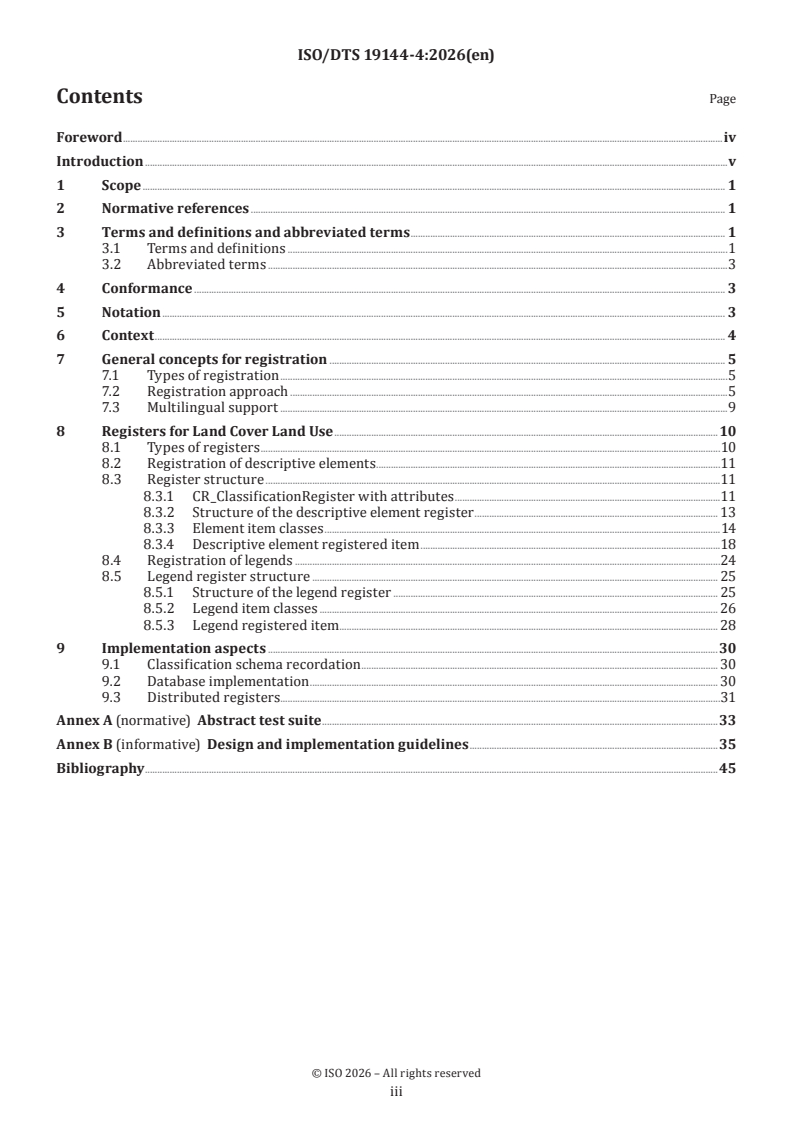
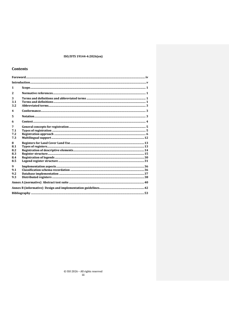
Contents Page
Foreword .iv
Introduction .v
1 Scope . 1
2 Normative references . 1
3 Terms and definitions and abbreviated terms . 1
3.1 Terms and definitions .1
3.2 Abbreviated terms .3
4 Conformance . 3
5 Notation . 3
6 Context . 4
7 General concepts for registration . 5
7.1 Types of registration .5
7.2 Registration approach .5
7.3 Multilingual support .9
8 Registers for Land Cover Land Use .10
8.1 Types of registers .10
8.2 Registration of descriptive elements .11
8.3 Register structure .11
8.3.1 CR_ClassificationRegister with attributes .11
8.3.2 Structure of the descriptive element register . 13
8.3.3 Element item classes .14
8.3.4 Descriptive element registered item .18
8.4 Registration of legends .24
8.5 Legend register structure . 25
8.5.1 Structure of the legend register . 25
8.5.2 Legend item classes . 26
8.5.3 Legend registered item . . . 28
9 Implementation aspects .30
9.1 Classification schema recordation . 30
9.2 Database implementation . 30
9.3 Distributed registers.31
Annex A (normative) Abstract test suite .33
Annex B (informative) Design and implementation guidelines .35
Bibliography .45
iii
Foreword
ISO (the International Organization for Standardization) is a worldwide federation of national standards
bodies (ISO member bodies). The work of preparing International Standards is normally carried out through
ISO technical committees. Each member body interested in a subject for which a technical committee
has been established has the right to be represented on that committee. International organizations,
governmental and non-governmental, in liaison with ISO, also take part in the work. ISO collaborates closely
with the International Electrotechnical Commission (IEC) on all matters of electrotechnical standardization.
The procedures used to develop this document and those intended for its further maintenance are described
in the ISO/IEC Directives, Part 1. In particular, the different approval criteria needed for the different types
of ISO document should be noted. This document was drafted in accordance with the editorial rules of the
ISO/IEC Directives, Part 2 (see www.iso.org/directives).
ISO draws attention to the possibility that the implementation of this document may involve the use of (a)
patent(s). ISO takes no position concerning the evidence, validity or applicability of any claimed patent
rights in respect thereof. As of the date of publication of this document, ISO had not received notice of (a)
patent(s) which may be required to implement this document. However, implementers are cautioned that
this may not represent the latest information, which may be obtained from the patent database available at
www.iso.org/patents. ISO shall not be held responsible for identifying any or all such patent rights.
Any trade name used in this document is information given for the convenience of users and does not
constitute an endorsement.
For an explanation of the voluntary nature of standards, the meaning of ISO specific terms and expressions
related to conformity assessment, as well as information about ISO's adherence to the World Trade
Organization (WTO) principles in the Technical Barriers to Trade (TBT), see www.iso.org/iso/foreword.html.
This document was prepared by Technical Committee ISO/TC 211, Geographic information/Geomatics, in
collaboration with the European Committee for Standardization (CEN) Technical Committee CEN/TC 287,
Geographic Information, in accordance with the Agreement on technical cooperation between ISO and CEN
(Vienna Agreement).
A list of all parts in the ISO 19144 series can be found on the ISO website.
Any feedback or questions on this document should be directed to the user’s national standards body. A
complete listing of these bodies can be found at www.iso.org/members.html.
iv
Introduction
A classification system can be used to subdivide any geographic area into small units each of which carries
an identifier that describes its type. The spatial representation of each geographic area is a discrete coverage
[1]
as described in ISO 19123-1 . The general approach to classification systems is described in ISO 19144-1
Classification systems — Part 1: Classification System Structure. Many organizations and jurisdictions
have developed classification systems that particularly suite their national, regional or application related
requirements. Many of these classifications systems are different and can not easily be compared or
integrated to produce world data sets. In order to assist in the description of classification systems used to
address Land Cover and Land Use two meta-language-based standards have been developed. ISO 19144-2
[2] [2]
LCML addresses the description of Land Cover and ISO 19144-2 LUML addresses the description of
Land Use. These two standards may also be used in combination to describe combined Land Cover / Land
Use classification systems. The result of a description of a classification system is a UML model defined in
[3]
accordance with the modelling precepts established in ISO 19103 . This resultant model represents the
particular classification system established by a specific organization or jurisdiction.
The representation of Land Cover, and the associated representation of Land Use, is an important source of
information for decision makers, planners, researchers, and private interests about terrestrial ecosystems.
This is true both internationally and in national, regional and other jurisdictions. Many nations have similar
requirements and the United Nations needs to compile global data sets and assist developing and other
nations in producing Land Cover and Land Use data for their areas. Creating global Land Cover and Land Use
data is very difficult because data is gathered for different purposes through different survey and acquisition
projects and various nations use different classification schemes to represent that data. There are many
different legends used to classify data. However, the integration of data is required to address regional and
world-wide requirements in the United Nations, various nations, and in academic and industrial contexts.
[2] [4]
The meta-languages described in ISO 19144-2 LCML and ISO/TS 19144-3 LUML are not exhaustive.
They can each be extended to include additional characteristics, Land Use activities, attributes, and attribute
code list values to better represent specific Land Cover or Land Use conditions. In order for these potential
extensions to be reused in a compatible manner a registration system is established in this document.
This register also allows for the registration of alternate representations such as the use of definitions and
names in multiple languages. This is very important in a global context. It is also important to allow for
distributed maintenance of the register system so that aspects such as the translation of definitions into
multiple languages can be managed locally by those nations or organizations expert in those languages. The
Land Cover and Land Use meta-languages can also be extended nationally or locally resulting in additional
registers developed at the national, regional or organizational level. These additional registers may be
federated to link them together and linked to world registers.
The description of whole classification systems needs to be preserved so that they can be used to assist
in the comparison of different systems, or in the integration of data from multiple sources to create world
data sets. An example is the integration of data from many (different) national data sets world wide to
support the particular climate change classification system used to support the United Nations Framework
Convention on Climate Change (UNFCCC) and the Intergovernmental Panel on Climate Change (IPCC) in an
unbiased manner. This document also established the approach for registering whole classification systems
[2] [4]
as described using the meta-languages defined in ISO 19144-2 LCML and ISO/TS 19144-3 LUML.
In order to facilitate this registration process, several implementation aspects are defined including the
representation of classification elements in UML represented as XML. Other implementation aspect are
described such as the management of identifiers across distributed federated registries forming one logical
register.
The aim of this document is to provide direction for registration and definition of the implementation
[2] [4]
aspects. ISO 19144-2 and ISO/TS 19144-3 are meta-languages that allow for the description of Land
Cover and Land Use classification legends or application schema elements. In particular descriptive elements
including attributes, attribute values such as those identified in code lists and characteristics and Land Use
[5]
activities may be extended through the registration process. In addition, ISO 19144-1 describes how the
description of whole classification systems including their legends expressed in LCML and/ or LUML may be
registered. These are two different types of registration.
v
[5]
Text exists in the first version of ISO 19144-1 which generally described the registration process for
[2]
whole classification systems, and text exists in ISO 19144-2 which described how descriptive elements
may be extended through registration. In the process of the revision of the ISO 19144 series of standards,
the material on registration was moved to this document.
This document is a joint International Standard with the UN Food and Agriculture Organization. Permission
has been granted to ISO by the UN FAO to make a derived work based on any material developed or copyright
UN FAO.
In this document, UML attributes names are given in italics.
In accordance with the ISO/IEC Directives, Part 2, 2018, Rules for the structure and drafting of International
Standards, in International Standards the decimal sign is a comma on the line. However, the General
Conference on Weights and Measures (Conférence Générale des Poids et Mesures) at its meeting in 2003
passed unanimously the following resolution:
“The decimal marker shall be either a point on the line or a comma on the line.”
In practice, the choice between these alternatives depends on customary use in the language concerned. In
the technical areas of geodesy and geographic information it is customary for the decimal point always to be
used, for all languages. That practice is used throughout this document.
vi
FINAL DRAFT Technical Specification ISO/DTS 19144-4:2026(en)
Geographic information — Classification systems —
Part 4:
Registration and implementation aspects
1 Scope
This document specifies a methodology for the registration of Land Cover and Land Use classification
systems, together with a mechanism of registration of the elements needed to extend either of the Land
[2] [4]
Cover or Land Use meta-languages as described in ISO 19144-2 (LCML) and ISO/TS 19144-3 (LUML).
In addition, this document describes supporting implementation aspects that assist in the recording of
registered systems or elements, and for the encoding of the description of these systems and elements for
inclusion in a register.
2 Normative references
The following documents are referred to in the text in such a way that some or all of their content constitutes
requirements of this document. For dated references, only the edition cited applies. For undated references,
the latest edition of the referenced document (including any amendments) applies.
ISO 19103, Geographic information — Conceptual schema language
ISO 19115-1, Geographic information — Metadata — Part 1: Fundamentals
ISO 19135, Geographic information — Registration and register governance
ISO 19135:2026, Geographic information — Registration and register governance
ISO 19144-1, Geographic information — Classification systems — Part 1: Classification system structure
ISO 19144-2, Geographic information — Classification systems — Part 2: Land Cover Meta Language (LCML)
ISO/TS 19144-3, Geographic information — Classification systems — Part 3: Land Use Meta Language (LUML)
3 Terms and definitions and abbreviated terms
3.1 Terms and definitions
For the purposes of this document, the terms and definitions given in ISO 19144-1, ISO 19144-2,
ISO/TS 19144-3, ISO 19135 and the following apply.
ISO and IEC maintain terminology databases for use in standardization at the following addresses:
— IEC Electropedia: available at http:// www .electropedia .org/
— ISO Online browsing platform: available at http:// www .iso .org/ obp
3.1.1
abstract test suite
ATS, noun
set of conformance classes that define tests for all requirements of a specification
Note 1 to entry: Evidence of conformance to all or part of a standard, awarded for passing one or more of the
conformance test classes specified in that standard.
[6]
[SOURCE: ISO 19105:2022 , 3.3]
3.1.2
class
〈UML〉 classifier (3.1.3) of a set of objects
Note 1 to entry: Adapted from UML 2.5.1, 11.8.3.1.
Note 2 to entry: Class is used in the ISO 19144 series to represent a construct in a classification system; however, the
term has several meanings in other contexts, including in the UML modelling language. Where possible, attributes,
domains, or other identifiers are needed to distinguish between the various uses of the term class.
[7]
[SOURCE: ISO 19103:2024 , 3.14, modified — Note 2 to entry added.]
3.1.3
classifier
〈UML〉 classification of instances according to their features
Note 1 to entry: A classifier is a kind of type.
Note 2 to entry: Adapted from UML 2.5.1, 9.2.1.
[7]
[SOURCE: ISO 19103:2024 , 3.16]
3.1.4
coverage
function which returns values from its range for any direct position within its domain
[8]
[SOURCE: ISO 19123-1:2023 , 3.1.9]
3.1.5
discrete coverage
coverage (3.1.4) that returns value for the direct position within its domain
Note 1 to entry: Discrete coverages have values only for their direct positions, whereas continuous coverages can be
interpolated, thereby providing values Between direct positions in addition
[8]
[SOURCE: ISO 19123-1:2023 , 3.1.15]
3.1.6
object
〈UML〉 individual with a state and relationships to other individuals
Note 1 to entry: An object is an instance of a class (3.1.2).
Note 2 to entry: Adapted from UML 2.5.1, 6.3.1.
[7]
[SOURCE: ISO 19103:2024 , 3.54]
3.2 Abbreviated terms
ATS Abstract Test Suite
IPCC Intergovernmental Panel on Climate Change
LCML Land Cover Meta Language
LUML Land Use Meta Language
UML Unified Modelling Language
UN United Nations
UNEP United Nations Environment Programme
UNFAO United Nations Food and Agriculture Organization
UNFCCC United Nations Framework Convention on Climate Change
XML Extensible Markup Language
XSD XML Schema
CLA Culturally and Linguisticaly Adaptable
4 Conformance
Conformance to this document consists of alignment with the requirements established in 7.1, 8.2, 8.3.2.2,
8.3.2.3, 8.5.1.2, and 8.5.1.3. The Abstract Test Suite given in Annex A describes a methodology that shall
be used for testing conformance to these requirements. Conformance to this document also consists of
alignment with the requirements set out in ISO 19135, which provides several choices for implementing a
register.
5 Notation
The conceptual schema specified in this document is described using the Unified Modelling Language (UML),
[3]
following the guidance of ISO 19103 .
Several model elements used in this schema are defined in other ISO geographic information standards.
Names of UML classes, with the exception of basic data type classes, include a two-letter prefix that identifies
the standard and the UML package in which the UML class is defined. This provides a global unique name for
the class. UML classes defined in this document have the two-letter prefix of CR. Examples in this document
[2] [4]
and in ISO 19144-2 and ISO/TS 19144-3 have the two-letter prefix EL. Table 1 lists the other standards
and packages in which UML classes used in this document have been defined. The classes referenced in
[9]
ISO 19135 are unique based on there name and have no prefix.
Table 1 — Sources of externally defined UML classes
Prefix Standard Package
CL 19144-1 Classification System Structure
LC 19144-2 Land Cover Meta Language classes
LU 19144-3 Land Use Meta Language classes
EL 19144-2 & Examples in the 19144 series
19144-3
CI 19115-1 Metadata – Citation and responsible party information
19135 RegisterComponents
The term "class" is a normal English word with a dictionary definition; however, it has several meanings in
the ISO 19144 series on “Classification Systems” dependent upon context. Classification is a process and the
results of a classification process is a “class”. The term class is used in the ISO 19144 series
to represent a construct in a classification system. However, the term class has several other meanings in
other contexts. A classification system consists of a set of classes subdividing the concepts within a given
topic area. There is an unavoidable conflict with the terminology when a modelling language such as UML is
used to describe a classification system meta-language systems and elements. The UML modelling language
uses the term class as a construct in an object-oriented programming or data modelling paradigm,
as the template for an object. That is, a UML class describes the properties associated with the instances of
the class called objects. The term class is used in normal practice in both modelling and classification, and
it is unreasonable for either modelling or classification to avoid the term. The term “Item Class” is also used
in the process of registration identifying the item that is registered. This term occurs in this document.
Adjectives have been used in this document where possible to reduce this confusion, for example UML
classes can be called “UML classes” and classification system classes can be called “classification classes” or
“legend classes”. At times a UML class describes a classification class and it is possible to dispense with the
adjective since both meanings of class are equivalent in the context. The conflict results from the fact that
there is a deep relationship between data modelling and classification as used in other domains.
There is a similar related potential conflict with the associated terms of "attribute" and "object". Adjectives
have been used where possible, but at times it is necessary to derive the meaning from the context. Other
terms where there is a potential for confusion are the terms “element”, “component”, and “characteristic”.
The use of these terms is potentially confusing as they have different meanings in different contexts. These
terms come from different places and all that can be controlled is their usage in the ISO 19144 series. Care is
taken to use adjectives with these terms to endeavour to make their meaning clear.
Certain classes that are common across the entire set of ISO 19144 series standards are defined once. The
classes that describe how permitted numeric values at the meta-language level maybe instantiated to
the basic number types at the type level represented by LC_ValueObject or its subtypes are described in
[10] [3]
ISO 19144-2:2012 . The basic number types are defined in ISO 19103 .
6 Context
[2] [4]
The Land Cover and Land Use meta-languages defined in ISO 19144-2 LCML and ISO/TS 19144-3 LUML
provide a structure for the description of classification systems. The level of detail of the description can
vary based on the use case. For the recording of specific national or regional classification systems a detailed
description may be necessary to capture the full meaning of the classes defined in that classification system.
For other use cases such as the comparison of classification systems, only the level of detail needed to
describe the differences between systems is required.
In order to be able to full describe particular Land Cover or Land Use classes additional detail may be
[2]
required beyond the structure provided in the LCML or LUML meta-languages. Both ISO 19144-2 LCML
[4]
and ISO/TS 19144-3 LUML have allowed for extension by identifying where additional descriptors may
be added. There are many places in both standards where it is identified that a descriptor element can be
extended through registration. It is possible to add attribute values to code lists. Also, there are a number
of code lists that are deliberately empty where it is indicated that attribute values may be added through
registration. In addition, it is possible to define whole new characteristics and Land Use activities. These
extensions can be defined once for the description of a particular classification system; however, they may
be registered in order that they may be reused to allow for a similar descriptions of different classification
systems. That is, it is not necessary to use registration, but the use of registration allows for reuse of
extended descriptor elements.
In many national, regional or other classification systems class types are described only in words, where the
textual description of each class is expressed in the documentation of that system. However, the ISO 19144-2
[2] [4]
LCML and ISO/TS 19144-3 LUML provide the opportunity to provide a rigorous description as a model
element that can be easily compared with other classification systems. In order to do this the description of
complete classification systems may also be registered.
Specifically, there are two types of registration:
— Registration of extended descriptor elements, including characteristics, activities, attributes, code lists
and code list attribute values; and
— Registration of the description of complete classification systems.
The registration of elements and the registration classification systems may be recorded in separate
registers or in a compound register, as described in ISO 19135:2026, E.1.
In the initial versions of the ISO 19144 series standards, the methodology for registering whole classification
[5]
systems was described in ISO 19144-1 and the methodology for registering extended descriptors was
[2]
described in ISO 19144-2 . Now that the ISO 19144 series of classification system standards is being
revised and the capability to describe Land Use has been added, this information is now described in this
document. This document also describes the representation of classification elements in UML represented
as XML so that they may be included in a register and the management of identifiers across distributed
federated registries forming one logical register to allow multi-lingual registers and registers where the
authority for maintenance of the register is distributed.
[9]
The following clauses describe the methodology for registration in accordance with ISO 19135 and the
items to be registered for the descriptor elements and the registration of the description of classification
systems.
7 General concepts for registration
7.1 Types of registration
This document defines two separate types of registration in support of classification systems for Land
[2]
Cover and Land Use. The first type is for the extension of the meta-languages defined in ISO 19144-2 and
[4]
ISO ISO/TS 19144-3 . The second type of registration is for the recording of the description of complete
classification systems.
Registers provide stability and flexibility. If a registered item is extended or otherwise altered the old
version of the registered item is superseded by the new in accordance with the rules of ISO 19135. The
general approach to registration of geospatial information elements is given in the Handbook of Geographic
[11]
Information .
[9]
ISO 19135 optionally allows that invalid register entries be deleted from the register. This is optional and
appropriate for certain types of registers. However, the registration defined in this document, both for the
registration of elements for the extension of the LCML or LUML meta-languages and for the registration of
complete classification systems or legends requires the maintenance of history. By the combination of date
and the primary identifier (or name) one can query a register and determine what was valid at a particular
time in the past. This means that old datasets that use old definitions of classes remain valid in the context
of the older registered definitions, and it becomes possible to compare datasets defined at different times.
Requirement 1: A register, as defined in this document, shall retain a date and validity status for all
registered items, and no registered item shall be removed from the register (even if it becomes invalid or
superseded).
7.2 Registration approach
[9]
The procedures for registration derives directly from ISO 19135 . The relationship between the various
[9]
components of the ISO 19144 series of standards and the ISO 19135 registration standard is shown in the
package diagram in Figure 1.
Figure 1 — Packages related to registration
[9]
The schema of a register is derived fromISO 19135 and consists of three parts:
a) Data describing the whole register.
b) A description of the meaning of each type of item in the register (e.g. which columns are in the tables in
[9]
a relational database implementation of the register). In ISO 19135 this is called the Concept Plane.
c) The registered items (The content of each table entry in a relational database implementation of the
[9]
register). InISO 19135 this is called the Content Plane.
[9]
TheISO 19135 register schema permits multiple types of registered items to be held in the same register.
Each is described by a RegisteredItemClass object, which in this document becomes a CR_ItemClass object.
Figure 2 shows how the registration classes defined in this document for the support of Land Cover and
[9]
Land Use classification relate to the classes inISO 19135 . The classes CR_ClassificationRegister, CR_
ItemClass and CR_RegisterItem are subtypes of the corresponding classes Register, RegisterItemClass and
[9]
RegisterItem from ISO 19135 .
Figure 2 — Derived registration classes
CR_ClassificationRegister, CR_ItemClass and CR_RegisterItem are shown as abstract classes because they
will not be implemented directly. Subtypes of these classes will be established to implement any particular
registers. The CR_ClassificationRegister, CR_ItemClass and CR_RegisterItem classes may be used to
implement simple registers that may be implemented by some nations, regions or organizations to support
the particular Land Cover and Land Use applications that these parties address. However, organizations
such as the UN or other international bodies may need to aggregate information from multiple sources.
These simple registers making use of these registration elements can serve as the base registers in a more
complex heirachical or federated register scheme.
Figure 3 — Registration classes with attributes
Figure 3 presents the classification register classes with attributes. There exists considerable freedom
in how one implements these attributes in a register implementation. The description of each attribute is
outlined in Table 2. For a detailed description of the instantiated attributes and the inherited attribute value
[9]
types reference is made to ISO 19135 . The additional attributes of CR_ClassificationRegister are described
in Clause 8.3.1.
Table 2 — Instantiated attributes
Attribute Description
CR_ClassificationRegister: identifier Identifies the register as a whole.
CR_ItemClass: RegisterItemClassIdentifier Identifies defined structures applicable to a class of
register items
CR_ItemClass: RegisterItemClassRelation Used to manage class relations in the register.
CR_RegisterItem: RegisterItemIdentifier Identifies individual register items within the register
that realises a concept.
The description of Land Cover and Land Use is done by many nations, organizations and regional authorities
across the world. The description of land in a particular nation or region is an inherently local activity and
the detailed method of description is often closely linked to local practices and sometimes national laws.
For example, the description of what is a wet land may be specified in a national law that is established to
protect that type of wetland, but the description in one nation or jurisdiction may be different than that used
in another place. The definitions cannot be harmonized because they are the legal definition in different
jurisdictions. It is therefore necessary to support multiple definitions for certain concepts in different
jurisdictions at the same time, often in different languages.
It is necessary to be able to aggregate world wide data, without bias, for purposes such as estimating
world agricultural production or to support climate change research. There may be many local data sets
and extensions to the basic ISO classification system standards that may be registered nationally or
regionally. There also may be some world level registers that are required. This means that coordination
between registers at different levels is needed. One cannot simply establish world wide registers and be
able to address all national, regional or other organizational needs. Since nations and regions also make
use of different languages and alphabets and cultural practices (such as number formats or time formats)
multi-lingual registers and cultural and linguisticly adaptable registers are also needed. Management of
distributed national, regional or other organizational registers will be local and done at different times and
in different languages. Some of it may be coordinated with centeral international registers and some may
not. However, a general level of coordination is still required. Management of distributed, federated and
possibly non-heirachical registers can be extremely complex.
[9]
The heirachical register structure and the federated register structure defined in ISO 19135 are realized
by this document. These are explained in more detail in ISO 19135:2026, Annex E. The management of
federated and distributed registers is described in this document.
[9]
The procedures for registration and the details of the registration classes are described in ISO 19135 .
[9]
This document does not duplicate what is described in ISO 19135 . Rather it specializes the three abstract
classes CR_ClassificationRegister, CR_Class and CR_RegisterItem by the addition of several attributes. If a
simple register is established for Land Cover Land Use by a nation, regional authority or organization that
does not require any of the additional attributes in CR_ClassificationRegister, CR_Class and CR_RegisterItem,
then these attributes simply do not need to be expressed in a realization of these abstract classes.
7.3 Multilingual support
[12]
There are approximately 7000 languages used in the world and Land Cover and Land Use features
and elements may be described in various languages in different countries. One important aspect of any
standard that supports land characterization is the support of multiple languages. Some nations, regions or
organizations may only need to support one language at a time, but others need to support multiple languages
[9]
simultaneously. The ISO 19135 explicitly states that it permits the support of multiple languages. The
[13]
structure to support multiple languages is established in ISO 19115-1 using the structure defined by the
[14]
class PT_Locale and the list of languages described ISO 639 .
8 Registers for Land Cover Land Use
8.1 Types of registers
Two different types of registers are described in this document. These are:
[2] [4]
— A register for the extension of the meta-languages defined in ISO 19144-2 and ISO/TS 19144-3 .
— A register for the recording of the description of complete classification systems.
The first register type allows for the registration of descriptor elements to be used to augment the meta-
[2] [4]
languages defined in ISO 19144-2 and ISO/TS 19144-3 . The descriptor elements that may be registered
are:
[2]
— Land Cover characteristics to augment ISO 19144-2 ;
[4]
— Land Use activities to augment ISO/TS 19144-3 ; and
[2]
— attributes, code lists and code list attribute values to support both ISO 19144-2 and ISO/TS 19144-3
[4]
.
The second register type addresses the registration of the description of complete classification systems.
The first register type replaces the methodology for registering extended descriptors which was described
[2] [10]
inISO 19144-2 ISO 19144-2:2012 . The second register type replaces the methodology for registering
[5]
whole classification systems which was described in ISO 19144-1 .
This document does not serve as a “Register Specification” for the implementation of any of these registers.
This document defines the elements that can be registered in any register supporting Land Characterization
(for Land Cover and or Land Use) that may be associated in a heirachical or federated register system or
used in a stand alone register. A “Register Specification” providing the specific content model of a register
is still required for any particular implementation of a register, and is the responsibility of the nation, or
organization implementing that register.
NOTE The term “technical specification” was used in previous versions of some ISO registration standards
providing a “detailed document outlining requirements, characteristics or procedures … uniquely identified, managed,
[9]
and maintained often by a designated Registration Authority”. In ISO 19135 and this document the term has been
changed to “Register Specification” to reduce conflict with other uses of the term "Technical Specification".
Figure 4 shows the different types of registers specified in this document.
Figure 4 — Types of registers
The sub classes and attributes associated with each of these two registers is shown independently and
described separately in subsequent clauses.
8.2 Registration of descriptive elements
Classification systems can be relatively fixed a priori hierarchical structures or they can be very flexible
and complex a posteriori structures, but in both cases, they are specific to the application area for which
they were defined. Over time, additional classifiers can be added to the classification system or the
existing classifiers could need to be modified. This type of maintenance of a set of classifiers lends itself to
registration.
NOTE Registration has other indirect advantages. The overall structure of a classification system and the schema
for the register can be standardized, but the specific d
...
ISO/TC 211
ISO/CD TSDTS 19144-4(en)
ISO/TC 211
Secretariat: SIS
Date: 2026-06-29
Geographic information — Classification systems —
Part 4:
Registration and implementation aspects
Information géographique — Systèmes de classification —
Partie 4: Aspects d’enregistrement et de mise en œuvre
TTTTTTTTTThhhhhhhhhhiiiiiiiiiissssssssss d d d d d d d d d drrrrrrrrrraftaftaftaftaftaftaftaftaftaft i i i i i i i i i issssssssss s s s s s s s s s suuuuuuuuuubbbbbbbbbbmmmmmmmmmmiiiiiiiiiittttttttttttttttttttedededededededededed t t t t t t t t t toooooooooo a pa pa pa pa pa pa pa pa pa pararararararararararallel vallel vallel vallel vallel vallel vallel vallel vallel vallel vooooooooootttttttttte e e e e e e e e e iiiiiiiiiinnnnnnnnnn I I I I I I I I I ISSSSSSSSSSOOOOOOOOOO,,,,,,,,,, C C C C C C C C C CEEEEEEEEEENNNNNNNNNN.
All rights reserved. Unless otherwise specified, or required in the context of its implementation, no part of this publication
may be reproduced or utilized otherwise in any form or by any means, electronic or mechanical, including photocopying,
or posting on the internet or an intranet, without prior written permission. Permission can be requested from either ISO
at the address below or ISO’s member body in the country of the requester.
ISO copyright office
CP 401 • Ch. de Blandonnet 8
CH-1214 Vernier, Geneva
Phone: + 41 22 749 01 11
E-mail: copyright@iso.org
Website: www.iso.org
Published in Switzerland
ii
Contents
Foreword . iv
Introduction . v
1 Scope . 1
2 Normative references . 1
3 Terms and definitions and abbreviated terms . 1
3.1 Terms and definitions . 1
3.2 Abbreviated terms . 3
4 Conformance . 3
5 Notation . 3
6 Context . 4
7 General concepts for registration . 5
7.1 Types of registration . 5
7.2 Registration approach . 6
7.3 Multilingual support . 12
8 Registers for Land Cover Land Use . 13
8.1 Types of registers . 13
8.2 Registration of descriptive elements . 14
8.3 Register structure . 15
8.4 Registration of legends . 30
8.5 Legend register structure . 31
9 Implementation aspects . 36
9.1 Classification schema recordation . 36
9.2 Database implementation . 37
9.3 Distributed registers . 38
Annex A (normative) Abstract test suite . 40
Annex B (informative) Design and implementation guidelines. 42
Bibliography . 53
iii
Foreword
ISO (the International Organization for Standardization) is a worldwide federation of national standards
bodies (ISO member bodies). The work of preparing International Standards is normally carried out through
ISO technical committees. Each member body interested in a subject for which a technical committee has been
established has the right to be represented on that committee. International organizations, governmental and
non-governmental, in liaison with ISO, also take part in the work. ISO collaborates closely with the
International Electrotechnical Commission (IEC) on all matters of electrotechnical standardization.
The procedures used to develop this document and those intended for its further maintenance are described
in the ISO/IEC Directives, Part 1. In particular, the different approval criteria needed for the different types of
ISO documentsdocument should be noted. This document was drafted in accordance with the editorial rules
of the ISO/IEC Directives, Part 2 (see www.iso.org/directives).
Attention is drawnISO draws attention to the possibility that some of the elementsimplementation of this
document may beinvolve the subjectuse of (a) patent(s). ISO takes no position concerning the evidence,
validity or applicability of any claimed patent rights in respect thereof. As of the date of publication of this
document, ISO had not received notice of (a) patent(s) which may be required to implement this document.
However, implementers are cautioned that this may not represent the latest information, which may be
obtained from the patent database available at www.iso.org/patents. ISO shall not be held responsible for
identifying any or all such patent rights. Details of any patent rights identified during the development of the
document will be in the Introduction and/or on the ISO list of patent declarations received (see ).
Any trade name used in this document is information given for the convenience of users and does not
constitute an endorsement.
For an explanation onof the voluntary nature of standards, the meaning of ISO specific terms and expressions
related to conformity assessment, as well as information about ISO's adherence to the World Trade
Organization (WTO) principles in the Technical Barriers to Trade (TBT)), see the following URL:
www.iso.org/iso/foreword.html.
ISO 19144-4 This document was prepared jointly by the Food and Agriculture Organization of the United
Nations (UNFAO) andby Technical Committee ISO/TC 211, Geographic information/Geomatics under a
cooperative agreement, in collaboration with the European Committee for Standardization (CEN) Technical
Committee CEN/TC 287, Geographic Information, in accordance with the Agreement on technical cooperation
between the two organizations.ISO and CEN (Vienna Agreement).
This is a new part to the ISO 19144 series of Classification standards. Parts of this material addressing
registration was originally contained in ISO 19144-2:2012. The material was moved to this document in order
to support Land Cover as defined in ISO 19144-2:2023 and it has been extended to address Land Use as
defined in ISO/TS 19144-3:2024. In addition, some aspects of registration were addressed in ISO 19144-
1:2009 Geographic information - Classification systems - Part 1: Classification system structure. These
registration aspects have also been incorporated into this document.
A list of all parts in the ISO 19144 series can be found on the ISO website.
Any feedback or questions on this document should be directed to the user’s national standards body. A
complete listing of these bodies can be found at www.iso.org/members.html.
iv
Introduction
A classification system can be used to subdivide any geographic area into small units each of which carries an
identifier that describes its type. The spatial representation of each geographic area is a discrete coverage as
described in ISO 19123-1 -1 Schema for coverage geometry and functions - Part 1: Fundamentals. The general
approach to classification systems is described in ISO 19144-1 Classification systems — Part 1: Classification
System Structure. Many organizations and jurisdictions have developed classification systems that
particularly suite their national, regional or application related requirements. Many of these classifications
systems are different and can not easily be compared or integrated to produce world data sets. In order to
assist in the description of classification systems used to address Land Cover and Land Use two meta-
language-based standards have been developed. ISO 19144-2ISO 19144-2:2023 LCML addresses the
description of Land Cover and ISO 19144-2ISO/TS 19144-3:2024 LUML addresses the description of Land
Use. These two standards may also be used in combination to describe combined Land Cover / Land Use
classification systems. The result of a description of a classification system is a UML model defined in
accordance with the modelling precepts established in ISO 19103ISO 19103 - Conceptual schema language.
This resultant model represents the particular classification system established by a specific organization or
jurisdiction.
The representation of Land Cover, and the associated representation of Land Use, is an important source of
information for decision makers, planners, researchers, and private interests about terrestrial ecosystems.
This is true both internationally and in national, regional and other jurisdictions. Many nations have similar
requirements and the United Nations needs to compile global data sets and assist developing and other nations
in producing Land Cover and Land Use data for their areas. Creating global Land Cover and Land Use data is
very difficult because data is gathered for different purposes through different survey and acquisition projects
and various nations use different classification schemes to represent that data. There are many different
legends used to classify data. However, the integration of data is required to address regional and world-wide
requirements in the United Nations, various nations, and in academic and industrial contexts.
The meta-languages described in ISO 19144-2ISO 19144-2:2023 LCML and ISO/TS 19144-3ISO/TS 19144-
3:2024 LUML are not exhaustive. They can each be extended to include additional characteristics, Land Use
activities, attributes, and attribute code list values to better represent specific Land Cover or Land Use
conditions. In order for these potential extensions to be reused in a compatible manner a registration system
is established in this document. This register also allows for the registration of alternate representations such
as the use of definitions and names in multiple languages. This is very important in a global context. It is also
important to allow for distributed maintenance of the register system so that aspects such as the translation
of definitions into multiple languages can be managed locally by those nations or organizations expert in those
languages. The Land Cover and Land Use meta-languages maycan also be extended nationally or locally
resulting in additional registers developed at the national, regional or organizational level. These additional
registers may be federated to link them together and linked to world registers.
The description of whole classification systems needs to be preserved so that they can be used to assist in the
comparison of different systems, or in the integration of data from multiple sources to create world data sets.
An example would beis the integration of data from many (different) national data sets world wide to support
the particular climate change classification system used to support the United Nations Framework Convention
on Climate Change (UNFCCC) and the Intergovernmental Panel on Climate Change (IPCC) in an unbiased
manner. This document also established the approach for registering whole classification systems as
described using the meta-languages defined in ISO 19144-2ISO 19144-2:2023 LCML and ISO/TS 19144-
3ISO/TS 19144-3:2024 LUML.
In order to facilitate this registration process, several implementation aspects are defined including the
representation of classification elements in UML represented as XML. Other implementation aspect are
described such as the management of identifiers across distributed federated registries forming one logical
register.
v
The aim of this part of ISO 19144document is to provide direction for registration and definition of the
implementation aspects. ISO 19144-2The ISO 19144-2:2023 and ISO/TS 19144-3ISO/TS 19144-3:2024
standards are meta-languages that allow for the description of Land Cover and Land Use classification legends
or application schema elements. In particular descriptive elements including attributes, attribute values such
as those identified in code lists and characteristics and Land Use activities may be extended through the
registration process. In addition, ISO 19144-1the standard 19144-1 Classification System Fundamentals
describes how the description of whole classification systems including their legends expressed in LCML and/
or LUML may be registered. These are two different types of registration.
Text exists in the first version of ISO 19144-1ISO 19144-1:2009 which generally described the registration
process for whole classification systems, and text exists in ISO 19144-2 which described how descriptive
elements may be extended through registration. In the process of the revision of the ISO 19144 series of
standards, the material on registration was moved to this document.
This document is a joint International Standard is a joint standard with the UN Food and Agriculture
Organization. Permission has been granted to ISO by the UN FAO to make a derived work based on any
material developed or copyright UN FAO.
In this document, UML attributes names are given in italics.
In accordance with the ISO/IEC Directives, Part 2, 2018, Rules for the structure and drafting of International
Standards, in International Standards the decimal sign is a comma on the line. However, the General
Conference on Weights and Measures (Conférence Générale des Poids et Mesures) at its meeting in 2003
passed unanimously the following resolution:
“The decimal marker shall be either a point on the line or a comma on the line.”
In practice, the choice between these alternatives depends on customary use in the language concerned. In the
technical areas of geodesy and geographic information it is customary for the decimal point always to be used,
for all languages. That practice is used throughout this document.
When a maintenance agency is involved, the following sentence shall be included to give a link to the page
where users can find details of the MA:
The name and contact information of the maintenance agency for this document can be found at
vi
Geographic information — Classification systems —
Part 4:
Registration and implementation aspects
1 Scope
This document specifies a methodology for the registration of Land Cover and Land Use classification systems,
together with a mechanism of registration of the elements needed to extend either of the Land Cover or Land
Use meta-languages as described in ISO 19144-2ISO 19144-2:2023 (LCML) and ISO/TS 19144-3ISO/TS
19144-3:2024 (LUML). (LUML).
In addition, this part of ISO 19144document describes supporting implementation aspects that assist in the
recording of registered systems or elements, and for the encoding of the description of these systems and
elements for inclusion in a register.
2 Normative references
The following documents are referred to in the text in such a way that some or all of their content constitutes
requirements of this document. For dated references, only the edition cited applies. For undated references,
the latest edition of the referenced document (including any amendments) applies.
ISO 19103, Geographic information — Conceptual schema language
ISO 19115-1, Geographic information — Metadata — Part 1: Fundamentals
ISO 19127:2019, Geographic information — Geodetic register
ISO 19135, Geographic information — Registration and register governance
ISO 19135:2026, Geographic information — Registration and register governance
ISO 19144-1:2009, Geographic information — Classification systems — Part 1: Classification system structure
ISO 19144-2:2023, Geographic information — Classification systems — Part 2: Land Cover Meta Language
(LCML)
ISO/TS 19144-3:2024, Geographic information — Classification systems — Part 3: Land Use Meta Language
(LUML)
ISO/TS 19144-3:2024ISO/TS 19144-3, Geographic information — Classification systems — Part 3: Land Use
Meta Language (LUML)
3 Terms and definitions and abbreviated terms
3.1 Terms and definitions
For the purposes of this document, the following terms and definitions / terms and definitions given in ISO
19144-1:2009, ISO 19144-2:2023, ISO/TS 19144-3:2024 and, ISO 19135:2026 as well as and the following
apply.
ISO and IEC maintain terminologicalterminology databases for use in standardization at the following
addresses:
— IEC Electropedia: available at http://www.electropedia.org/
— ISO Online browsing platform: available at http://www.iso.org/obp
NOTE The term class is used in the ISO 19144 series of standards to represent a construct in a classification system;
however, the term has several meanings in other contexts, including in the UML modelling language. Where possible,
attributes, domains, or other identifiers are needed to distinguish between the various uses of the term class.
3.1.1
abstract test suite
ATS, noun
set of conformance classes that define tests for all requirements of a specification
Note 1 to entry: Evidence of conformance to all or part of a standard, awarded for passing one or more of the conformance
test classes specified in that standard.
[SOURCE: ISO 19105:2022, 3.3]
Field Code Changed
3.1.2
class
〈UML〉 classifier (3.1.3) of a set of objects
Note 1 to entry: Adapted from UML 2.5.1, 11.8.3.1.
Note 2 to entry: Class is used in the ISO 19144 series to represent a construct in a classification system; however, the
term has several meanings in other contexts, including in the UML modelling language. Where possible, attributes,
domains, or other identifiers are needed to distinguish between the various uses of the term class.
[SOURCE: ISO 19103:2024, 3.14], modified — Note 2 to entry added.]
3.1.3
classifier
〈UML〉 classification of instances according to their features
Note 1 to entry: A classifier is a kind of type.
Note 2 to entry: Adapted from UML 2.5.1, 9.2.1.
[SOURCE: ISO 19103:2024, 3.16]
3.1.4
coverage
function which returns values from its range for any direct position within its domain
[SOURCE: ISO 19123-1:2023, 3.1.9]
Field Code Changed
3.1.5
discrete coverage
coverage (3.1.4) that returns value for the direct position within its domain
Note 1 to entry: Discrete coverages have values only for their direct positions, whereas continuous coverages can be
interpolated, thereby providing values Between direct positions in addition
[SOURCE: ISO 19123-1:2023, 3.1.15]
3.1.6
object
〈UML〉 individual with a state and relationships to other individuals
Note 1 to entry: An object is an instance of a class (3.1.2).
Note 2 to entry: Adapted from UML 2.5.1, 6.3.1.
[SOURCE: ISO 19103:2024, 3.54]
Field Code Changed
3.2 Abbreviated terms
ATS Abstract Test Suite
IPCC Intergovernmental Panel on Climate Change
LCML Land Cover Meta Language
LUML Land Use Meta Language
UML Unified Modelling Language
UN United Nations
UNEP United Nations Environment Programme
UNFAO United Nations Food and Agriculture Organization
UNFCCC United Nations Framework Convention on Climate Change
XML Extensible Markup Language
XSD XML Schema
CLA Culturally and Linguisticaly Adaptable
4 Conformance
Conformance to this document consists of alignment with the requirements established in 7.1, 8.2, 8.3.2.2,
8.3.2.3, 8.5.1.2, and 8.5.1.3. The Abstract Test Suite given in Annex A describes a methodology that shall be
used for testing conformance to these requirements. Conformance to this document also consists of alignment
with the requirements set out in ISO 19135:2026, which provides several choices for implementing a register.
5 Notation
The conceptual schema specified in this document is described using the Unified Modelling Language (UML),
following the guidance of ISO 19103ISO 19103.
Several model elements used in this schema are defined in other ISO geographic information standards. Names
of UML classes, with the exception of basic data type classes, include a two-letter prefix that identifies the
standard and the UML package in which the UML class is defined. This provides a global unique name for the
class. UML classes defined in this document have the two-letter prefix of CR. Examples in this document and
in ISO 19144-2ISO 19144-2:2023 and ISO/TS 19144-3ISO/TS 19144-3:2024 have the two-letter prefix EL.
Table 1 lists the other standards and packages in which UML classes used in this document have been defined.
The classes referenced in ISO 19135ISO 19135:2026 are unique based on there name and have no prefix.
Table 1 — Sources of externally defined UML classes
Prefix Standard Package
CL 19144-1 Classification System Structure
LC 19144-2 Land Cover Meta Language classes
LU 19144-3 Land Use Meta Language classes
EL 19144-2 & Examples in the 19144 series
19144-3
CI 19115-1 Metadata – Citation and responsible party information
19135 RegisterComponents
The term "class" is a normal English word with a dictionary definition; however, it has several meanings in
the ISO 19144 series on “Classification Systems” dependent upon context. Classification is a process and the
results of a classification process is a “class”. The term class is used in the ISO 19144 series to
represent a construct in a classification system. However, the term class has several other meanings in other
contexts. A classification system consists of a set of classes subdividing the concepts within a given topic area.
There is an unavoidable conflict with the terminology when a modelling language such as UML is used to
describe a classification system meta-language systems and elements. The UML modelling language uses the
term class as a construct in an object-oriented programming or data modelling paradigm, as the
template for an object. That is, a UML class describes the properties associated with the instances of the class
called objects. The term class is used in normal practice in both modelling and classification, and it is
unreasonable for either modelling or classification to avoid the term. The term “Item Class” is also used in the
process of registration identifying the item that is registered. This term occurs in this document. Adjectives
have been used in this document where possible to reduce this confusion, for example UML classes can be
called “UML classes” and classification system classes can be called “classification classes” or “legend classes”.
At times a UML class describes a classification class and it is possible to dispense with the adjective since both
meanings of class are equivalent in the context. The conflict results from the fact that there is a deep
relationship between data modelling and classification as used in other domains.
There is a similar related potential conflict with the associated terms of "attribute" and "object". Adjectives
have been used where possible, but at times it is necessary to derive the meaning from the context. Other
terms where there is a potential for confusion are the terms “element”, “component”, and “characteristic”. The
use of these terms is potentially confusing as they have different meanings in different contexts. These terms
come from different places and all that can be controlled is their usage in the ISO 19144 series. Care is taken
to use adjectives with these terms to endeavour to make their meaning clear.
Certain classes that are common across the entire set of ISO 19144 series standards are defined once. The
classes that describe how permitted numeric values at the meta-language level maybe instantiated to the basic
number types at the type level represented by LC_ValueObject or its subtypes are described in ISO 19144-
2:2012. The basic number types are defined in ISO 19103ISO 19103.
6 Context
The Land Cover and Land Use meta-languages defined in ISO 19144-2ISO 19144-2:2023 LCML and ISO/TS
19144-3ISO/TS 19144-3:2024 LUML provide a structure for the description of classification systems. The
level of detail of the description can vary based on the use case. For the recording of specific national or
regional classification systems a detailed description may be necessary to capture the full meaning of the
classes defined in that classification system. For other use cases such as the comparison of classification
systems, only the level of detail needed to describe the differences between systems is required.
In order to be able to full describe particular Land Cover or Land Use classes additional detail may be required
beyond the structure provided in the LCML or LUML meta-languages. Both ISO 19144-2ISO 19144-2:2023
LCML and ISO/TS 19144-3ISO/TS 19144-3:2024 LUML have allowed for extension by identifying where
additional descriptors may be added. There are many places in both standards where it is identified that a
descriptor element can be extended through registration. It is possible to add attribute values to code lists.
Also, there are a number of code lists that are deliberately empty where it is indicated that attribute values
may be added through registration. In addition, it is possible to define whole new characteristics and Land Use
activities. These extensions can be defined once for the description of a particular classification system;
however, they may be registered in order that they may be reused to allow for a similar descriptions of
different classification systems. That is, it is not necessary to use registration, but the use of registration allows
for reuse of extended descriptor elements.
In many national, regional or other classification systems class types are described only in words, where the
textual description of each class is expressed in the documentation of that system. However, the ISO 19144-
2ISO 19144-2:2023 LCML and ISO/TS 19144-3ISO/TS 19144-3:2024 LUML provide the opportunity to
provide a rigorous description as a model element that can be easily compared with other classification
systems. In order to do this the description of complete classification systems may also be registered.
Specifically, there are two types of registration:
— Registration of extended descriptor elements, including characteristics, activities, attributes, code lists and
code list attribute values; and
— Registration of the description of complete classification systems.
The registration of elements and the registration classification systems may be recorded in separate registers
or in a compound register, as described in ISO 19135:2026, E.1.
In the initial versions of the ISO 19144 series standards, the methodology for registering whole classification
systems was described in ISO 19144-1ISO 19144-1:2009 and the methodology for registering extended
descriptors was described in ISO 19144-2. Now that the ISO 19144 suiteseries of classification system
standards is being revised and the capability to describe Land Use has been added, this information is now
described in this document ISO 19144-4 registration and implementation aspects. This document also
describes the representation of classification elements in UML represented as XML so that they may be
included in a register and the management of identifiers across distributed federated registries forming one
logical register to allow multi-lingual registers and registers where the authority for maintenance of the
register is distributed.
The following clauses describe the methodology for registration in accordance with ISO 19135ISO
19135:2026 and the items to be registered for the descriptor elements and the registration of the description
of classification systems.
7 General concepts for registration
7.1 Types of registration
This document defines two separate types of registration in support of classification systems for Land Cover
and Land Use. The first type is for the extension of the meta-languages defined in ISO 19144-2ISO 19144-
2:2023 and ISO ISO/TS 19144-3ISO/TS 19144-3:2024. The second type of registration is for the recording of
the description of complete classification systems.
Registers provide stability and flexibility. If a registered item is extended or otherwise altered the old version
of the registered item is superseded by the new in accordance with the rules of ISO 19135:2026. The general
approach to registration of geospatial information elements is given in the Handbook of Geographic
[611]
Information .
Field Code Changed
ISO 19135ISO 19135:2026 optionally allows that invalid register entries be deleted from the register. This is
optional and appropriate for certain types of registers. However, the registration defined in this document,
both for the registration of elements for the extension of the LCML or LUML meta-languages and for the
registration of complete classification systems or legends requires the maintenance of history. By the
combination of date and the primary identifier (or name) one can query a register and determine what was
valid at a particular time in the past. This means that old datasets that use old definitions of classes remain
valid in the context of the older registered definitions, and it becomes possible to compare datasets defined at
different times.
Requirement 1: A register, as defined in this document, shall retain a date and validity status for all registered
items, and no registered item shall be removed from the register (even if it becomes invalid or superseded).
7.2 Registration approach
The procedures for registration derives directly from ISO 19135ISO 19135:2026. The relationship between
the various components of the ISO 19144 series of standards and the ISO 19135ISO 19135:2026 registration
standard is shown in the package diagram in Figure 1.
Figure 1 — Packages related to registration
The schema of a register is derived fromISO 19135 ISO 19135:2026 and consists of three parts:
a) Data describing the whole register.
b) A description of the meaning of each type of item in the register (e.g. which columns are in the tables in a
relational database implementation of the register). In ISO 19135ISO 19135:2026 this is called the
Concept Plane.
c) The registered items (The content of each table entry in a relational database implementation of the
register). InISO 19135 ISO 19135:2026 this is called the Content Plane.
TheISO 19135 ISO 19135:2026 register schema permits multiple types of registered items to be held in the
same register. Each is described by a RegisteredItemClass object, which in this document becomes a
CR_ItemClass object.
Figure 2 shows how the registration classes defined in this document for the support of Land Cover and Land
Use classification relate to the classes inISO 19135 ISO 19135:2026. The classes CR_ClassificationRegister,
CR_ItemClass and CR_RegisterItem are subtypes of the corresponding classes Register, RegisterItemClass and
RegisterItem from ISO 19135ISO 19135:2026.
Figure 2 — Derived registration classes
CR_ClassificationRegister, CR_ItemClass and CR_RegisterItem are shown as abstract classes because they will
not be implemented directly. Subtypes of these classes will be established to implement any particular
registers. The CR_ClassificationRegister, CR_ItemClass and CR_RegisterItem classes may be used to implement
simple registers that may be implemented by some nations, regions or organizations to support the particular
Land Cover and Land Use applications that these parties address. However, organizations such as the UN or
other international bodies may need to aggregate information from multiple sources. These simple registers
making use of these registration elements can serve as the base registers in a more complex heirachical or
federated register scheme.
Figure 3 — Registration classes with attributes
Figure 3 presents the classification register classes with attributes. There exists considerable freedom in how
one implements these attributes in a register implementation. The description of each attribute is outlined in
Table 2. For a detailed description of the instantiated attributes and the inherited attribute value types
reference is made to ISO 19135ISO 19135:2026 . The additional attributes of CR_ClassificationRegister are
described in Clause 8.3.1.
Table 2 — Instantiated attributes
Attribute Description
CR_ClassificationRegister: identifier Identifies the register as a whole.
CR_ItemClass: RegisterItemClassIdentifier Identifies defined structures applicable to a class of
register items
CR_ItemClass: RegisterItemClassRelation Used to manage class relations in the register.
Identifies individual register items within the register
CR_RegisterItem: RegisterItemIdentifier
that realises a concept.
The description of Land Cover and Land Use is done by many nations, organizations and regional authorities
across the world. The description of land in a particular nation or region is an inherently local activity and the
detailed method of description is often closely linked to local practices and sometimes national laws. For
example, the description of what is a wet land may be specified in a national law that is established to protect
that type of wetland, but the description in one nation or jurisdiction may be different than that used in
another place. The definitions cannot be harmonized because they are the legal definition in different
jurisdictions. It is therefore necessary to support multiple definitions for certain concepts in different
jurisdictions at the same time, often in different languages.
It is necessary to be able to aggregate world wide data, without bias, for purposes such as estimating world
agricultural production or to support climate change research. There may be many local data sets and
extensions to the basic ISO classification system standards that may be registered nationally or regionally.
There also may be some world level registers that are required. This means that coordination between
registers at different levels is needed. One cannot simply establish world wide registers and be able to address
all national, regional or other organizational needs. Since nations and regions also make use of different
languages and alphabets and cultural practices (such as number formats or time formats) multi-lingual
registers and cultural and linguisticly adaptable registers are also needed. Management of distributed
national, regional or other organizational registers will be local and done at different times and in different
languages. Some of it may be coordinated with centeral international registers and some may not. However, a
general level of coordination is still required. Management of distributed, federated and possibly non-
heirachical registers can be extremely complex.
The heirachical register structure and the federated register structure defined in ISO 19135ISO 19135:2026
are realized by this document. These are explained in more detail in ISO 19135:2026, Annex E. The
management of federated and distributed registers is described in of this document.
The procedures for registration and the details of the registration classes are described in ISO 19135ISO
19135:2026. This document does not duplicate what is described in ISO 19135ISO 19135:2026. Rather it
specializes the three abstract classes CR_ClassificationRegister, CR_Class and CR_RegisterItem by the addition
of several attributes. If a simple register is established for Land Cover Land Use by a nation, regional authority
or organization that does not require any of the additional attributes in CR_ClassificationRegister, CR_Class
and CR_RegisterItem, then these attributes simply do not need to be expressed in a realization of these abstract
classes.
7.3 Multilingual support
[12]
There are approximately 7000 languages used in the world and Land Cover and Land Use features and
elements may be described in various languages in different countries. One important aspect of any standard
that supports land characterization is the support of multiple languages. Some nations, regions or
organizations may only need to support one language at a time, but others need to support multiple languages
simultaneously. The ISO 19135ISO 19135:2026 explicitly states that it permits the support of multiple
languages. The structure to support multiple languages is established in ISO 19115-1ISO 19115-1 using the
structure defined by the class PT_Locale and the list of languages described ISO 639ISO 639:2023.
8 Registers for Land Cover Land Use
8.1 Types of registers
Two different types of registers are described in this document. These are:
— A register for the extension of the meta-languages defined in ISO 19144-2 and ISO/TS 19144-3ISO 19144-
2:2023 and ISO/TS 19144-3:2024.
— A register for the recording of the description of complete classification systems.
The first register type allows for the registration of descriptor elements to be used to augment the meta-
languages defined in ISO 19144-2 and ISO/TS 19144-3ISO 19144-2:2023 and ISO/TS 19144-3:2024. The
descriptor elements that may be registered are:
— Land Cover characteristics to augment ISO 19144-2ISO 19144-2:2023;;
— Land Use activities to augment ISO/TS 19144-3ISO/TS 19144-3:2024;; and
— attributes, code lists and code list attribute values to support both ISO 19144-2ISO 19144-2:2023 and
ISO/TS 19144-3ISO/TS 19144-3:2024.
The second register type addresses the registration of the description of complete classification systems.
The first register type replaces the methodology for registering extended descriptors which was described
inISO 19144-2ISO 19144-2:2012. The second register type replaces the methodology for registering whole
classification systems which was described in ISO 19144-1inISO 19144-1:2009 .
This document does not serve as a “Register Specification” for the implementation of any of these registers.
This document defines the elements that can be registered in any register supporting Land Characterization
(for Land Cover and or Land Use) that may be associated in a heirachical or federated register system or used
in a stand alone register. A “Register Specification” providing the specific content model of a register is still
required for any particular implementation of a register, and is the responsibility of the nation, or organization
implementing that register.
NOTE The term “technical specification” was used in previous versions of some ISO registration standards providing
a “detailed document outlining requirements, characteristics or procedures … uniquely identified, managed, and
maintained often by a designated Registration Authority”. In ISO 19135ISO 19135:2026 and this document the term has
been changed to “Register Specification” to reduce conflict with other uses of the term "Technical Specification".
Figure 4 shows the different types of registers specified in this document.
Figure 4 — Types of registers
The sub classes and attributes associated with each of these two registers is shown independently and
described separately in subsequent clauses.
8.2 Registration of descriptive elements
Classification systems can be relatively fixed a priori hierarchical structures or they can be very flexible and
complex a posteriori structures, but in both cases, they are specific to the application area for which they were
defined. Over time, additional classifiers can be added to the classification system or the existing classifiers
could need to be modified. This type of maintenance of a set of classifiers lends itself to registration.
NOTE Registration has other indirect advantages. The overall structure of a classification system and the schema for
the register can be standardized, but the specific details of the classifiers are held in the register. This permits flexibility
and the handling of a large number of classifiers and resultant classified object types which are collected in a legend. It
also allows for maintenance of the register by the information community supporting the application area.
The LUML a
...